Relentless Warm U.S. Forecasts Continue
03/03/2024, 12:58 pm ESTWarmest U.S. Winter on Record!
03/08/2024, 1:53 pm EST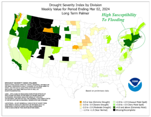
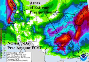
Fig. 1-2: The weekly Drought Severity Index identifies soaking wet soils from the northern Mid-Atlantic to southern New England and the NOAA/WPC 7-day precipitation forecast indicates excessive rainfall for this area.
Discussion: Soaking wet soils are present across the Northwest U.S. and parts of the West Coast (Fig. 1). However, our concern in this report is the emerging excessive soil moisture across the northern Mid-Atlantic region and the southern half of New England. The NOAA/WPC 7-day quantitative precipitation forecast (QPF) indicates prohibitive rainfall in the coastal Northeast Corridor region (Fig. 2). Heavy rains causing flooding are also indicated in the Gulf States and Coastal Northwest. Severe thunderstorms are added to the forecast beginning on Thursday in Central Texas with repeat events for Eastern Texas and Louisiana Friday and Saturday. The U.S. gas population weight HDD forecast remains very warm and warmer than yesterday through the first 2/3 of March (Fig. 3). In case you missed it, Climate Impact Company constructed analog, NCEP CFS V2, and IRI/LDEO climate forecasts each indicate drought potential for the Great Plains during summer 2024 (Fig. 4-6). Note the wet pattern may continue this summer in the East.
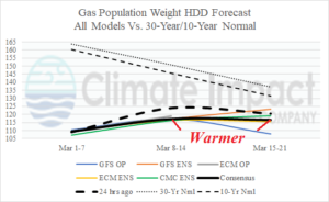
Fig. 3: The U.S. gas population weight HDD forecast utilizing all models, their consensus, and comparing with 24 hours ago and the 10-year/30-year normal.
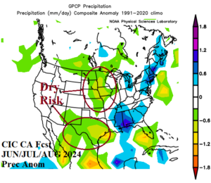
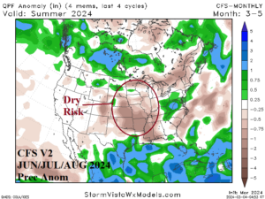
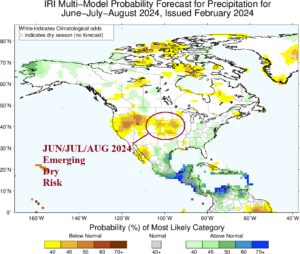
Fig. 4-6: The CIC-CA, CFS V2, and IRI/LDEO summer 2024 precipitation forecasts are agreeable to dryness in the Great Plains.
