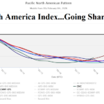
Negative Pacific North America Index Pattern Ahead; Cold to Storms High Impact U.S. Weather
02/08/2026, 10:07 am EST
Climate Impact Company ENSO Climate Diagnostics
Issued: Monday February 9, 2026
Highlight: Ocean surface/atmosphere linger La Nina; Subsurface warming is strengthening rapidly, signals El Nino ahead.
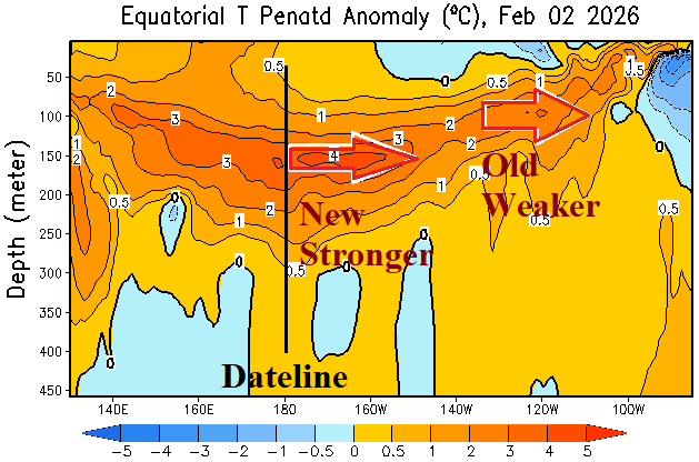
Fig. 1: A second Kelvinn Wave has developed in the equatorial Pacific subsurface.
Discussion: What is an oceanic Kelvin Wave? A large-scale, non-dispersive gravity wave trapped at the equatorial latitude or along coastlines, characterized by ability to transport heat across ocean basins without breaking. Kelvin Wave’s are critical to El Nino development causing erosion of thermoclines. Kelvin Waves move eastward with strongest signature on the front edge. The eastward propagation of Kelvin Waves across the equatorial Pacific is usually caused by westerly wind bursts (WWB) also causal of El Nino.
Right now, the leaning-edge of a Kelvin Wave shifting through the eastern equatorial Pacific during the past few weeks has weakened just before reaching the northwest coast of South America (Fig. 1). A new Kelvin Wave has strengthened and shifted just east of the Dateline. A westerly wind burst associated with the new Kelvin Wave is present just west of the Dateline (Fig. 2).
At the surface, Nino SSTA are slow to respond to the subsurface warming. In fact, during the past week, the Nino34 SSTA returned to the -0.5C La Nina threshold (Fig. 3). Also notable, the daily southern oscillation index (SOI) is very supportive of a lingering La Nina climate during early February continuing a similar observation by multi-variate ENSO index (MEI). The subsurface oceanic character of the equatorial Pacific is very supportive of dissipating La Nina and encouraging El Nino development while surface conditions stubbornly hang onto La Nina (Fig. 4-5). The conflicting signals are typical of this time of year and represented by the ENSO prediction barrier as FEB/MAR/APR historically yield very low skill in forecasting ENSO phase. Nevertheless, the subsurface warm water signals support an aggressive NCEP CFS V2 El Nino forecast for 2026 (Fig. 6).
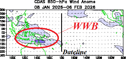
Fig. 2: A westerly wind burst has developed near and west of the Dateline in the tropical Pacific Ocean.
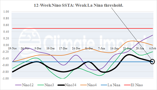
Fig. 3: The 12-week Nino SSTA monitor indicates the Nino34 SSTA has returned to the La Nina threshold.
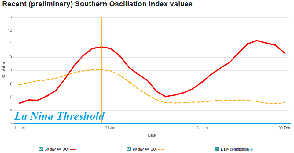
Fig. 4: Daily southern oscillation index has steadily favored La Nina.
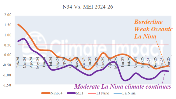
Fig. 5: Multivariate ENSO index has consistently indicated the presence of a La Nina climate.
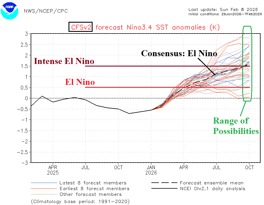
Fig. 6: The latest NCEP CFS V2 Nino34 SSTA forecast reveals El Nino ahead.