SUN/MON Northeast Coastal Storm Could Produce Blizzard Conditions
02/20/2026, 5:24 am EST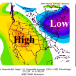
The Ongoing Memory of The Winter 2025-26 Upper Air Pattern in North America
02/23/2026, 5:25 am EST
![]()
Climate Impact Company Sunday Report
Issued: Sunday, February 22, 2026
Highlight: Northeast U.S. blizzard later today through Monday. Big differences ECM vs. GFS in 11-15-day period.
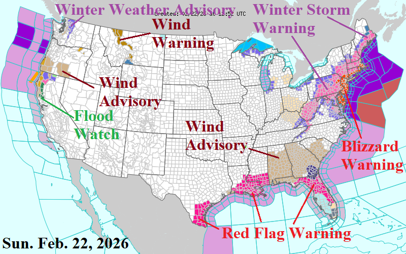
Fig. 1: The NOAA/NWS weather watch, warning, and advisory areas.
Discussion: Focus is on the Northeast Corridor blizzard, the first widespread blizzard since January 2022. Blizzard Warnings extend from the Mid-Atlantic Coast to east and south portions of New England (Fig. 1). The culprit is a coastal storm developing east-southeast of Norfolk, VA early this afternoon drifting slowly northeastward as a “bomb cyclone” with a central pressure near 970 MB south of Nantucket tomorrow at dawn. This type of strengthening implies intense precipitation for the Coastal Northeast Corridor and high wind approaching hurricane force near the coast. Additionally, high onshore wind guarantees strong-to-severe flooding for coasts in the face of a northeast wind, particularly southeastern Massachusetts. The supporting upper trough is intense and supports an all snow/sleet event. Much of the snow is 8:1 rain to snow ratio near the coast increasing the risk of power outages given the accompanying high wind.
The NBM snowfall forecast realizes the quantitative precipitation forecast (QPF) which is near or above 2 inches near the coast and supportive of 18-30-inch snowfall projection (Fig. 2). Away from the coast, the NBM snowfall forecast is likely not as high as shown. The max wind gust forecast in the Mid-Atlantic region is around midnight tonight when gusts of 45-65 mph are near the coast and extending west of the I-95 Corridor (Fig. 3). As surface pressure lowers tomorrow morning, wind gusts increase to 65-80 mph eastern Long Island to southeastern Massachusetts (Fig. 4). Coastal Flood Warning’s are issued for Delaware Bay to the eastern coast of Massachusetts. This elongated area is susceptible to significant flooding due to high onshore wind and steep inland crashing large waves.
The latest U.S. gas population weight HDD forecast highlights extreme differences between the (cold) ECM and (warm) GFS (Fig. 5). The ensembles are reasonable and their consensus is similar with yesterday.
Climate signals are last profound over the next 2 weeks with negative West Pacific oscillation supportive of the East Coast storminess and cold this week while negative Pacific North America index may linger into the medium range which would sustain West Coast storms longer than operational models indicate. Madden Julian oscillation shifts east into the equatorial West Pacific which is a warm U.S. signal although strength of the MJO is questionable.
The warming in the subsurface equatorial East Pacific is impressive and risk of El Nino ahead in 2026 continues to increase.
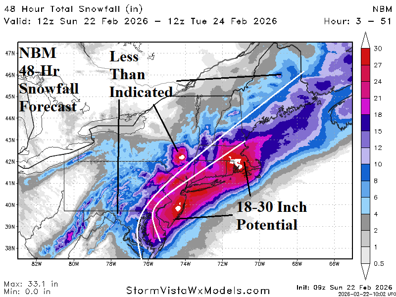
Fig. 2: NBM 48-hour snowfall forecast for the Northeast Corridor.
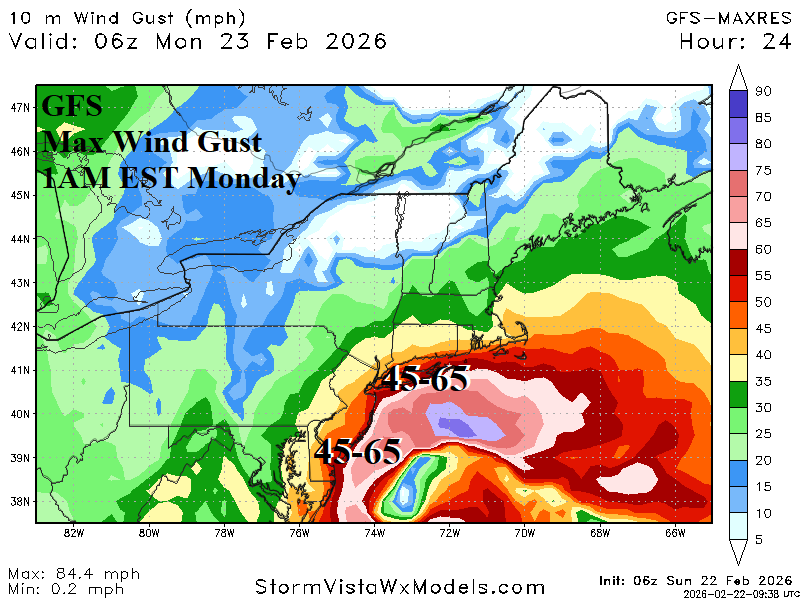
Fig. 3: The GFS max wind gusts in the Mid-Atlantic Coast region tonight.
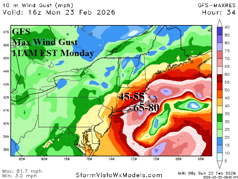
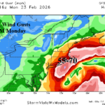
Fig. 4: The GFS max wind gusts in the coastal New England region tomorrow morning.
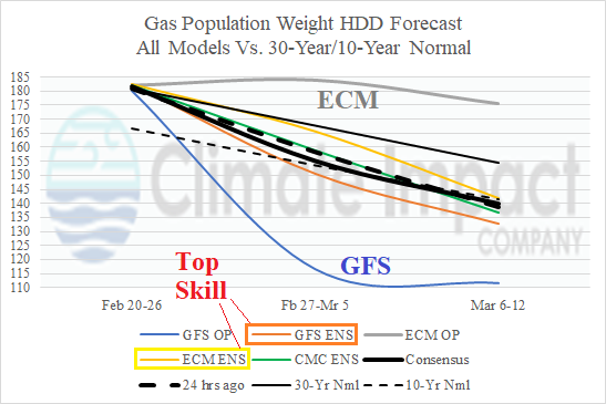
Fig. 5: The U.S. gas population weight HDD forecast utilizing all models through the first third of March.