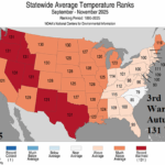
3rd Warmest Autumn on Record in the U.S.; November 4th Warmest
12/11/2025, 8:36 am EST
Historical Precipitation Event Ahead West U.S. – Causes and Implications
12/16/2025, 4:43 am EST
![]()
Climate Impact Company Daily Feature
Issued: Sunday, December 14, 2025
Highlight: MJO caused stratospheric warming event and attendant arctic air to chill the U.S. first half of December. MJO is now quiet, stratosphere colder, therefore milder U.S. pattern ahead. But! There are caveats!

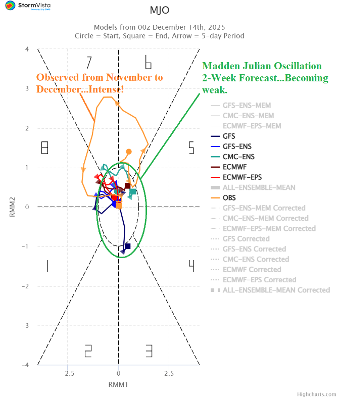
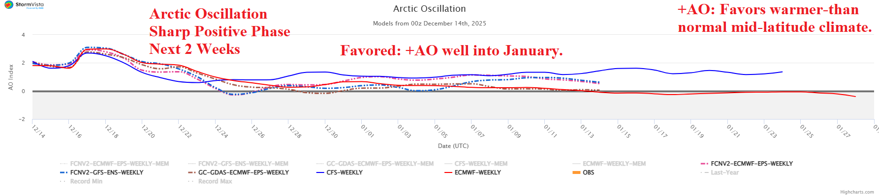
Fig. 1-3: Stratospheric warming emerged during NOV/DEC 2025 due to the influence of a powerful Indonesia/West Pacific tropics convection phase of the Madden Julian oscillation. Note the 15-day MJO forecast is quiet. The conditions described lead to positive phase of the arctic oscillation which may last into January.
Discussion: An intense convection phase of the Madden Julian oscillation (+MJO) across Maritime Continent and the West Pacific tropics during November and early December (Fig. 1) contributed warming into the upper atmosphere and pole ward causing a stratosphere warming event (Fig. 2). However, the MJO is forecast to shift quieter during the second half of December. Consequently, stratospheric warming fades. The arctic oscillation (AO) which identifies the location of the polar vortex indicates a change to positive phase the next 1-2 weeks as the recent frigid Canadian polar vortex shifts poleward. The shift toward the North Pole allows milder Pacific maritime influence to warm the U.S. pattern. The extended-range AO forecast suggests the positive phase may continue well into January (Fig. 3). However, there are caveats. The New York/New England states are susceptible to regenerating cold due to proximity of snow cover which re-expands just after Christmas Day (Fig. 4). The prohibitive atmospheric river pattern should pile snow across the Northwest U.S. and possibly farther south to the Great Basin and certainly the Sierra Nevada and Rocky Mountains (Fig. 5). The West U.S. snow cover expansion suggests a colder regime vs. mild forecasts. The negative phase Pacific North America (-PNA) index supports the colder/stormy regime in the West continuing beyond 15 days (Fig. 6) while regenerating negative phase North Atlantic oscillation (-NAO) supports returning cold to the Northeast in the extended range (Fig. 7).
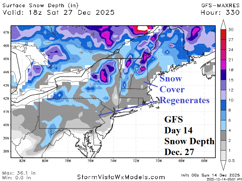
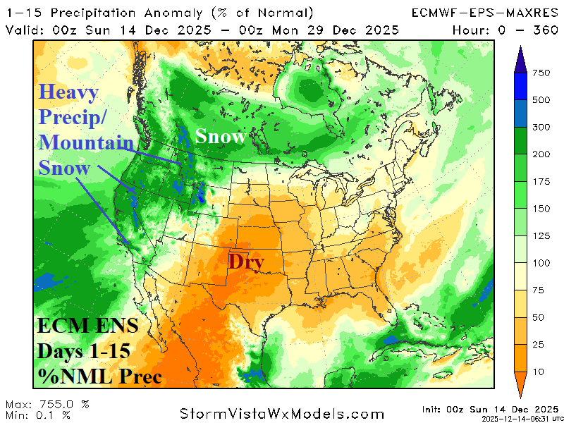
Fig. 4-5: Regenerating Northeast U.S. snow cover after Christmas Day and the 15-day prohibitive percent of normal precipitation forecast for the West U.S.
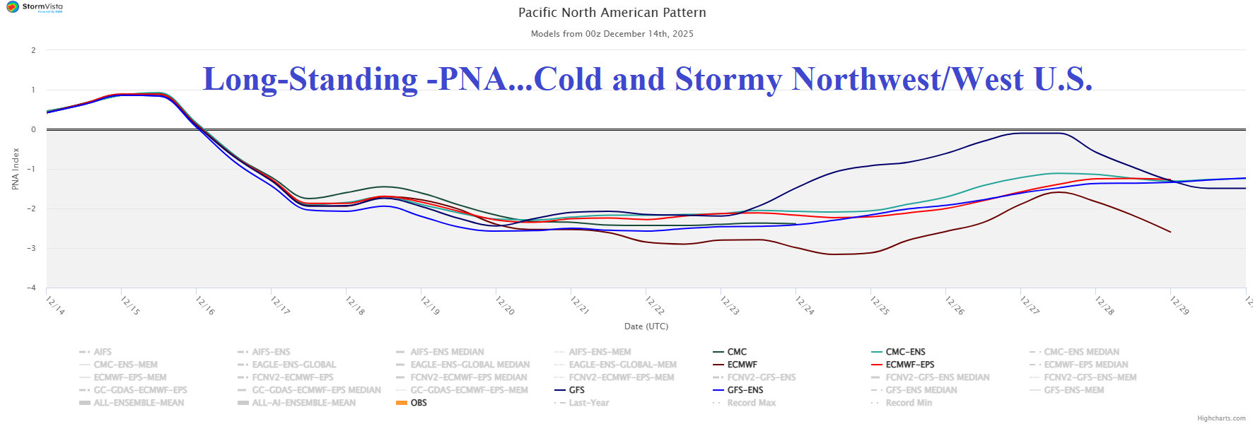
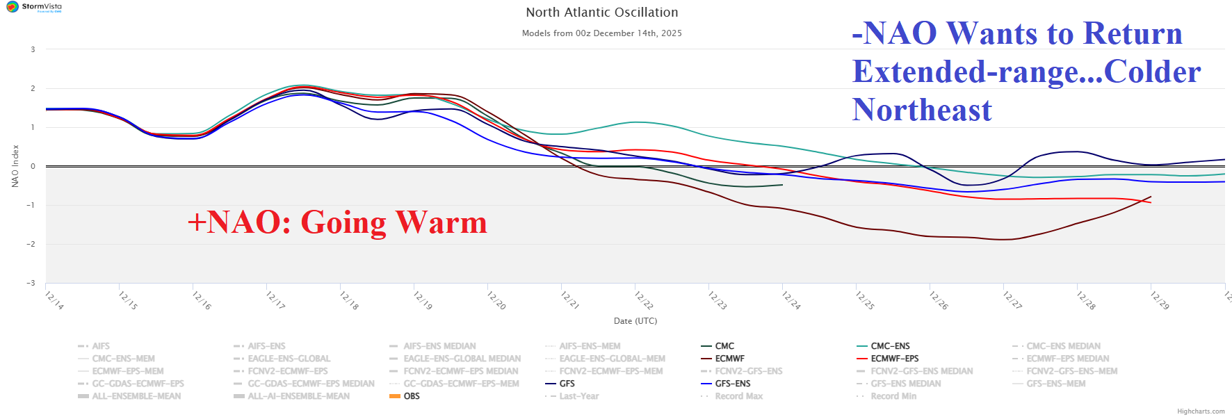
Fig. 6-7: Negative Pacific North America index supports stormy and colder West U.S. weather while the Northeast U.S. could shift colder again in the extended range as negative North Atlantic oscillation generates.