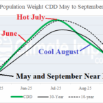
U.S. CDD’s Crash in August!
09/01/2025, 9:10 am EDT
-IOD/La Nina Inspired Wet Climate Ahead for Australia
09/03/2025, 6:02 am EDT
Climate Impact Company Tropical Feature
Issued: Tuesday September 2, 2025
Highlight: Overall, North Atlantic is much cooler than recent summer seasons. However, Gulf, Caribbean, and MDR are very warm!
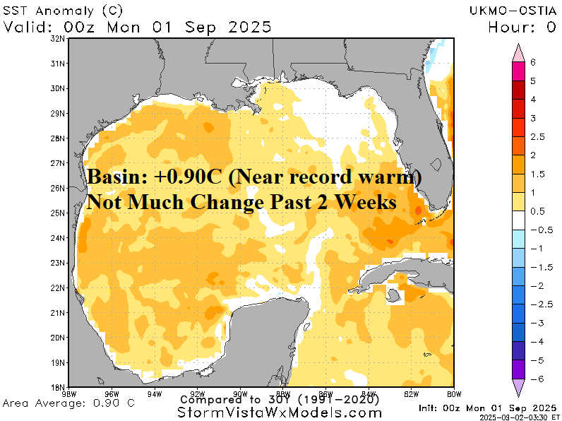

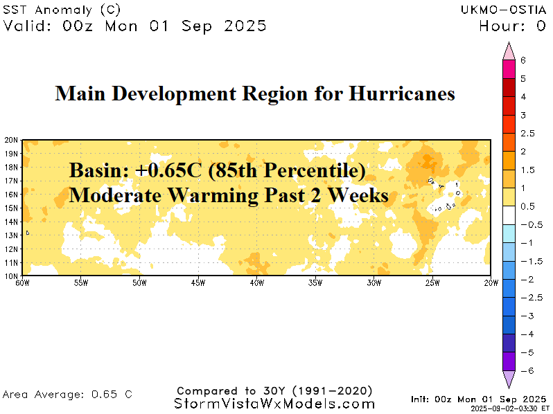

Fig. 1-4: Checking the North Atlantic sea surface temperature anomalies.
Discussion: The North Atlantic basin SSTA is +0.28C which is quite cool compared to other years this decade. The 1-year change is -0.53C which is very impressive. However, there are basins which are very warm and capable of contributing to over-achieving tropical cyclones and their intensity. The Gulf of Mexico is near record warm (+0.90C) which is steady during the past 2 weeks (Fig. 1). The Caribbean Sea is also very warm and unchanged during the past 2 weeks (Fig. 2). The 30-31C SST is most prominent across the west and southeast portion of the Gulf of Mexico and the northern Caribbean Sea. The main development region (MDR) for hurricanes located between the Caribbean Sea and west tropical Africa has warmed to +0.65C which is in the 85th percentile (Fig. 3). While the MDR, Caribbean Sea, and Gulf of Mexico are scary warmer than normal, the western North Atlantic basin has cooled substantially to near normal due to the passage of Erin (Fig. 4). However, rewarming has started during the past week.