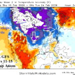
A Much Colder 06Z GFS Days 11-15 in U.S.
02/09/2026, 8:15 am EST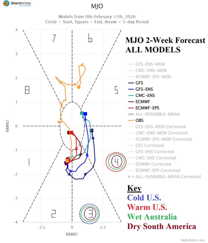

Climate Impact Company Madden Julian Oscillation Outlook
Issued: Wednesday, February 11, 2026
Highlight: MJO is active, shifts from East Indian Ocean across Maritime Continent. However, a farther eastward shift to dissipate La Nina not indicated.

Fig. 1: The 2-week Madden Julian oscillation forecast utilizing all operational models indicates a moderate-strength phase_3 through the middle third of February followed by a weaker phase_4.
Discussion: The Madden Julian oscillation (MJO) has been active and a key contributor to climate patterns of the past several months. The MJO trend continues through mid-to-late February. Models indicate a strengthening phase_3 (East Indian Ocean/West Maritime Continent) over the next 10 days shifting east to phase_4 (Eastern Maritime Continent) in the 11-15-day period (Fig. 1). MJO extending eastward to the Dateline is not expected in the extended range which implies a delay in La Nina demise.
The MJO phase_3 to phase_4 transition supports a wetter climate for Australia and drier regime in South America (Fig. 2). The 15-day operational forecast indicates prohibitive rains in Australia (Fig. 3) while the rainfall pattern in South America is patchy (Fig. 4).
In the U.S., the MJO phase_3 favors a colder regime (Fig. 5) for the U.S. which is in the face of very warm operational forecasts. Once MJO reaches phase_6, the influence on the U.S. is generally warm. MJO phase_3 favors West U.S. storminess shifting to the Midwest States during phase_4 (Fig. 6).
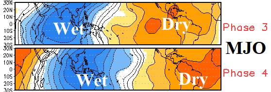
Fig. 2: The MJO influence on vertical motion acting as the catalyst to rainfall in the tropics for phase_3 and phase_4.
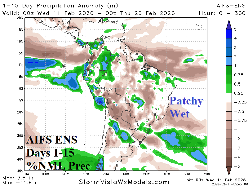
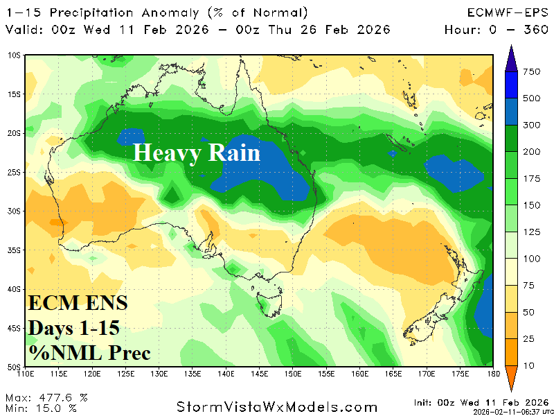
Fig. 3-4: 15-day rainfall anomaly forecasts for South America and Australia.
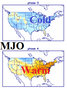
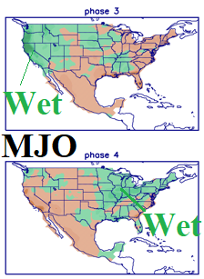
Fig. 5-6: MJO temperature and precipitation influence on the U.S. for phase_3 and phase_4 during February.