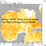
Overall, North Atlantic Cooler Than Recent Summer Seasons; But Gulf/Caribbean/MDR Very Warm!
09/02/2025, 2:46 pm EDT
Subsurface Equatorial Upper Ocean Heat Anomalies Dictate IOD/ENSO Ahead
09/04/2025, 5:03 am EDT
Climate Impact Company Week 2-4 Outlook
Australia
Issued: Wednesday, September 3, 2025
Highlight: Using AI Graph Cast to project wet pattern ahead.
Charts of the day: August and Winter 2025
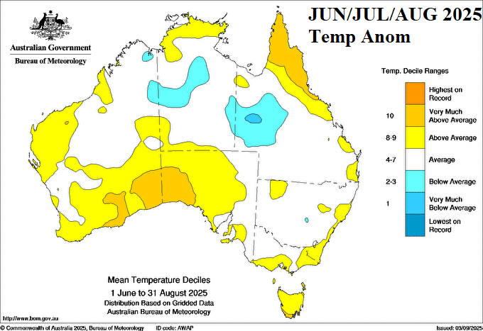
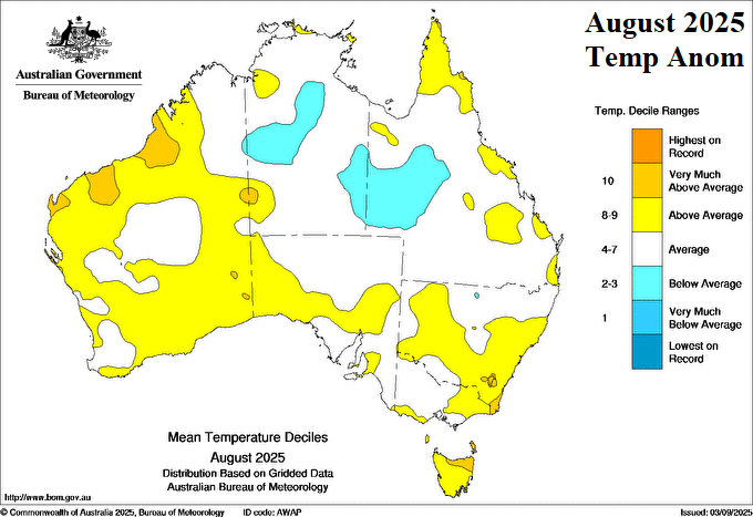
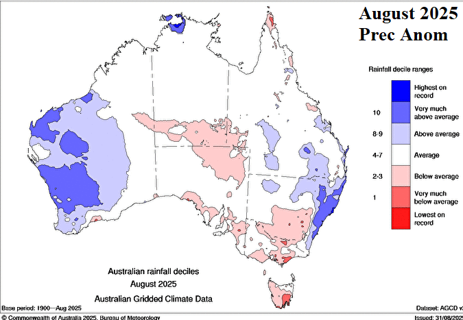
Discussion: The winter 2025 thermal pattern across Australia featured mostly near normal temperature except MUCH ABOVE normal on the central South Coast and northern Queensland. Southwest Queensland was the cool spot due to the cool bias appearing in August. In August, the New South Wales and Western Australia were wetter than normal.
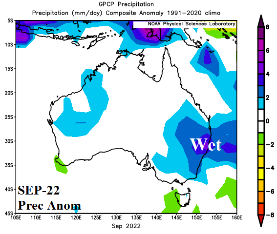
The Indian Ocean Dipole has shifted to negative phase and a borderline La Nina is developing. The last time -IOD and La Nina were present during SEP/OCT was in 2022 when buckets of rain fell on the East/Southeast! Be aware of potential over-achieving rains in the East for spring 2025!

Week-2 Ahead Forecast valid September 14-21, 2025: Wet West Coast and Southeast.
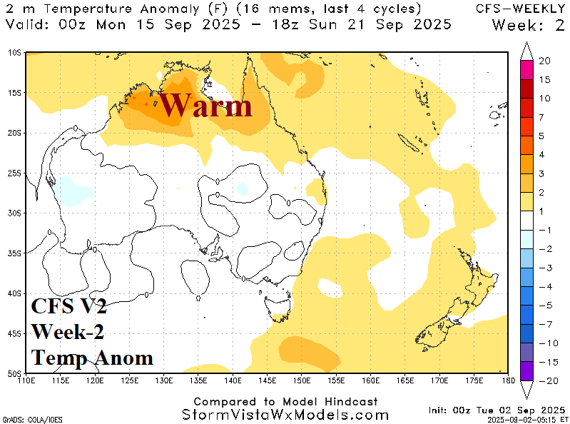
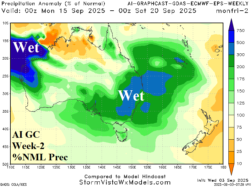
Discussion: Areas of significant rain appear on the West Coast and in the East/Southeast.
Week-3 Ahead Forecast valid September 21-28, 2025: Significant rain East.
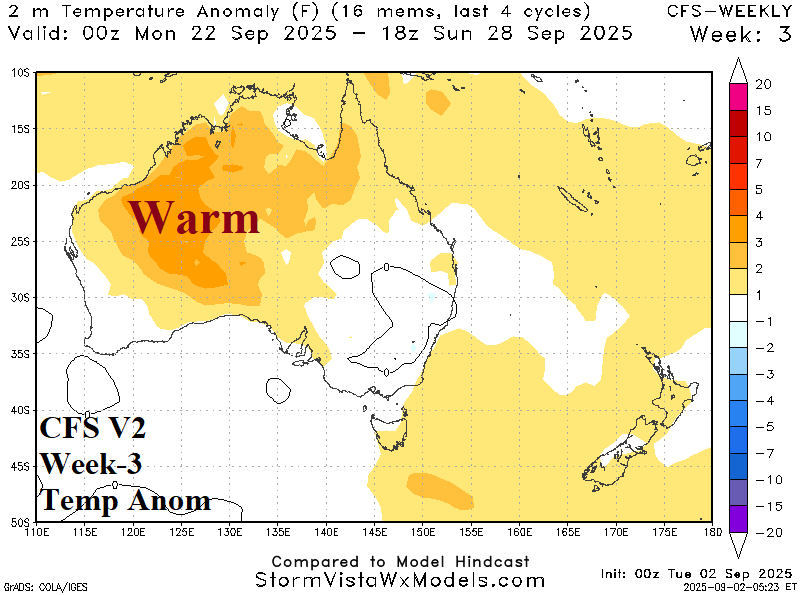
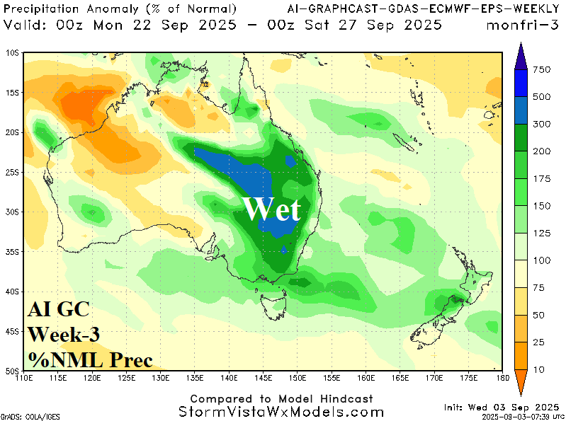
Discussion: Expect significant rain risk in the East. The Western Australia warmth may be overstated.
Week-4 Ahead Forecast valid September 28-October 5, 2025: Not as wet East.
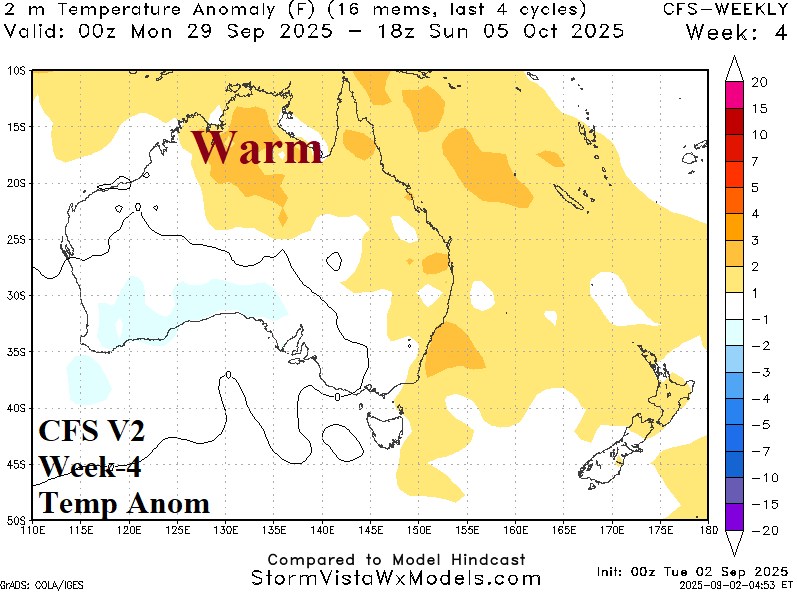

Discussion: Wet weather is projected for the south-central continent while the wet regime in the East eases.