Excessive Rains This Week Queensland; More Heavy Rain East Australia Next Week
12/28/2025, 9:13 am EST
Busy Period Ahead: Wides Swings in U.S. HDD Forecasts!
12/31/2025, 8:29 am EST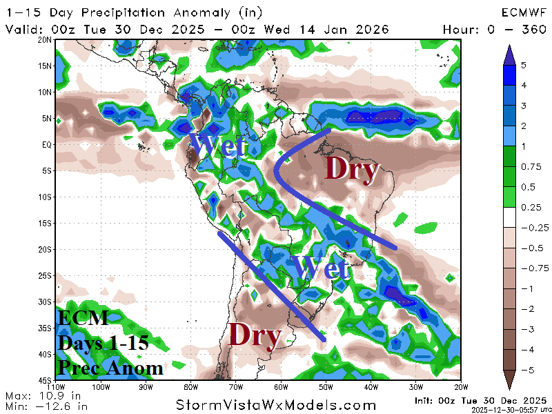

Climate Impact Company Early AG Market ALERT
Issued: Tuesday December 30, 2025, Happy New Year!
Highlight: Arc of heavy rain in South America, Northern Australia prohibitive rainfall, and losing the Western Canada cold air source region.
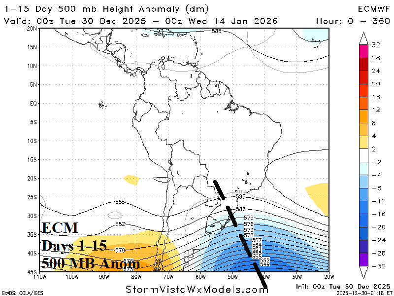
Fig. 1-2: The ECM 15-day rainfall anomaly forecast across South America and the attendant 500 MB anomaly outlook.
Discussion: The ECM 15-day rainfall anomaly forecast across South America indicates an arc of heavy rain extending from northwest continent across central continent and through Southeast Brazil touching northeastern Argentina (Fig. 1). The culprit is an unusually strong mid-latitude trough east of Argentina extending northwestward into Brazil (Fig. 2). Climate forecasts projected a cutoff upper trough on the Southeast Brazil Coast as January arrived. The full latitude trough is unusual and certainly a surprise and linked to a persistent negative phase Antarctic oscillation (-AAO) present for most of meteorological summer so far.
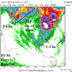
In Australia, extreme rainfall has developed across northern continent as observed during the past 7 days (Fig. 3). The heavy rain is linked, in-part, due to the presence of the convection phase of the Madden Julian oscillation (MJO) which extends from the North Coast into the eastern Indian Ocean. The ECM 15-day rainfall forecast intensifies the rainfall across Northern Australia causing widespread flood risk (Fig. 4).
In North America, an established cold air source region across deep snow cover stretching from Alaska to south-central Canada developed during December (Fig. 5). Occasionally, cold air masses break from this region and migrate into the East and Northeast U.S. during early winter. However, stratospheric cooling in the medium range across northwest North America is sufficiently intense (Fig. 6) to warm the troposphere below and cause the Western Canada cold air source region do dissipate in the 11-15-day period (Fig. 7).
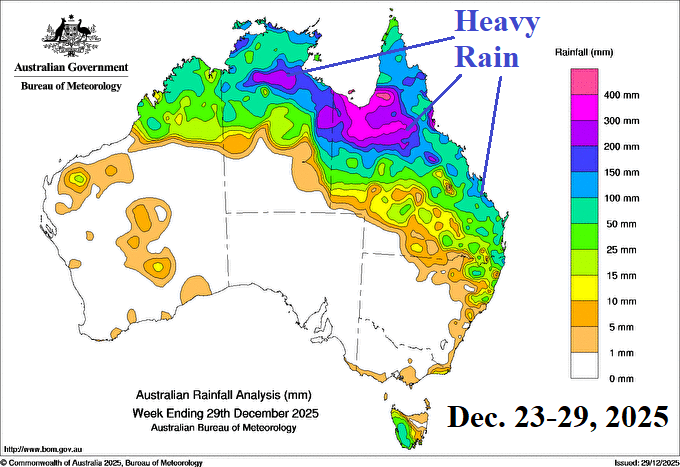
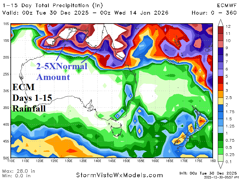
Fig. 3-4: The December 23-29, 2025, prohibitive rainfall observations across Northern Australia likely to continue with the ECM 15-day rainfall forecast.
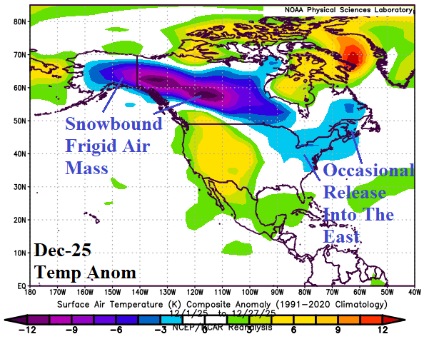
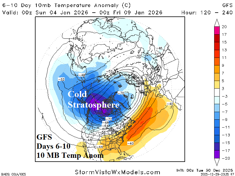

Fig. 5-7: The DEC-25 North America temperature anomalies so far, GFS 6-10-day stratosphere temperature anomaly forecast, and the GFS 11-15-day northern hemisphere temperature anomaly forecast.