High Impact Weather Next 10 Days Argentina and Brazil
01/29/2026, 5:08 am EST
![]()
Climate Impact Company Sunday Report
Issued: Sunday, February 1, 2026
Highlight: Surprise warmer pattern-change during days 11-15.
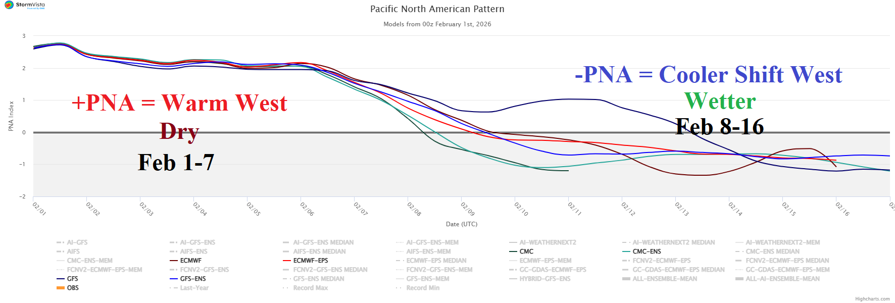
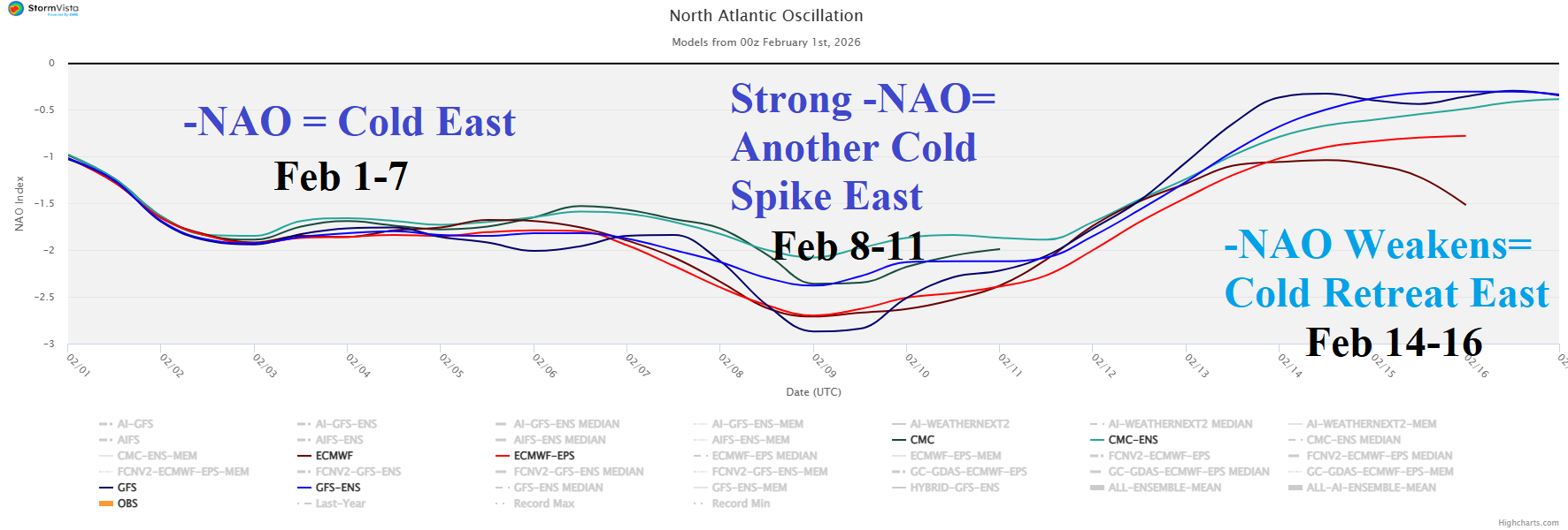
Fig. 1-2: The 16-day Pacific North America and North Atlantic oscillation forecast utilizing all models.
Discussion: A sizeable change in the Pacific North America (PNA) index is forecast by all models over the next 2 weeks. The persistent strong positive phase fueling the warm and dry West U.S. climate for much of January finally breaks down. Next week, the PNA pattern shifts to negative phase supportive of a cooler and wetter West U.S. low-pressure trough pattern (Fig. 1). In response, the strengthening negative North Atlantic oscillation (-NAO), fueling East U.S. cold fades mid-month likely causing a cold retreat (Fig. 2). Overnight models are hyper-reactive to the PNA/NAO change as the warm West/cold East persistence lasts through 10 days and is followed by a dramatic warm-up using a GFS+ECM consensus (Fig. 3-5). Helping to inspire the warmer extended range is a spike in stratospheric cooling across Canada prominently indicated by ECM (Fig. 6).
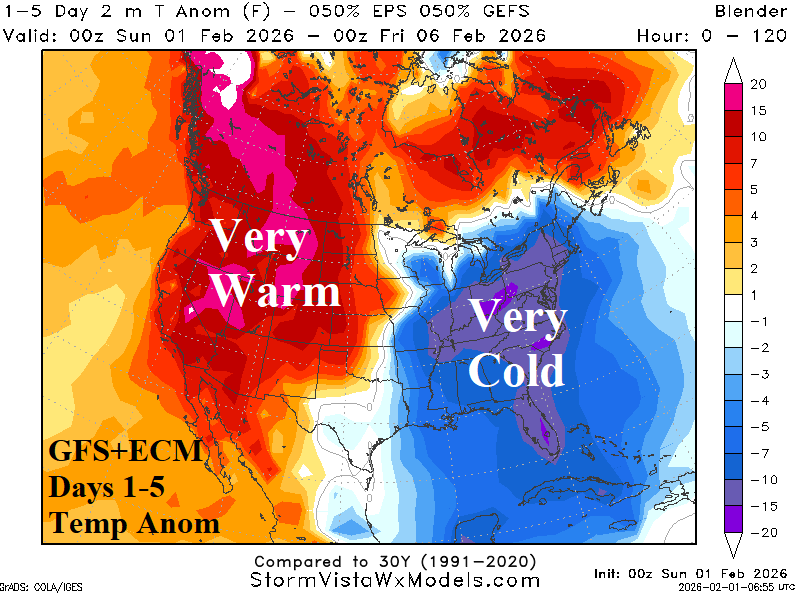
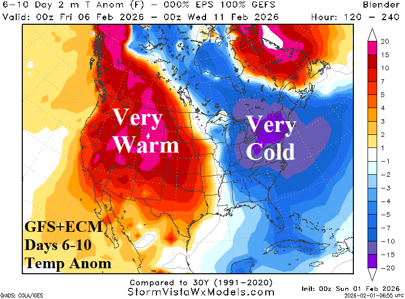
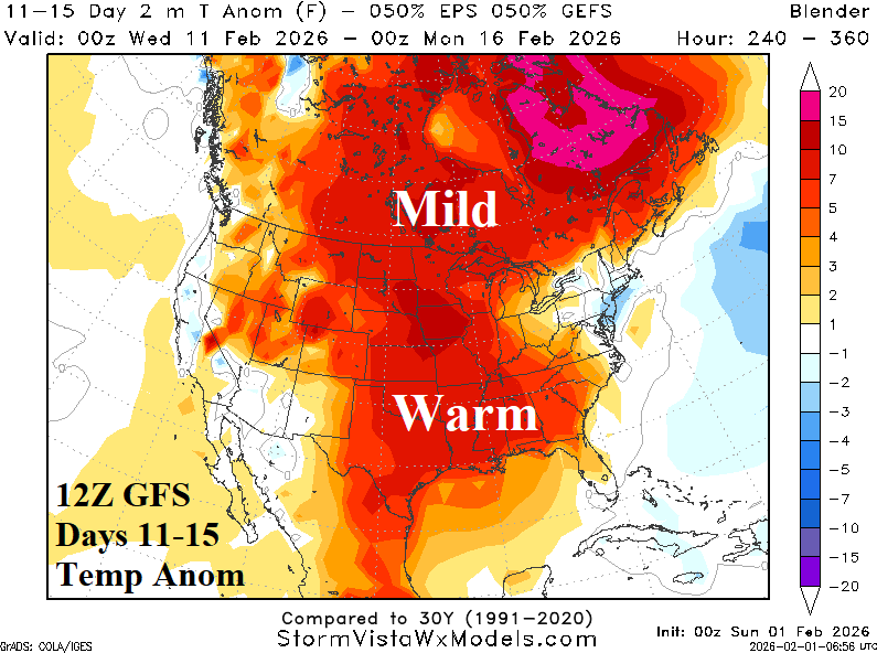
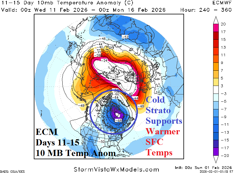
Fig. 3-6: The GFS+ECM 1-15-day U.S. temperature anomaly forecasts and the changeable stratospheric temperature anomaly regime featuring cooling across Canada in the 11-15-day period supportive of warmer surface temperatures.
A plethora of weather hazards affects the East and South U.S. on this first day of February. Most dramatic are 20’s extending southward to just west and north of Lake Okeechobee in Florida. Upper teens have reached Northern Florida. A combination of Extreme Cold and Freeze Warnings across Florida cause citrus groves at risk of fruit and leaf damage (Fig. 7). Several inches (or more) of snow are likely today across east and southeast North Carolina where Winter Storm Warnings continue. Offshore North Carolina, the evolving intense storm causes high wind and Hurricane Force Wind Warnings. High wind will extend northward along the Mid-Atlantic to New England Coasts today.
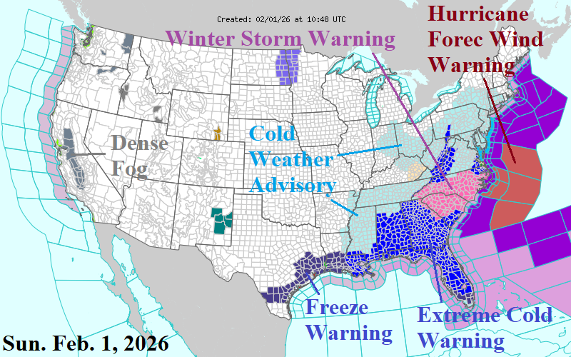
Fig. 7: NOAA/NWS weather watch, warning, and advisories.
The U.S. gas population weight HDD forecast features a significant warmer change for next week and the week of Feb. 16-22 since the Friday morning forecast utilizing all operational models (Fig. 8). Interestingly, the colder AI models of January for week 4-5 ahead flip warmer than normal on the 1st of February (Fig. 9).
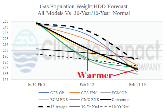
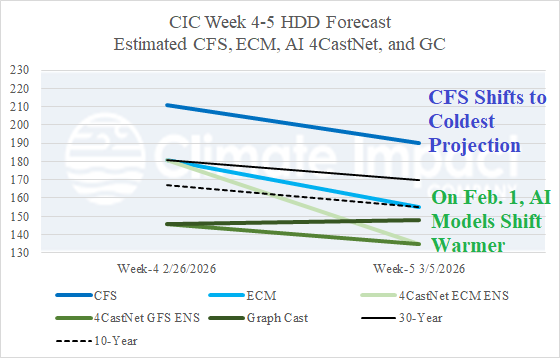
Fig. 8-9: U.S. gas population weight HDD forecast through Feb. 22 utilizing all operational models plus CIC estimates for week 4-5 ahead using CFS, ECM, and 3 AI models.