Severe Storms/Heavy Rain and Flooding Mid-south U.S. Continues
05/28/2024, 8:51 am EDTNorth Atlantic Basin 2024 Seasonal Activity Forecast Update: Steady, Very Active and Dangerous Season Ahead
05/31/2024, 8:01 am EDTCharts of the day: Re-emerging Northeast Pacific marine heat wave.
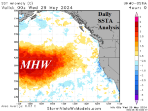
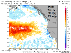
Discussion: During the past 30 days, a semi-permanent marine heat wave located northeast of Hawaii has strengthened sharply and is edging eastward. An eastward shift to the North America West Coast would promote widespread anomalous heat and dryness causing drought. This type of eastern surge is not likely during La Nina. However, close monitoring warranted into early summer 2024!
Medium-range 6-10 Day Forecast Valid June 4-8, 2024 (24-hour change right)
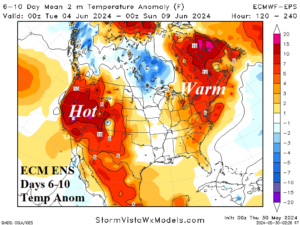
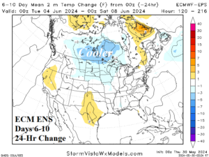
Discussion: Amplified upper features: Strong broad ridge West and Southeast Canada with an upper trough in-between over the Upper Midwest. Forecast trend is cooler South-central Canada while the Northeast is very warm and a heatwave spreads across the West.
Medium-range 11-15 Day Forecast Valid June 9-13, 2024 (24-hour change right)
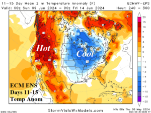
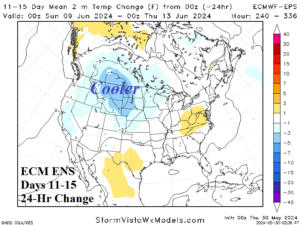
Discussion: Ridge across the Northwest is compensated for by a broad trough in the Midwest. A cooler forecast for the Northern Rockies to the Ohio Valley. The West stays hot.
U.S. Medium-range Precipitation Forecast
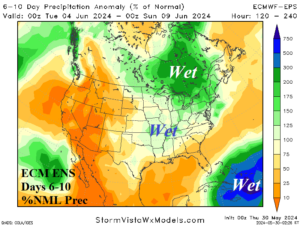
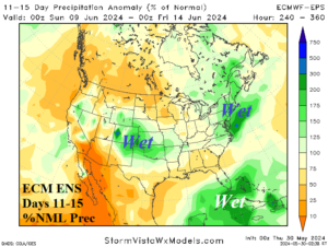
Discussion: Heavy rain ahead of a sharp upper trough across Ontario in the 6-10-day period. Heavy rains persist across Cuba and Hispaniola where tropical development is monitored. In the 11-15-day period, the wet weather across Cuba shifts westward into the Gulf of Mexico while wet weather is also indicated across the southwest Great Plains and coastal Northeast Corridor.
Days 16-20 Extended range Temperature Forecast valid June 14-18, 2024
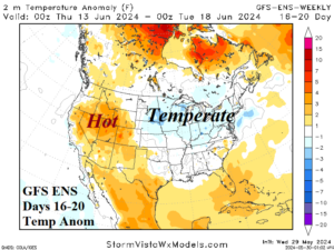
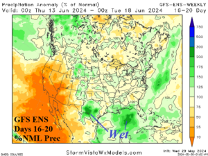
Discussion: GFS ENS is utilized keeping the Interior West hot while the East is temperate. Wet weather affects the Gulf States.
