The “Caveat” Forecast…A Case for Regenerating Cold
01/28/2026, 5:04 am EST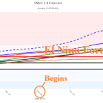
Southern U.S. Drought Ends if El Nino Forms in 2026
01/30/2026, 5:03 am EST
Climate Impact Company Early U.S. Notes
Issued: Thursday January 29, 2026
Highlight: Ongoing intense cold East, weekend East Coast storm concern shifts toward high wind, Feb. 6-12 looks colder.
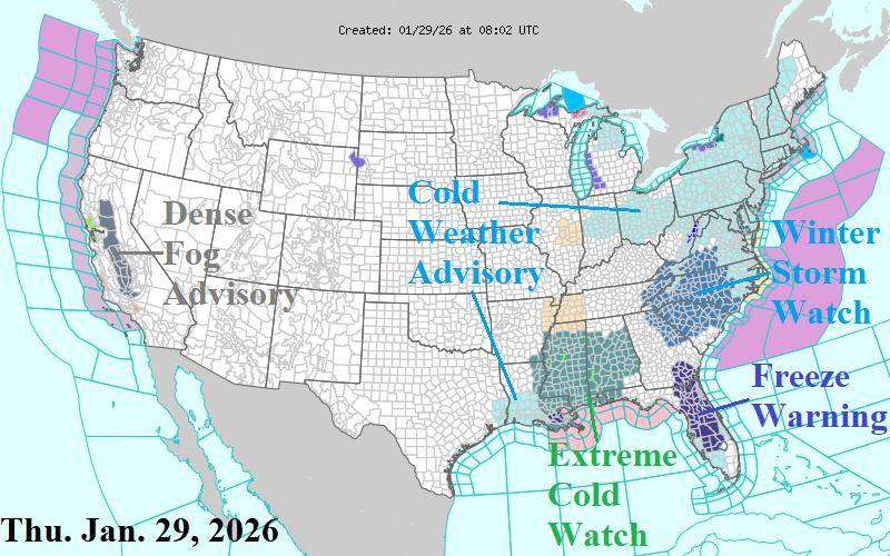
Fig. 1: Current NOAA/NWS weather watch, warning, and advisories.
Discussion: The severe cold continues in the East. A Freeze Warning extends south of Orlando in Florida (Fig. 1), usually the benchmark for citrus crop damage. An Extreme Cold Watch is in effect for Mississippi and Alabama. Heavy rains from earlier in the week caused some ongoing river flooding in both states. A Cold Weather Advisory extends across the Northeast U.S. An expected weekend coastal storm warrants a Winter Storm Watch for the Interior Carolinas. Another day of dense fog limiting travel in the San Joaquin Valley.
The weekend East Coast storm appears powerful, as indicated by both GFS and ECM, except far enough offshore to prevent a major snowfall for the Northeast Corridor with some exceptions. Duration of storm, as the event develops, causes 4-8 inches of snow across the Carolinas (away from the coast) Friday night into Sunday morning according to ECM (Fig. 2). Some locally heavy snow is possible across northeastern North Carolina and possibly the Norfolk, VA area. Snowfall amounts are cutback across Virginia. The northern Mid-Atlantic misses the snow although coastal areas are likely snowy. Southeast Massachusetts remains targeted for >10 inches of snow with a likely sleet mix for Cape Cod. A larger concern is the wind. Due to unusually low pressure, this storm will produce hurricane force gusts on the North Carolina Coast with gusts to 50 mph across interior eastern Virginia and North Carolina (Fig. 3). Wind gusts of 50-65 mph are likely across southeast Massachusetts (Fig. 4). The increased marine influence on the air mass in Southeast Massachusetts causes heavy sleet.
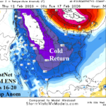
Another wave of cold air follows the storm. Briefly, chilly air reaches ERCOT as Houston plummets to 24 Saturday night (Fig. 5). Deep cold rolls across SERC as Atlanta chills at 29/15 Saturday and 33/21 Sunday (Fig. 6).
Temperatures are well below zero across the Upper Midwest to Interior Northeast this morning, continuing through Saturday, and moderating due to the East Coast storm late weekend.
The PJM forecast identifies the extreme cold through the weekend with some moderation to follow but staying colder than normal throughout the 15-day outlook although some AI models, moderate temperatures to near normal (Fig. 7).
The ongoing negative arctic oscillation (-AO) is in-the-face of any significant U.S. warm-up. Overnight, forecasts are trending colder in the 11-15-day period, particularly GFS, as -AO inspires cross-polar flow of arctic chill into the U.S. Consequently, the February 6-12 HDD forecast increases substantially, 23 HDD from 24 hours ago (Fig. 8).
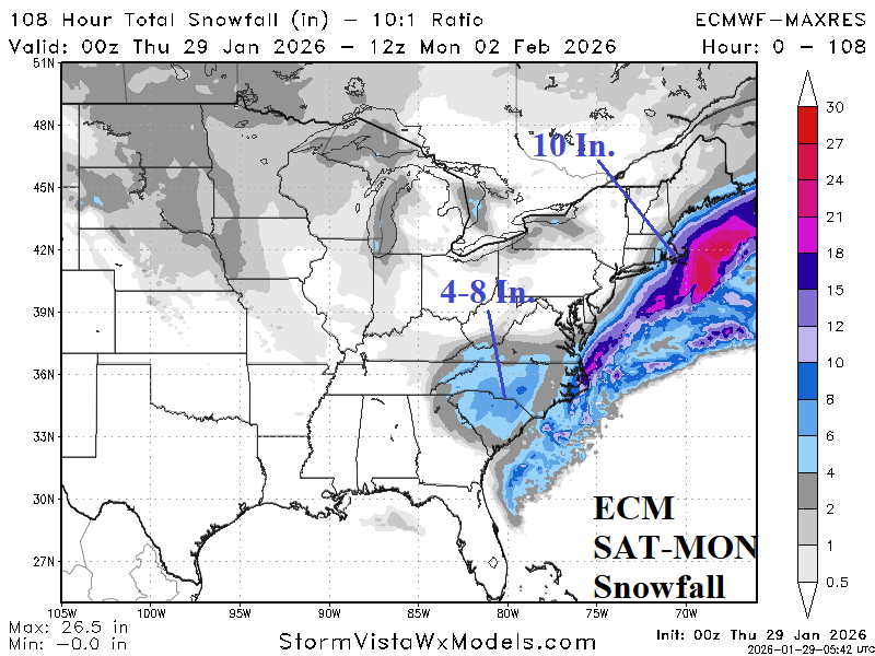
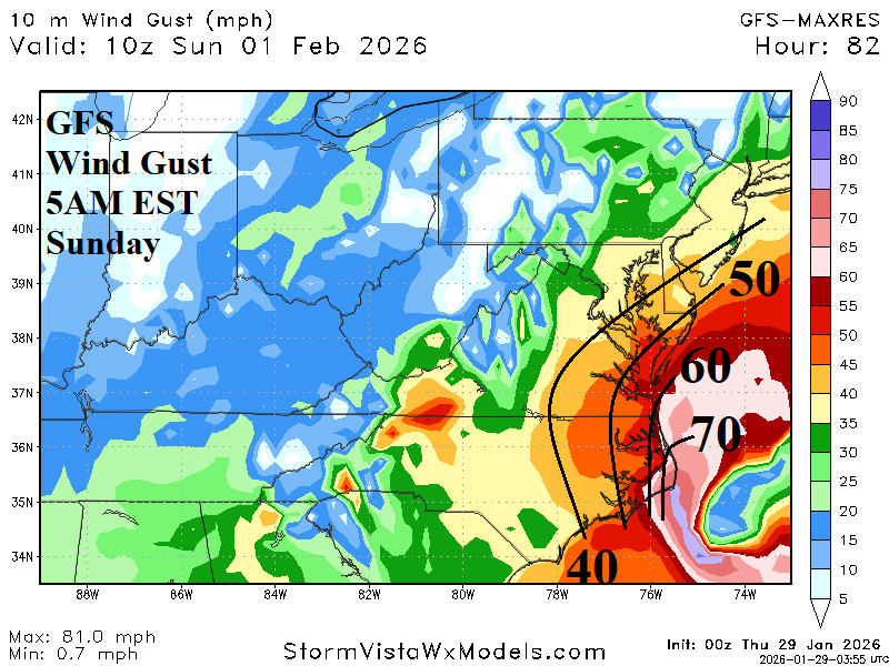
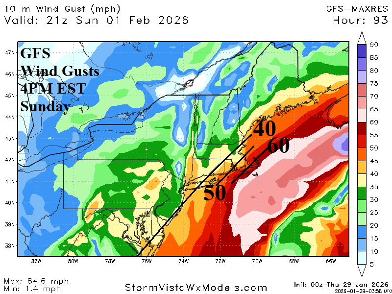
Fig. 2-4: Utilizing ECM, the most reasonable snowfall amount forecast for the weekend storm plus GFS wind gusts projections for Sunday morning and afternoon.
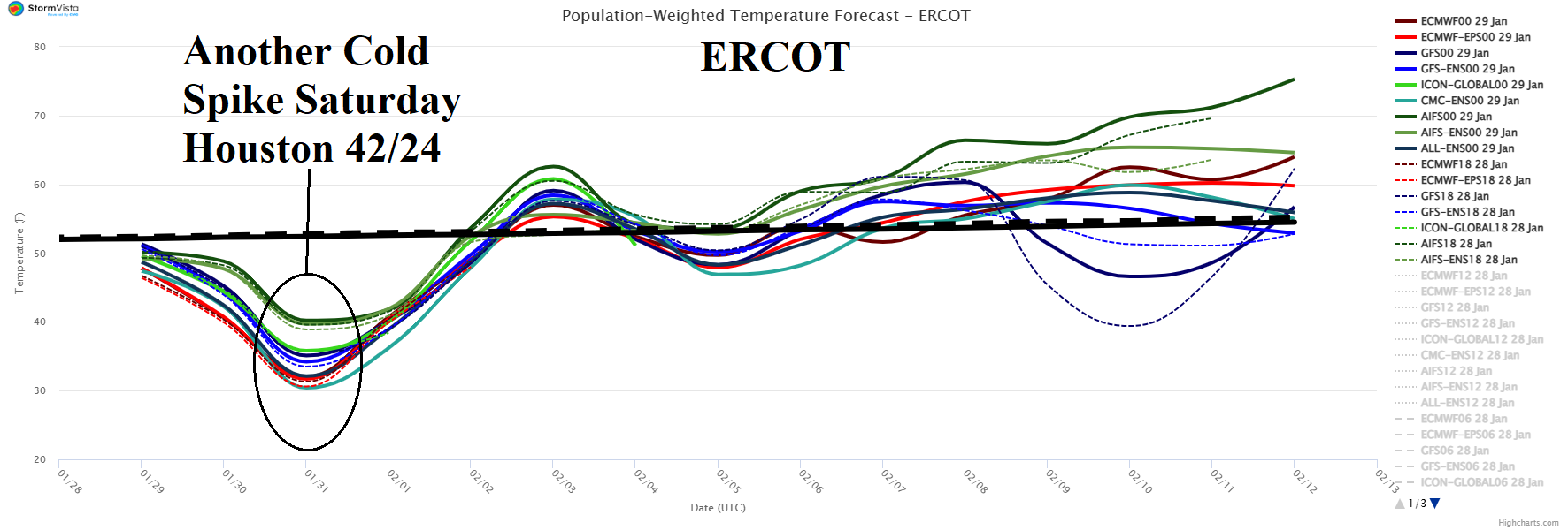

Fig. 5-6: ERCOT and SERC 15-day population weight daily average temperature forecasts utilizing all models.
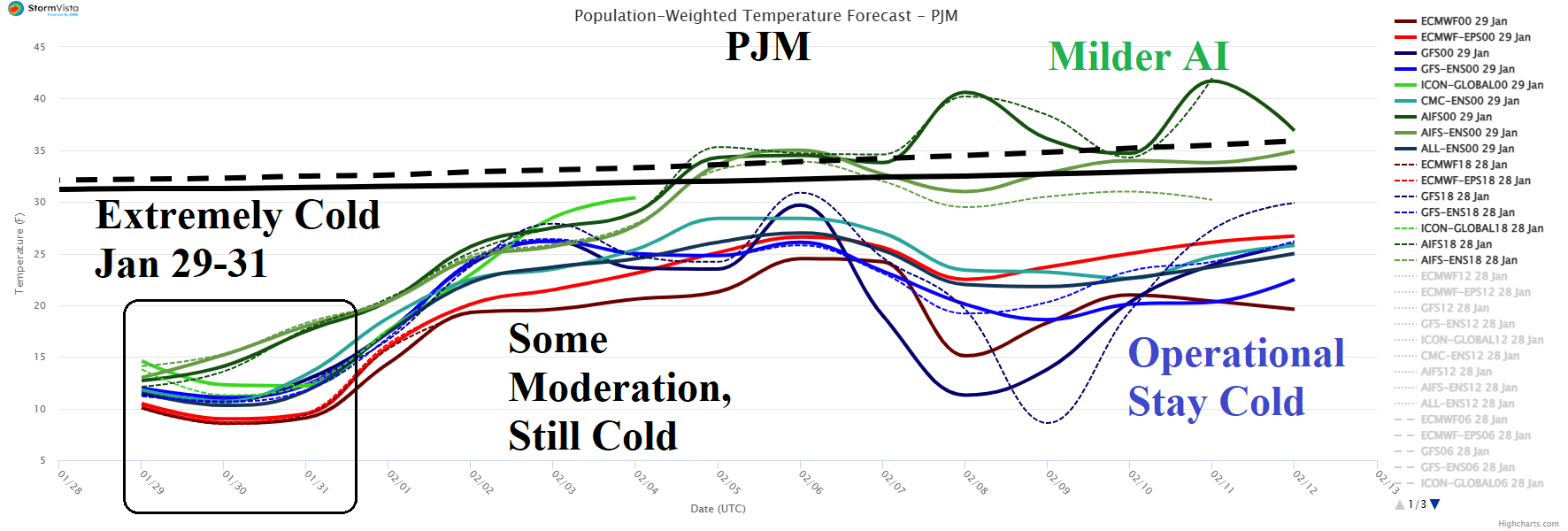
Fig. 7: PJM 15-day population weight daily average temperature forecasts utilizing all models.
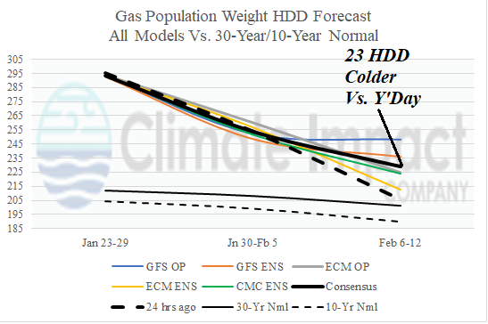
Fig. 8: U.S. gas population weight HDD forecasts through Feb. 12 utilizing all models, their consensus, and comparing with 24 hours ago plus the 10-year/30-year normal.