Incoming Arctic Air Triggers Major Snow and Ice Storm South and East U.S.
01/21/2026, 6:09 am EST
Climate Impact Company Early U.S. Notes
Issued: Thursday January 22, 2026
Highlight: Gigantic storm ahead, increased risk of wider ice storm, especially Mid-Atlantic States.
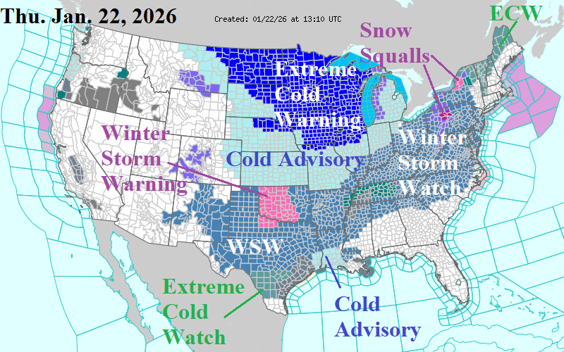
Fig. 1: Latest NOAA/NWS weather watch, warning, and advisories.
Discussion: Alerts for weather hazards are widespread across the Central and East U.S. (Fig. 1). Expect the Winter Storm Watch to advance across New England later today. The entire Winter Storm Watch area shifts to a warning tomorrow. The Upper Midwest is hit with extremely cold temperatures (and wind). The chill surges south and east this weekend. The new concern is a larger exposure of significant ice accretion, especially northward through the Mid-Atlantic region to the south and southeast coast of New England (Fig. 2). Already, widespread power loss and impossible travel due to a major ice accretion is forecast for the Mid-south U.S. plus the Carolinas. However, the ice accretion forecast trend leaves Virgina in a similar risk and Washington/Baltimore/Philadelphia could be added. Consequently, the high snowfall accumulations south of the DCA/BWI/PHL line are likely half of indicated by NBM (Fig. 3). However, to the north, 10-20 in. of snow across Pennsylvania, the interior northern Mid-Atlantic and interior southern New England is likely. The latest U.S. gas population weight HDD forecast utilizing all models maintains the coldest last week in January this century and shifts early February colder (Fig. 4).
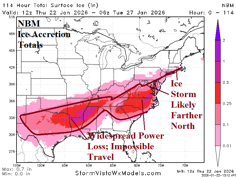
Fig. 2: NBM ice accretion forecast for the weekend/early next week storm.
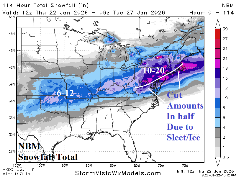
Fig. 3: NBM snowfall forecast for the weekend/early next week storm.
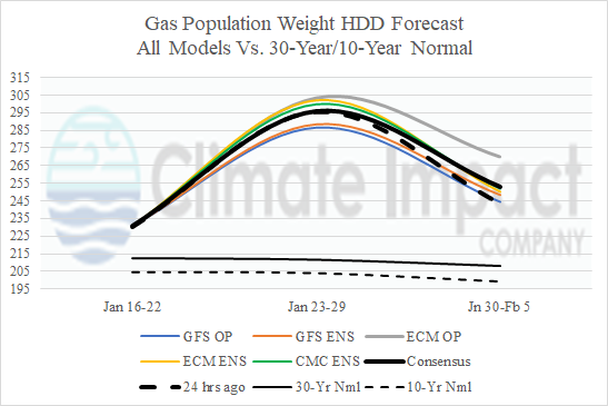
Fig. 4: The U.S. gas population weight HDD forecast utilizing all models into early February.