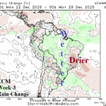
Wetter Brazil Short-term but Longer-term Forecasts Less Wet East Brazil
12/05/2025, 6:22 am EST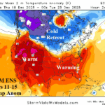
Cold Retreat, Operational/AI Models Warm U.S. Extended-range
12/08/2025, 4:27 am EST
![]()
Climate Impact Company Sunday AG Report
Global Weather/Climate Report
Issued: Sunday December 7, 2025
Highlight: Will the U.S. pattern warm in 8-14/11-15 days? Heavy rains in Central/East-central South America! Warm Europe and hot Australia.

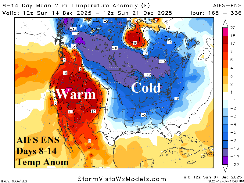
Fig. 1-2: The 12Z ECM ENS and AIFS ENS 8-14-day temperature anomaly forecasts for the U.S.
Discussion: The frigid start to December 2025 across the entire central and eastern U.S. continues this week. However, the usually reliable ECM ENS moderates the Northeast/East U.S. cold in the 8-14-day period (Fig. 1). The North Atlantic oscillation (NAO) shifts to positive phase supporting a warm-up. However, the above normal snow cover in-place now needs to significantly erode to allow warming. AIFS ENS, comparative with ECM ENS skill scores, maintains the East U.S. cold in the extended range (Fig. 2). Northern U.S. snowfall/snow cover is expected to increase during the next 15 days.
In South America, rainfall forecasts have shifted wet risk to Brazil during the past 1-2 weeks. The 7-day percent of normal observed rainfall identifies wetter Brazil weather while rains linger in Argentina (Fig. 3). Low pressure areas spawn heavy rain the next 1-2 days Paraguay into Brazil and Northeast Argentina late this week (Fig. 4). Additional heavy rain is projected in the 6-10-day and 11-15-day period centered east of Paraguay (Fig. 5-6).
In Europe, the lack of snow cover (Fig. 7) continues through the next 2 weeks. Consequently, the 15-day outlook is somewhat warmer than normal (Fig. 8). A recent wet pattern across Southeast Europe reverses to dry and spreads across East Europe to the Black Sea region in the 15-day outlook.
In Australia, anomalous heat is dominant this week and again in the 11-15-day period while wet weather is generally confined to northwest continent and coastal New South Wales.
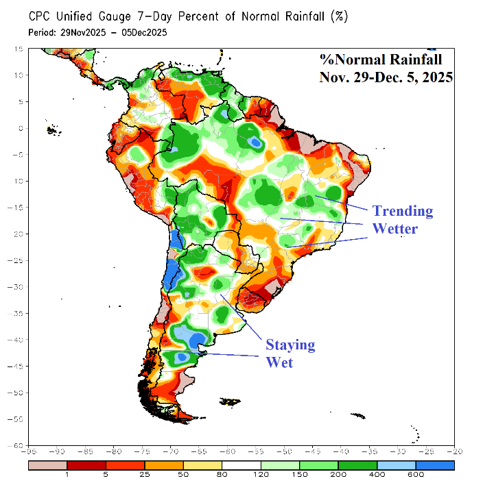
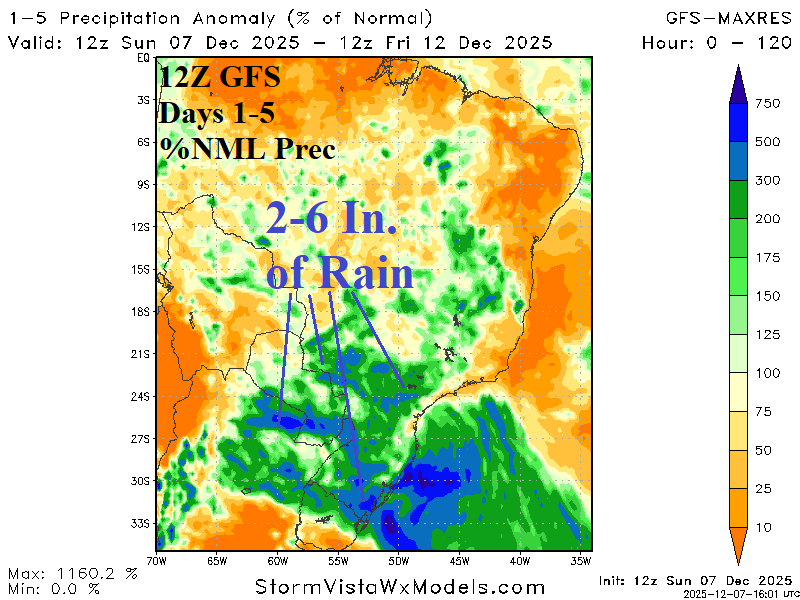
Fig. 3-4: The 7-day percent of normal rainfall observations and 5-day percent of normal rainfall forecast.
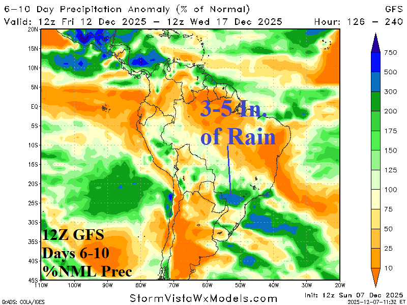
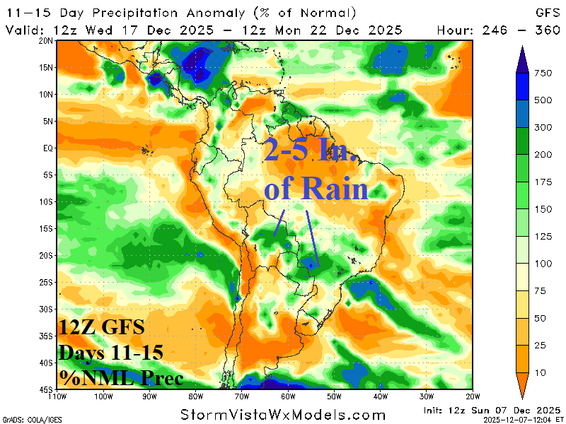
Fig. 5-6: The 12Z GFS medium range percent of normal rainfall forecast across South America.
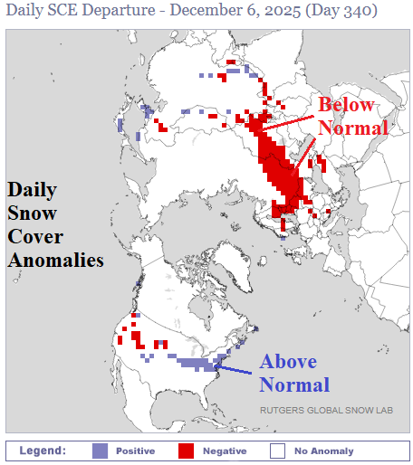
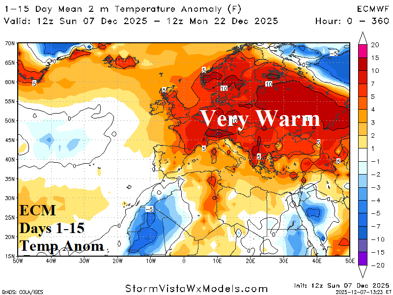
Fig. 7-8: Daily northern hemisphere snow cover anomalies and the lack of snow in Europe maintaining a warm bias to the weather pattern through 15 days.