U.S. Heatwave to Expand to Midwest and Mid-Atlantic U.S. and Midwest Drought to Re-intensify
07/19/2023, 4:59 am EDTAtmospheric El Nino Climate Continues to Lag Oceanic El Nino
07/24/2023, 11:50 am EDT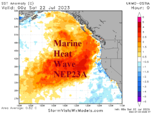
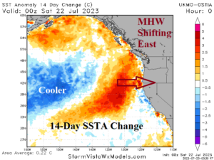
Fig. 1-2: The Northeast Pacific marine heatwave “NEP23A” and 14-day SSTA change indicating an eastward shift to the coast.
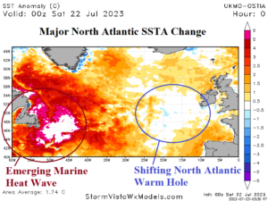
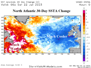
Fig. 3-4: The North Atlantic SSTA analysis identifying a new marine heatwave off Newfoundland and eastward shift of the North Atlantic warm hole.
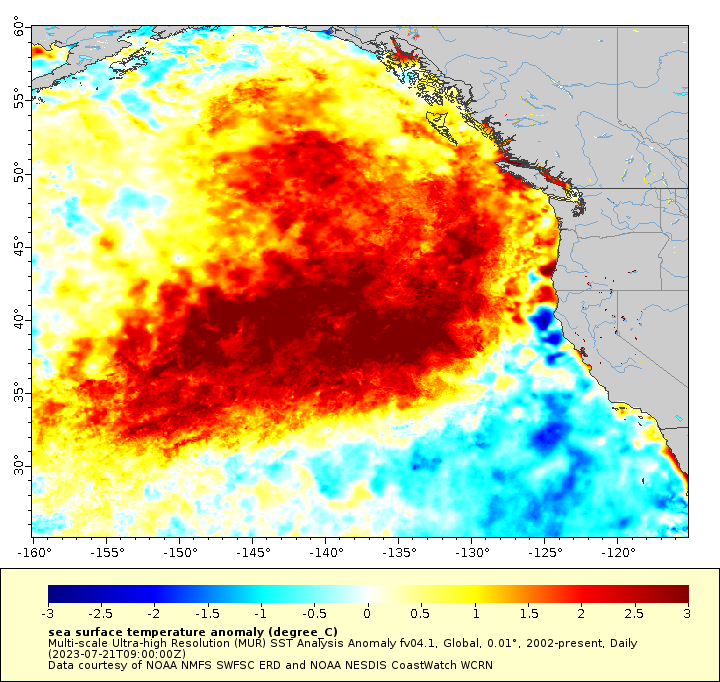
Discussion: The Northeast Pacific marine heatwave “NEP23A” has intensified and shifted east during the past several weeks. Waters northeast of Hawaii have cooled significantly. The long-standing cool phase of the Pacific decadal oscillation (-PDO) is weakening. Waters off Southern California and Baja California coasts are also warming. The warmer trend is expected given the prohibitive El Nino warming of the tropical East Pacific. If the warming trend continues along the entire East Coast of the U.S. and joins the warming of the East Pacific tropics, a 2015-style intense El Nino would form by SEP/OCT. For now, global SSTA forecast models are not forecasting this warm surge. However, for dynamic models forecasting a strong El Nino ahead for late this year, the U.S. West Coast warming is required. The warming of waters off the U.S. West Coast supports returning upper-level high-pressure ridging for late summer to reheat the West U.S./Southwest Canada.
Meanwhile, a dramatic change in the North Atlantic SSTA pattern has emerged causing weather pattern changes and extreme events. After a springtime presence of a large area of exceptionally cool SSTA off the Southeast Coast of Canada and east of the Northeast U.S. Corridor and identifying the presence of the semi-permanent North America warm hole (NAWH), a titanic change has occurred during the past 1-2 months. A large marine heat wave has emerged off Newfoundland extending to the U.S. East Coast. The 30-day change identifies the rapid development of this regional warm water zone. The NAWH pattern has shifted eastward to the west of Europe where 30-day SSTA changes are prohibitively cool. The rapid warming of waters off Southeast Canada propelled recent storms to cause >10 in. of rain flooding Nova Scotia while a much cooler/wetter weather pattern change associated with NAHW is about to sweep into Europe. In response to an upper trough across and downwind the shifting NAWH, the upper ridge pattern capable of delivering late season heat and drought risk is likely to also shift eastward to Eastern Europe/Western Russia.

