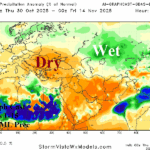
Black Sea Region Was Wet in October Reverses Dry in November
10/30/2025, 4:42 am EDT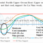
Short On Fuel to Keep La Nina Going
11/03/2025, 3:18 pm EST
Climate Impact Company Week 2-4 Outlook
North America
Issued: Friday, October 31, 2025
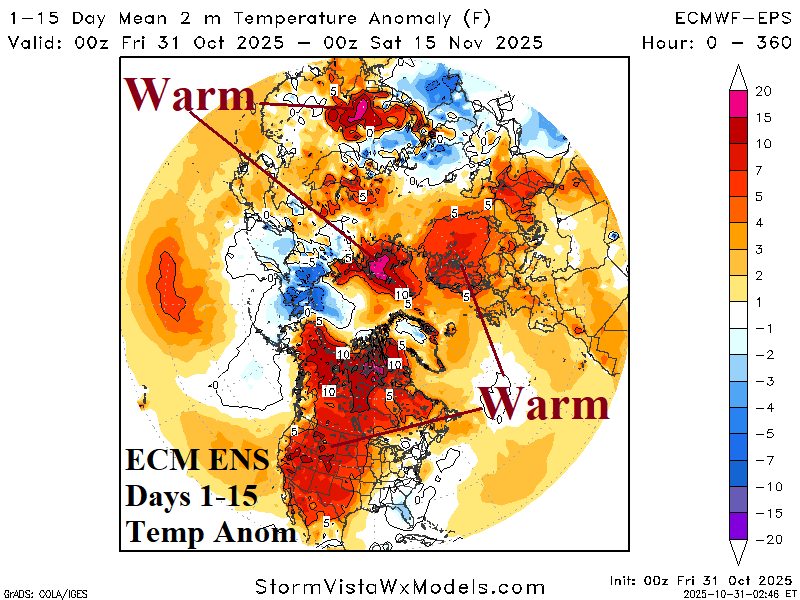
Highlight: Warm pattern continues shifting to seasonably chilly late November.
Charts of the day: The northern hemisphere cold season starts warmer than normal, inspired by warmer than normal oceans.
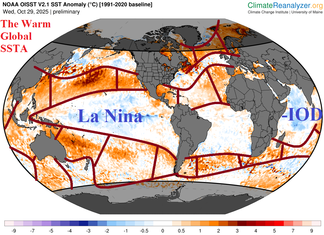
Discussion: The much warmer than normal ocean surface away from the tropics will provide a warmer than normal bias to the hemispheric thermal pattern until a pattern shift propelled by a strong convection phase of the Madden Julian oscillation (MJO) shifting across the tropical Pacific through the Atlantic Ocean(s) or a stratospheric warming event. The MJO is moderately strong across Maritime Continent but slow to shift east while minor stratospheric warming appears in Northeast Asia in the 11-15-day period.
Week-2 Ahead Forecast valid November 9-16, 2025: Dry and warm.
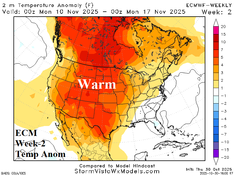
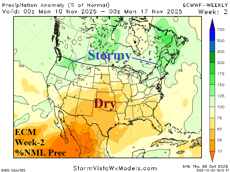
Discussion: Looking familiar, another warm ECM week-2 outlook featuring mostly dry weather across the U.S. The Northwest U.S. and New England are stormy. Excellent agreement between operational and AI models.
Week-3 Ahead Forecast valid November 16-23, 2025: Stormy; a little cooler.
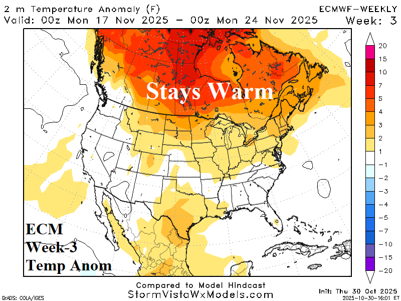
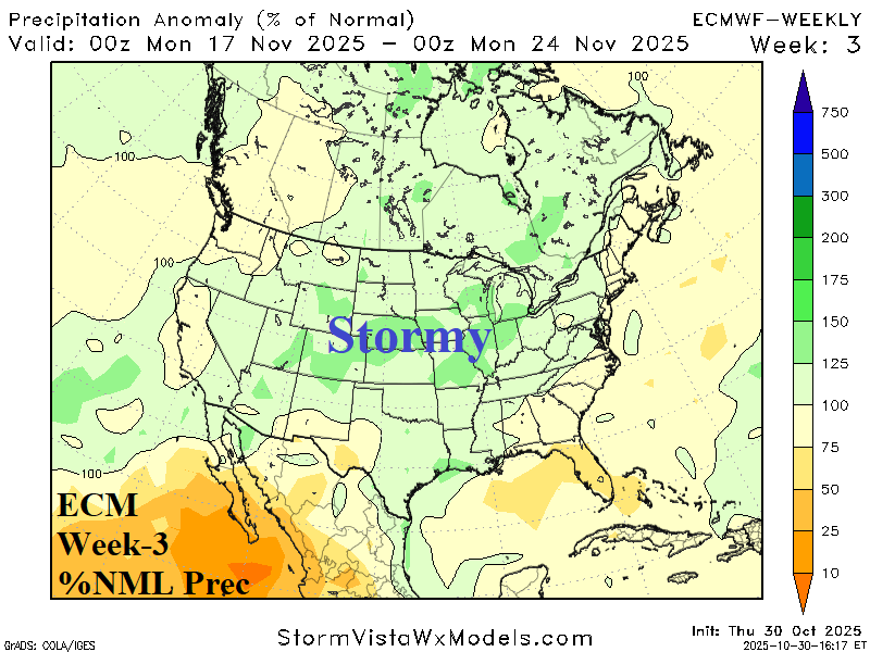
Discussion: An energetic storm track, possibly motivated by a transient tropical Pacific MJO, emerges from the Colorado Rockies to Quebec. The wetter pattern (also featuring some snowfall) begins to cool the U.S. toward normal.
Week-4 Ahead Forecast valid November 23-30, 2025: Normally cool.
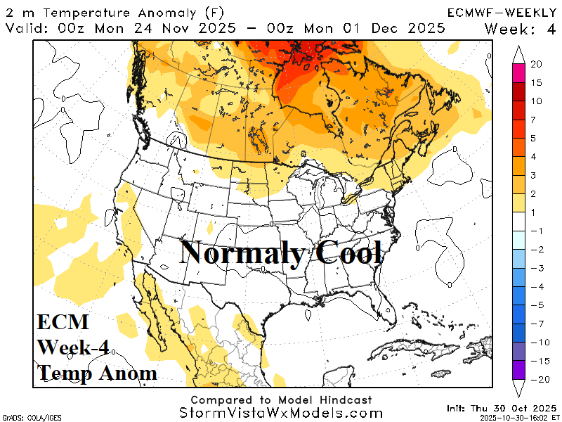
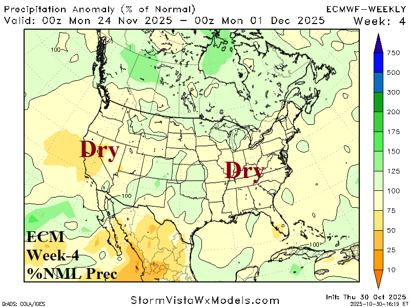
Discussion: A normally cool end to November is expected with lack of potent storms.