The Asia/Bering Sea/North America Pattern Shifts and Warms The U.S.
02/05/2026, 8:40 am EST

Climate Impact Company Early U.S. Notes
Issued: Friday February 6, 2026
Highlight: Last cold blast for the Northeast of winter.
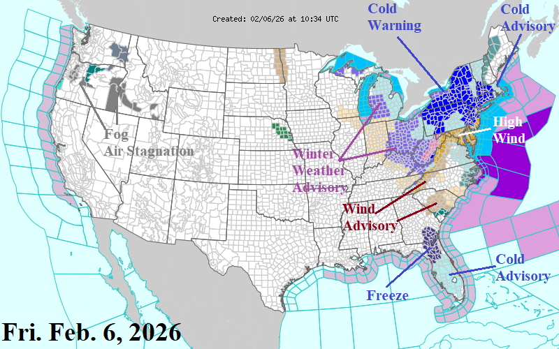
Fig. 1: Latest NOAA/NWS weather warnings, watch and advisory areas.
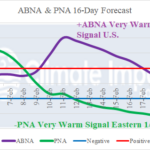
Discussion: Weather warning, watch, and advisories cover the Northeast and East U.S. this morning for the last blast of arctic air of the winter season (Fig. 1). Added are High Wind Warnings for the Mid-Atlantic region which drive wind chill to -10F to -20F shortly after dawn tomorrow once the arctic air arrives. Fresh snow helps to enhance the incoming cold (Fig. 2). The cold burst marks the coldest air mass of the season for NEPOOL (Fig. 3) with the second coldest for PJM-East. The U.S. gas population weight HDD forecast indicates a sharp decrease in heating demand for mid-to-late February (Fig. 4).
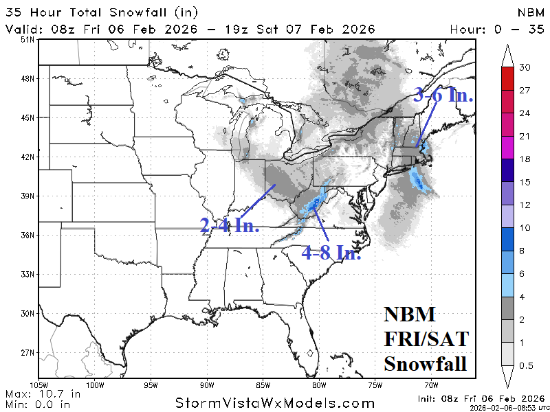
Fig. 2: NBM snowfall forecast for the next 48 hours across the East U.S.
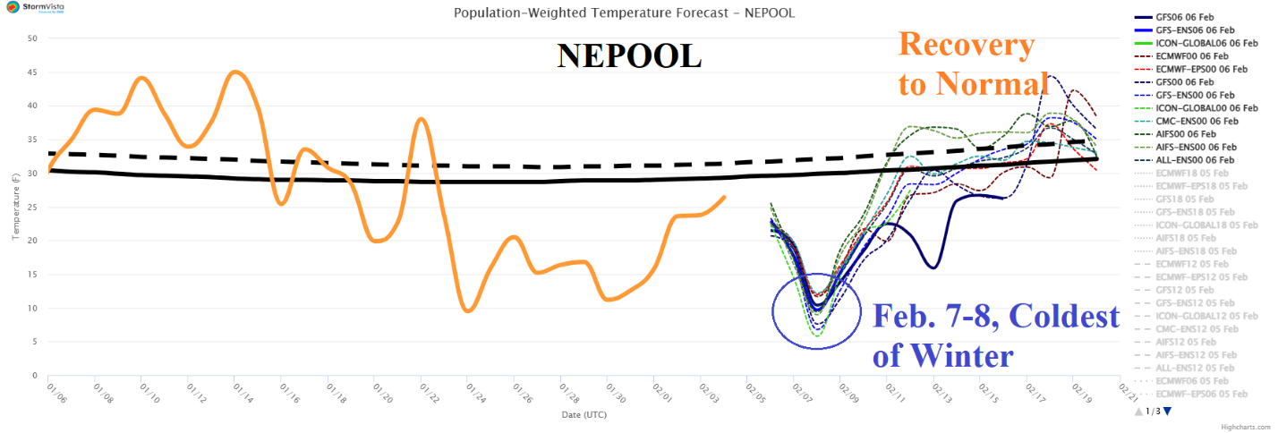
Fig. 3: The coldest 2 days of winter this weekend for NEPOOL.
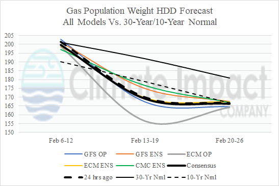
Fig. 4: The U.S. gas population weight HDD forecast through late February.