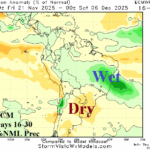
Wet Climate Develops Brazil; Argentina Turns Drier
11/07/2025, 6:05 am ESTIs 12Z GFS Arctic Air 11-15-day Period U.S. Forecast Real?
11/14/2025, 12:49 pm EST
Climate Impact Company U.S. Daily Report
Issued: Tuesday November 11, 2025
Highlight: More interesting (cold) weather ahead!
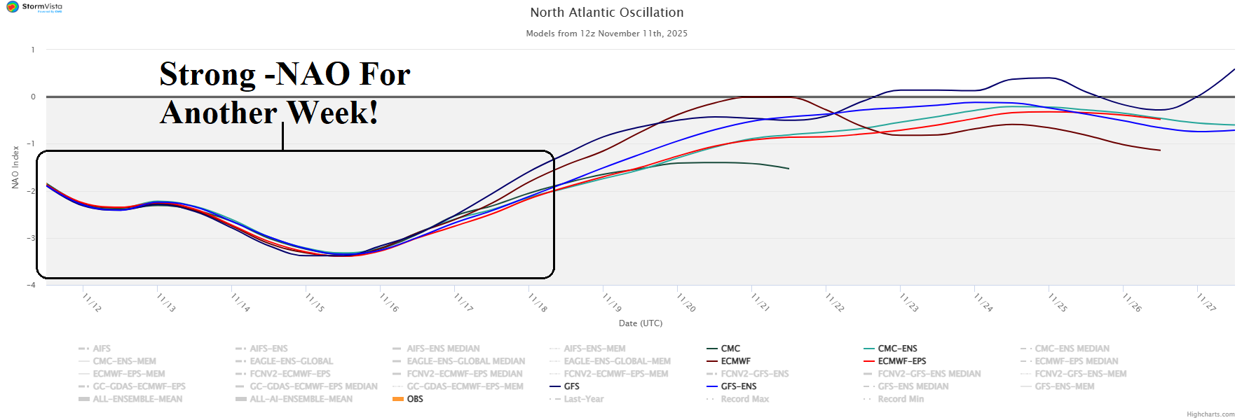
Fig. 1: Strong negative phase North Atlantic oscillation into early next week.
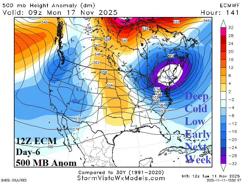
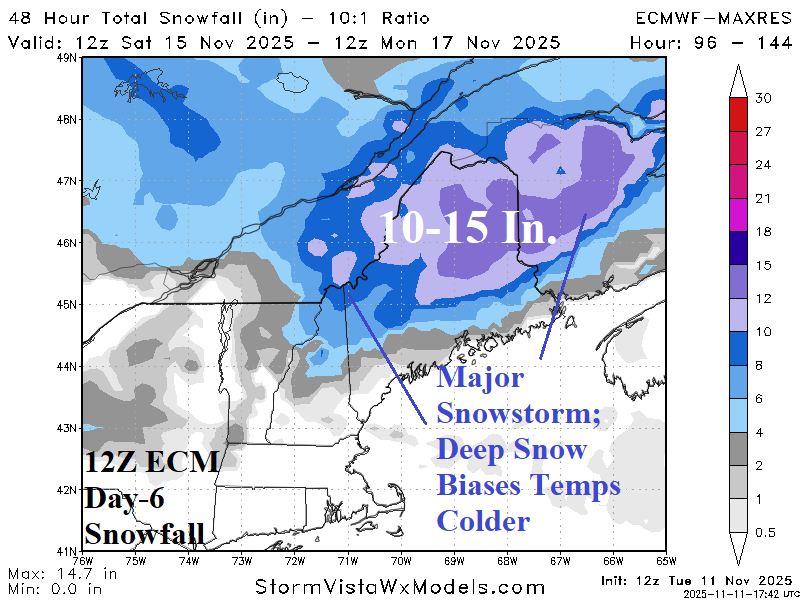
Fig. 2-3: Another -NAO inspired cold trough/snowstorm Northeast U.S. late weekend.
Discussion: An intense negative North Atlantic oscillation (-NAO) weather pattern continues into early next week (Fig. 1). Reasonable is the projection by ECM of another intense -NAO inspired upper trough into the Northeast late this weekend (Fig. 2). The upper trough triggers more chilly weather although not quite as cold as today plus a major snowstorm over Maine (Fig. 3). The snowfall/snow cover will bias temperature cold in that region. Meanwhile, a developing negative phase of the East Pacific oscillation (-EPO) is forecast for the 11-15-day period (Fig. 4) which favors a cold upper trough in the Central U.S. (Fig. 5). The ECM is correctly the coldest operational model in the 11-15-day forecast (Fig. 6).
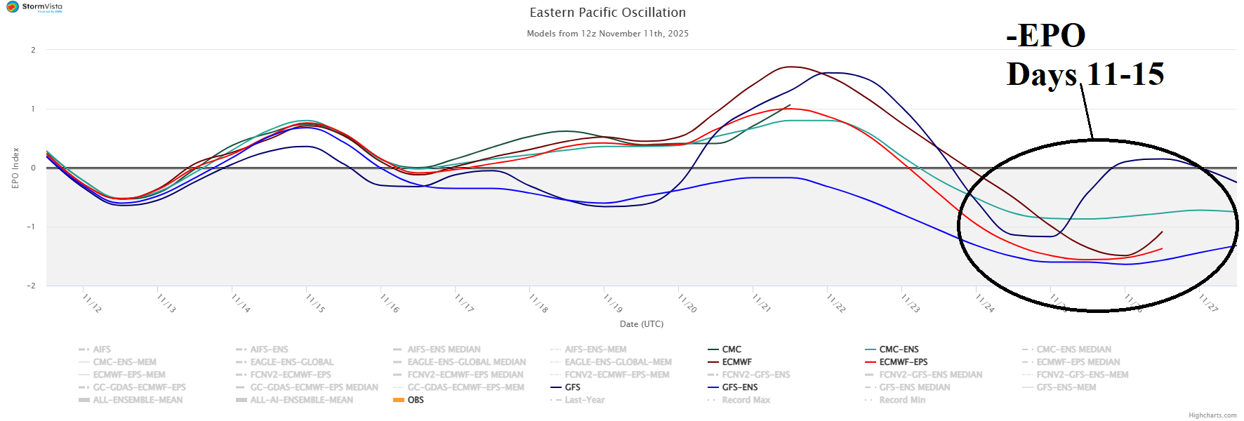
Fig. 4: Developing negative East Pacific oscillation in the 11-15-day period.
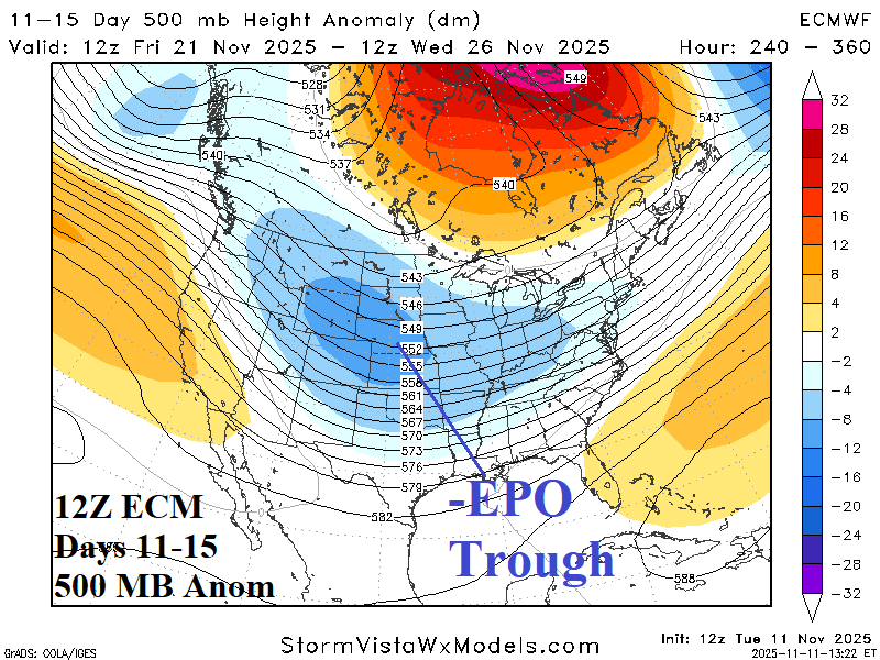
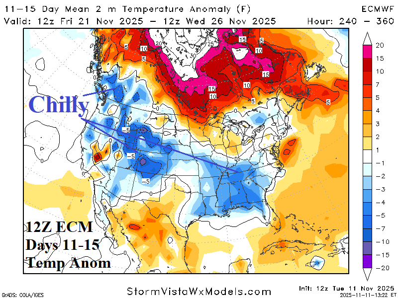
Fig. 5-6: ECM indicates -EPO inspired Central U.S. trough and attendant chill.