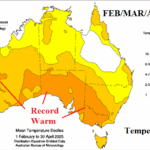
The Power of Marine Heatwaves on Australia Climate
05/09/2025, 6:30 am EDT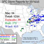
Brief Review of the May 15-16 U.S. Severe Weather Event
05/18/2025, 7:29 pm EDT
Climate Impact Company Tropical Feature
Issued: Monday May 12, 2025
Highlight: Monitoring the North Atlantic basin SSTA ahead of tropical cyclone season…Starting to warm but cooler than 1 year ago.
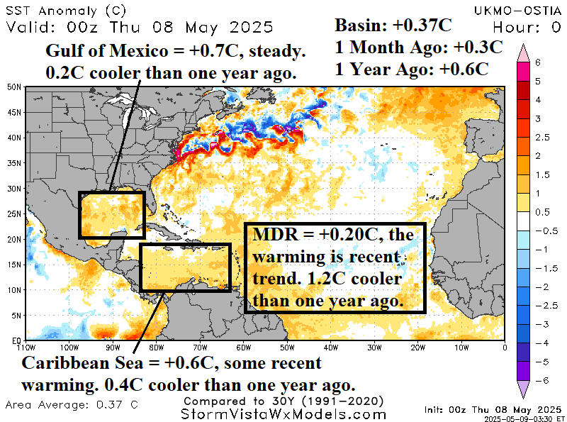
Fig. 1: The North Atlantic basin daily SSTA analysis with annotated statistics/comments for various basins.
Discussion: The official start of the North Atlantic basin tropical cyclone season is June 1st. During the active tropical cyclone season period of 2016-2024 when an average of 18-19 named storms have generated each year, the North Atlantic has averaged much warmer than normal and a likely catalyst to the active period. As mid-May approaches, the North Atlantic basin is marginally warm (+0.37C) and 0.23C cooler than 1 year ago (Fig. 1). In fact, the main development region (MDR) for hurricanes located between the Caribbean Sea and northwest coast of Africa is marginally warmer than normal and a whopping 1.2C cooler than one year ago. The Caribbean Sea and Gulf of Mexico are each marginally to moderately warmer than normal but much cooler than 1 year ago. The basin 30-day change identifies some warming in the Eastern Caribbean Sea and outer tropical North Atlantic plus the southwest Gulf of Mexico (Fig. 2). An exceptionally cooler than normal ocean surface off the Northeast U.S. Coast as calendar winter ended has warmed significantly during the past 30 days. Compared to 1 year ago, note the much cooler changes across the eastern North Atlantic basin while the western basin is warmer (Fig. 3).
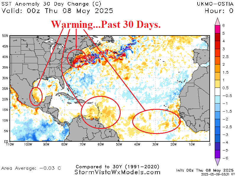
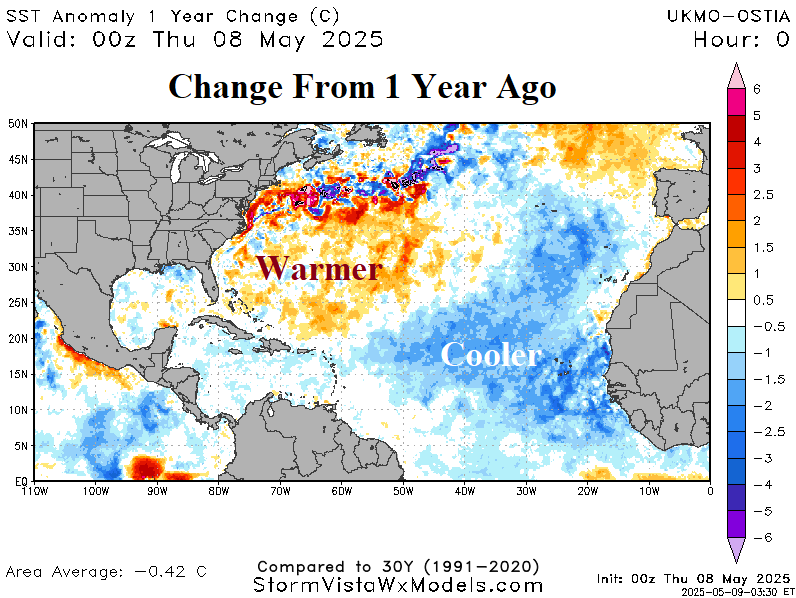
Fig. 2-3: The Climate Impact Company 2025 North Atlantic hurricane tracks outlook and CIC/CSU/TSR seasonal activity forecast.