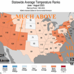
U.S. Meteorological Summer and August (2025) State Climate Rankings
09/09/2025, 12:22 pm EDT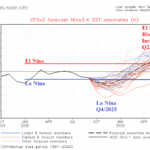
Flip to El Nino in 2026 Increasingly Confident
09/15/2025, 11:45 am EDT
Climate Impact Company Pacific Decadal Oscillation Report
Issued: Friday, September 12, 2025
Highlight: Has the Pacific decadal oscillation flipped to positive phase?
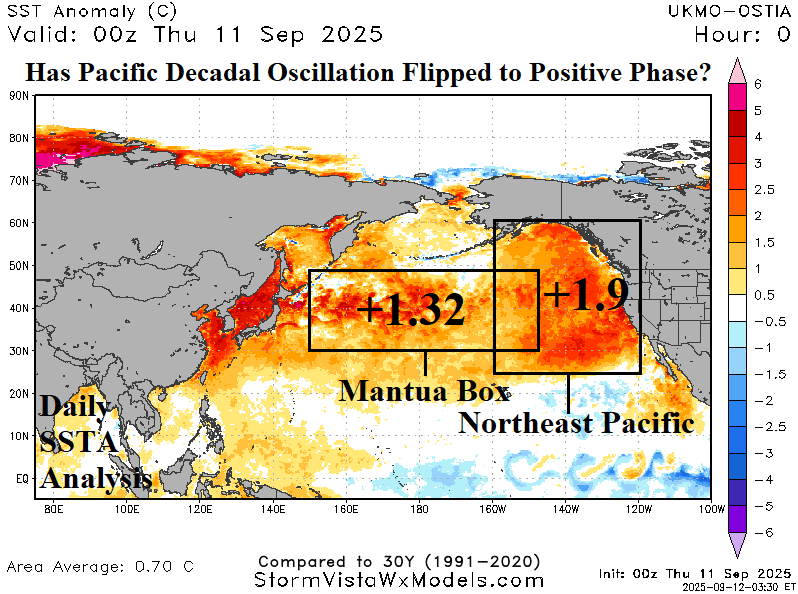
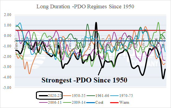
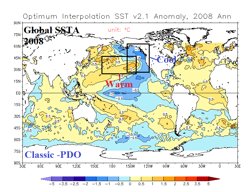
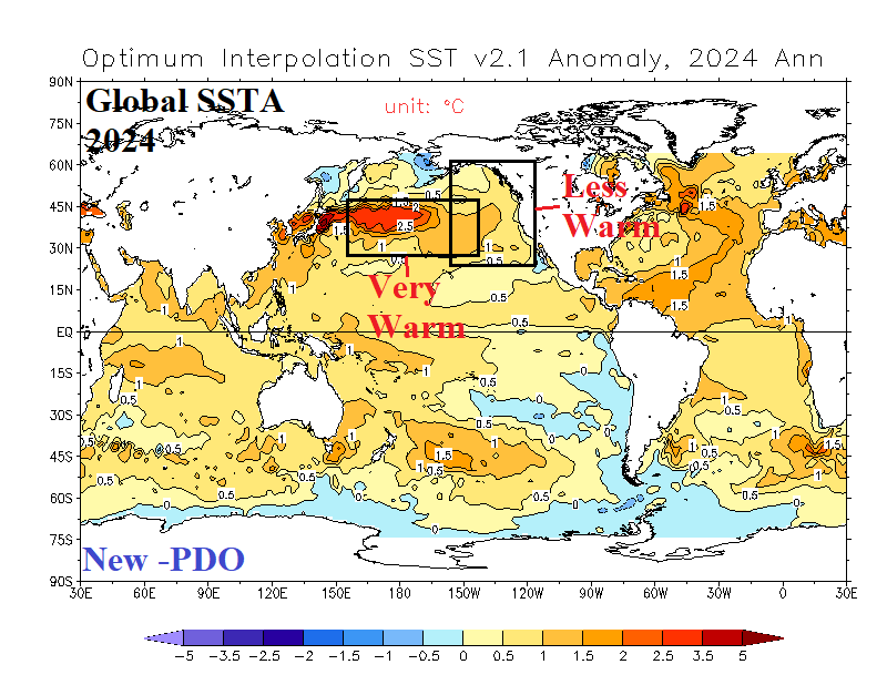
Fig. 1-4: The daily North Pacific SSTA analysis, long duration -PDO regimes since 1950, and classic and new -PDO regime comparisons.
Discussion: Merging between marine heatwave (MHW) NEP25A and NEP25B occurred during late AUG/early SEP as exceptionally warm sea surface temperature anomalies (SSTA) reached the West Coast of North America in the Northeast Pacific (Fig. 1). The warming water surface episode is similar with the previously strongest warming event observed during 2013-16, commonly referred to as the “warm blob”. During the “warm blob” regime, the Pacific decadal oscillation (PDO) warm phase was robust with warm peaks in DEC-14 (+1.86) and APR-16 (+1.74). Since 2020, the strongest long-term -PDO regime in the 1950-2025 record is observed (Fig. 2). Previous 5+ year -PDO regimes were each similar in that the “classic” cool phase PDO SSTA regimes were observed with warm Central Pacific SSTA compared to a cool Northeast Pacific SSTA as observed in 2008 (Fig. 3). The “new” -PDO is different. During the 2020-25 -PDO regime the SSTA pattern in the Northeast Pacific is generally warmer than normal while the Central (and West) Pacific is record warm as observed in 2024 (Fig. 4). Currently, a comparison between the Mantua Box (150E to 150W between 30N and 50N) which remains a robust warm +1.32C (SSTA) is not as warm as the Northeast Pacific due to the “warm blob” at +1.90C (SSTA). Implied is the 2020-25 -PDO has subsided. Recall that the 2013-16 “warm blob” eventually expanded to the tropical East Pacific resulting in one of the strongest El Nino episodes on record. NCEP CFS V2, ECMWF, and POAMA Nino34 SSTA forecasts depart the Q4/2025 La Nina and trend toward warm ENSO during the middle of 2026.