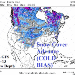
Expected Evolving Snow Cover Is The Cold Weather Key for December
11/21/2025, 12:54 pm EST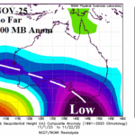
Hotter/Drier Regime Emerges Gradually in December for Australia
11/25/2025, 5:40 am EST
![]()
Climate Impact Company Sunday AG Report
Global Weather/Climate Report
Issued: Sunday November 23, 2025
Highlight: Changeable Argentina/Brazil rainfall pattern favoring mostly wet in Brazil, Europe is chilly with some snow this week, and wet North/East Coast Australia.

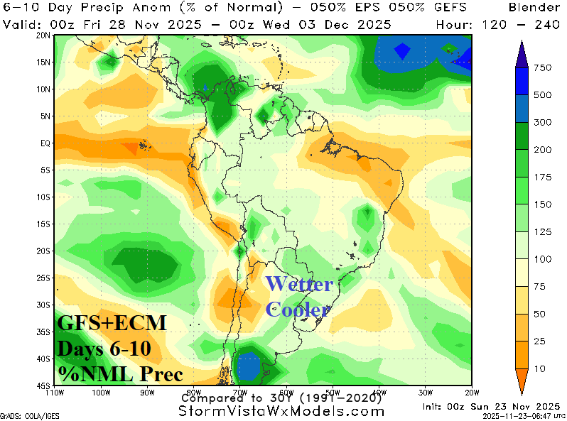
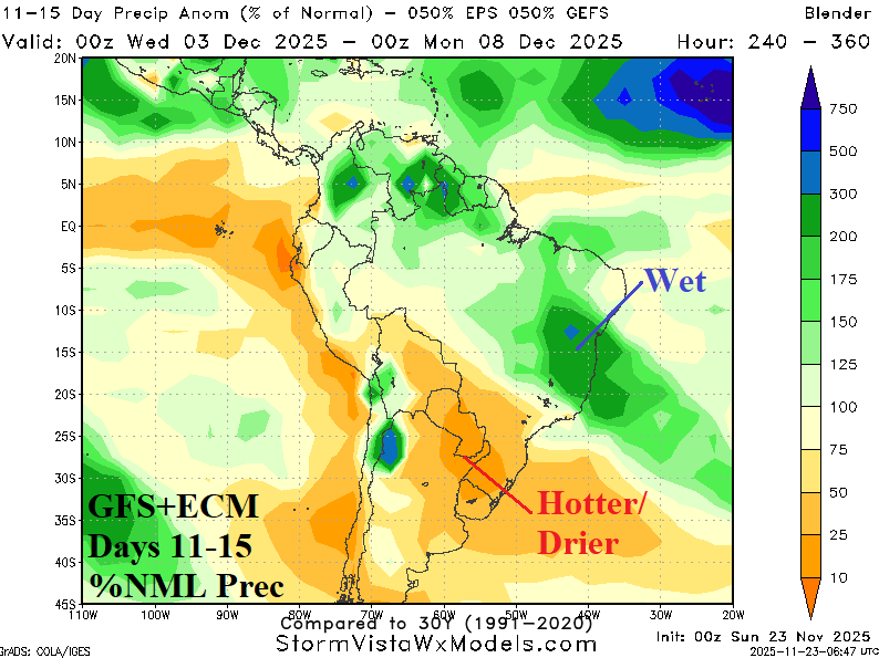
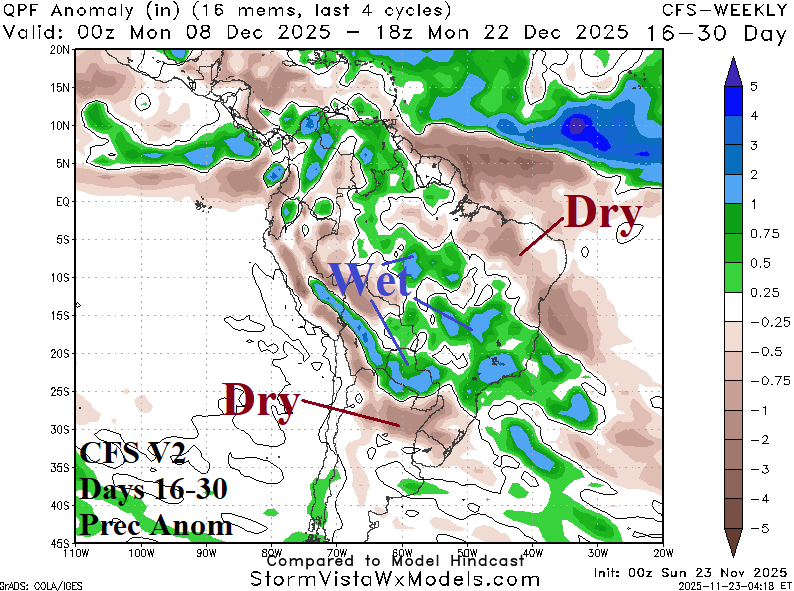
Fig. 1-4: The South America 1-15-day percent of normal rainfall forecast based on equally combining the GFS and ECM plus the CFS V2 16-30-day forecast.
Discussion: Combining equally the GFS and ECM produces a dry and hot forecast across Argentina while East Brazil is wetter than normal (Fig. 1). An interruption in this (new) pattern appears in the 6-10-day forecast as widespread rain affects both Argentina and Brazil (Fig. 2). Additionally, Argentina is cooler due to the precipitation. In the 11-15-day forecast, the dryness and heat regenerate in Argentina while East/Northeast Brazil are wet again (Fig. 3). The wettest 16-30-day forecast is the NCEP CFS V2 which indicates above normal rainfall across much of Brazil with some dryness in Northeast Argentina (Fig. 4). Other models such as ECM and Graph Cast are much drier Southeast Brazil and Northeast Argentina.
In Europe, cold weather finishes November followed by moderation early December with some uncertainty whether cold weather returns in 2 weeks (Fig. 5). In 15 days, the “most likely” upper air forecast for Europe supports near normal temperature in Europe while “caveat” forecasts develop an intense cold trough over North-central Asia while a mild upper trough is present over Europe. Extended-range temperature forecasts for Europe/Russia are made with low confidence. The Europe 15-day precipitation forecast indicates a vigorous storm track near and offshore the West Coast and across Southeast Europe (Fig. 6). Snow cover increase is notable midweek across South-central and East Europe (Fig. 7).
Through the next 15 days, on average, heavy rain affects the North and Northeast Coast of Australia while Coastal Southeast Australia (and offshore) observe heavy rains (Fig. 8). There is a pattern change, hot weather away from the coast for much of East Australia this week shifting cooler next week when anomalous heat shifts to the West Coast (Fig. 9-10).

Fig. 5: The daily average temperature anomaly across Europe through 15 days.


Fig. 6-7: The ECM 15-day percent of normal precipitation forecast for Europe and GFS snow on the ground projection for mid-week.

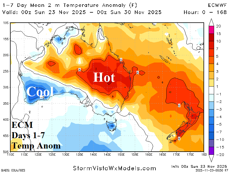

Fig. 8-10: The 15-day ECM ENS rainfall forecast across Australia and the ECM 1-7-day and 8-14-day temperature anomaly outlook.