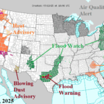
Central Texas Flash Flood Warnings Issued Again
07/13/2025, 1:04 pm EDT
Issuing Heat Alert for Central/South-central U.S. Late July
07/15/2025, 4:59 am EDT
Climate Impact Company Early AG Market ALERT
Issued: Monday July 14, 2025
Highlight: Monsoon inspired wet pattern U.S. Corn Belt; Developing heat Central Plains next week. Wetter Central Europe; Hotter Black Sea region.


Fig. 1-2: ECM 15-day percent of normal rainfall across North America identifies the Monsoon to Midwest connection; ECM ENS hot Central U.S. 8-14-day forecast.
Discussion: The ongoing wet Southwest U.S./Mexico monsoon moisture pattern to the persistent thunderstorms and heavy rain in the Midwest States continues in the latest 15-day outlook from ECM (Fig. 1). However, one change is regarding the temperature pattern. The release of heat from the Mexico/Southwest U.S. convection warms and dries the atmosphere to the east. Consequently, a drier and hot weather pattern emerges over recently soaking wet zones in Texas and northward to Kansas with an attendant hot weather pattern (Fig. 2). The heat could reach the U.S. Corn Belt in the 11-15-day period.
The persistent high-pressure area over Europe (Fig. 3) producing hot and dry weather during meteorological summer so far is associated with the North Atlantic SSTA pattern featuring a vivid North Atlantic warm hole (NAWH) south of Greenland and marine heat waves (MHW) west of Europe and across the Mediterranean Sea (Fig. 4). As mid-summer arrives, persistence begins to shift causing a pattern change for Europe for the second half of July. The pattern change is associated with an active phase_5/phase_6 of the Madden Julian oscillation (MJO) and shift from a long-standing negative phase of global atmospheric angular momentum (-GLAAM) to the positive phase for late July. ECM ENS best identifies the pattern change: 1.) Heat shifting to Southern Europe and eastward to the Black Sea region (Fig. 5) and 2.) Emerging showery weather pattern across Central Europe (Fig. 6).
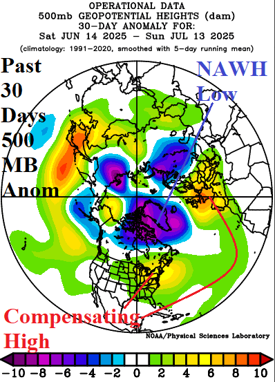
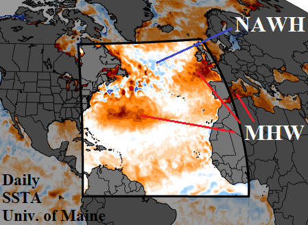
Fig. 3-4: The 30-day northern hemisphere 500 MB anomaly pattern identifies the upper trough across the North Atlantic warm hole and the compensating upper ridge areas across Europe and the East U.S. plus the daily SSTA analysis.
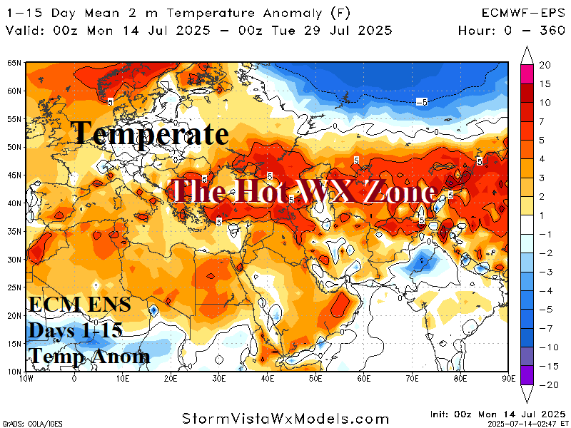
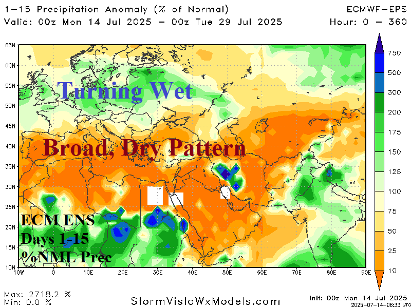
Fig. 5-6: The latest 15-day temperature anomaly and percent of normal rainfall forecast across Europe and Western Russia according to ECM ENS.