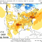
CFS V2 Projects Hot July Southwest Plains to New England and Eventually California
06/24/2025, 5:10 am EDT
AG Traders/Analysts Understanding Rainfall Forecasts
06/29/2025, 10:12 am EDT
Climate Impact Company Early AG Market ALERT
Issued: Thursday June 26, 2025
Highlight: North America (wet) monsoon controlling U.S. rainfall pattern.
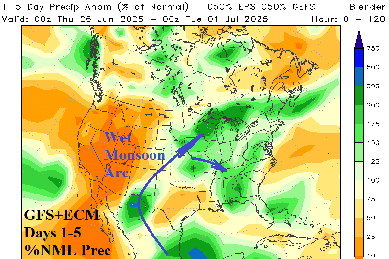
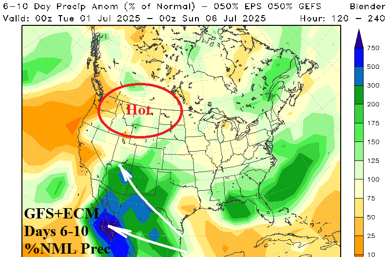
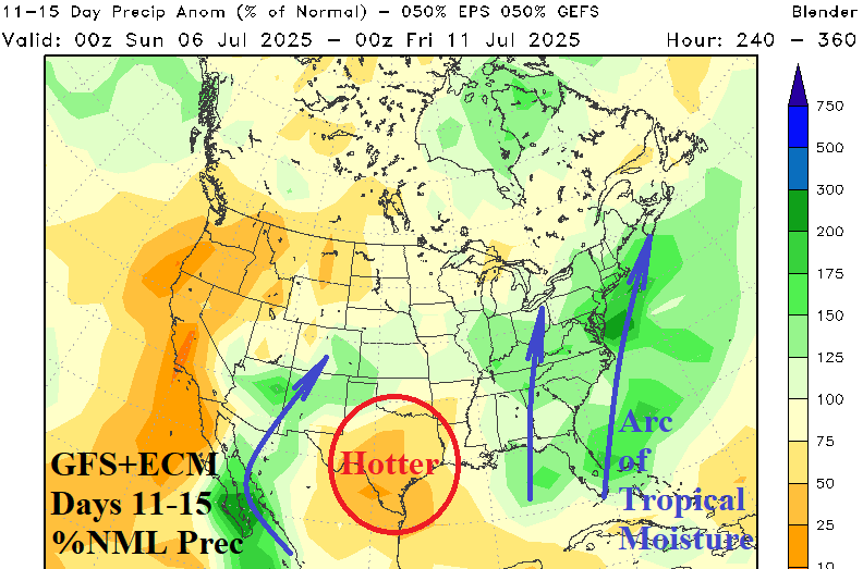
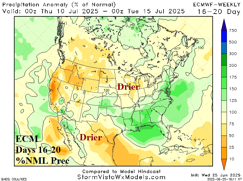
Fig. 1-4: The equally weighted GFS and ECM percent of normal precipitation forecast through 15 days and ECM for 16-20 days.
Discussion: An arc of tropical moisture extending across Mexico from the western Gulf of Mexico and northeastward to the Midwest U.S. is (clearly) evident in the 5-day rainfall forecast equally combining GFS and ECM (Fig. 1). Outflow boundaries from the Midwest rains trigger thunderstorms across the Southeast U.S. In the 6-10-day period, the Mexico/Southwest U.S. Wet Monsoon intensifies (Fig. 2). The latent heat release from the convection poleward causes a hot weather regime across the Northwest U.S. and Canadian Prairies. In the 11-15-day period, the GFS and ECM combine to indicate some weakening of the Mexico/Southwest U.S. Wet Monsoon while wet weather focus shifts to the East U.S., including much of the U.S. Corn Belt, fueled by a tropical connection to the northeast Gulf of Mexico (Fig. 3). As the Mexico/Southwest U.S. Wet Monsoon eases in the 16-20-day period, Northwest U.S. dryness reliably spreads to parts of the Midwest U.S. and is compensated for by drenching rains in the Southeast/Mid-Atlantic States (Fig. 4). The North Atlantic basin tropics are quiet while the wet monsoon climate is controlling U.S. climate.