NOAA/CPC High Impact Weather Forecast in 6-10-Day Period
10/23/2025, 8:20 am EDT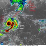
Category-5 Major Hurricane Melissa at 901 MB (175 mph wind); 890 MB (190 mph wind) Later Today
10/28/2025, 8:53 am EDTClimate Impact Company U.S. Sunday Report
Issued: Sunday, October 26, 2025
Highlight: Mid-winter U.S./Europe/China; Catastrophic Melissa; Cooler East U.S.
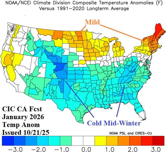
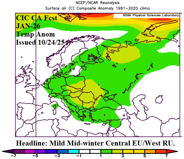
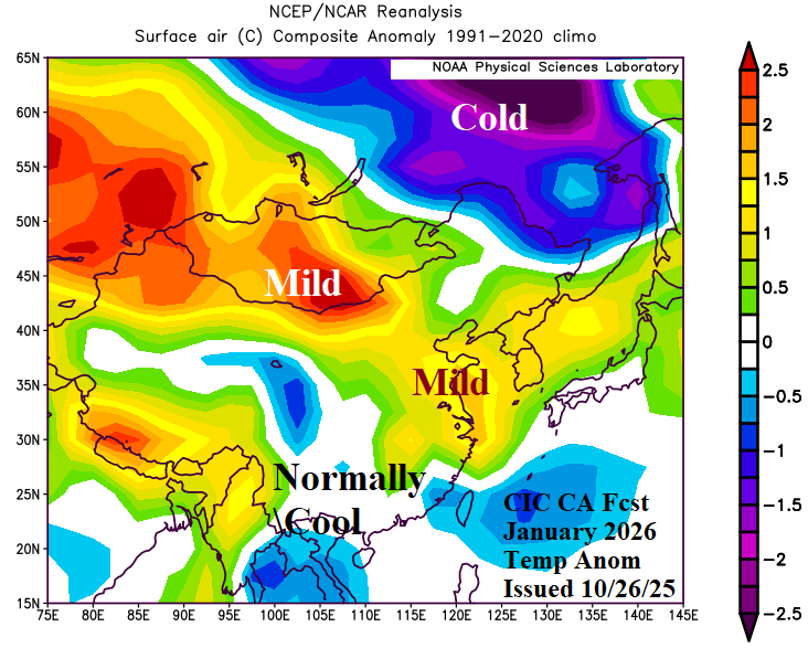
Fig. 1-3: Climate Impact Company constructed analog January 2026 temperature anomaly forecast for U.S., Europe, and East Asia.
Discussion: The mid-winter cold threat based on the Climate Impact Company constructed analog (CIC-CA) is highest in the U.S. while Europe and China avoid significant cold (Fig. 1-3). Largest arctic air threat for each region is in February.
Major Hurricane Melissa slowly approaches Jamaica over the next 24-36 hours while intensifying to a category-5 major hurricane (Fig. 4). Melissa moves northeastward as a major hurricane across Southern Cuba into midweek with the U.S. Naval Base at Guantanamo Bay in the dangerous right front quadrant of the hurricane. The NOAA/NHC rainfall forecast indicates widespread 10-30-inch amounts with high spots near 40 inches causing widespread flash flooding and numerous mudslides in parts of Hispaniola, all of Jamaica, and Eastern Cuba (Fig. 5). Melissa begins to weaken northeast of Cuba although remaining a hurricane striking Bermuda Wednesday.
The U.S. 15-day temperature outlook has shifted cooler East over the weekend. The cooler changes in the East weight the U.S. HDD forecast cooler than the 30-year normal this week and near normal during the medium range (Fig. 6).
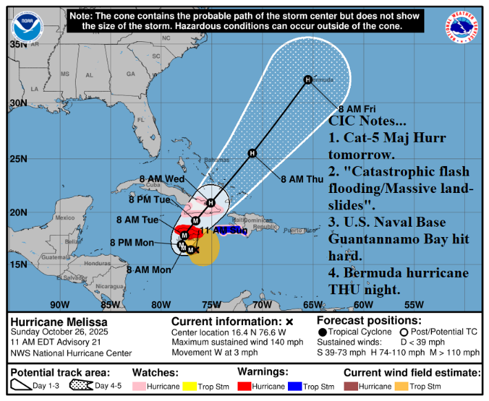
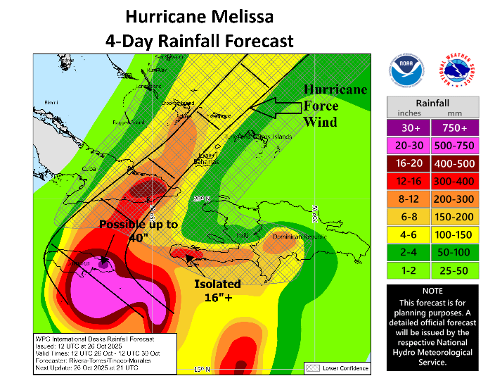
Fig. 4-5: Major Hurricane 5-day forecast track with the attendant heavy rain/hurricane force wind forecast.

Fig. 6: The U.S. gas population weight HDD forecast utilizing all models and comparing the consensus with this past Friday morning outlook plus 30-year/10-year normal.