Eclipse Obscured by Cloudiness: Wind Event Central Great Plains Days 11-15
03/26/2024, 9:37 am EDT
Slow Decay of El Nino Continues
04/01/2024, 7:53 pm EDT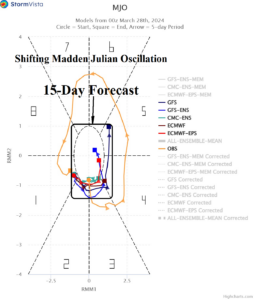
Fig. 1: The 15-day projection of the transient Madden Julian oscillation.
Discussion: The Madden Julian oscillation (MJO) has been very active since last September. The 5th transient MJO across the equatorial Pacific recently ended and MJO is now shifting across the tropical Atlantic and heading back to home base in the Indian Ocean tropics in early April. The 15-day forecast utilizing all models indicates an eastward shift reaching Maritime Continent in 2 weeks with marginally moderate intensity is likely (Fig. 1).
The MJO has influence on the Australia and Brazil rainfall climate. Based on climatology, the MJO favors a wetter short-term regime in Brazil flipping drier in the extended range. In Australia, the eastward MJO shift indicates the Australian climate becomes wetter in early April.
The 1-7-day wetter forecast for Brazil is supported by the MJO (Fig. 2). However, the wet forecast for Brazil in the 8-14-day period is too wet (Fig. 3). In Australia, short-term forecasts may be too wet (Fig. 4) while the 8-14-day forecast wet pattern could be more widespread (Fig. 5).
In Europe, the recent and ongoing heavy rains across West/Southwest Europe are contributed to by the MJO presence in the tropical Atlantic. The heavy rains continue in the 1-7-day forecast (Fig. 6). However, the eastward shift of the MJO back to the Indian Ocean and Maritime Continent in 10+ days should ease the wet pattern in Western Europe. Consequently, the 8-14-day forecast should trend less wet (Fig. 7).
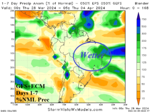
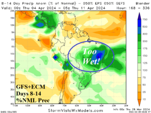
Fig. 2-3: The GFS+ECM 1-7-day and 8-14-day percent of normal rainfall across South America.
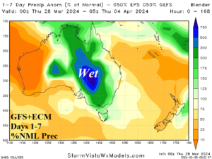
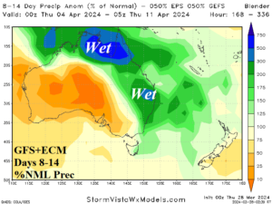
Fig. 4-5: The GFS+ECM 1-7-day and 8-14-day percent of normal rainfall across Australia.
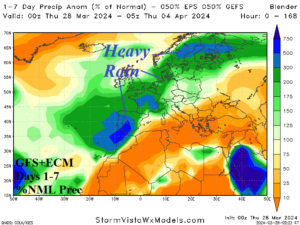
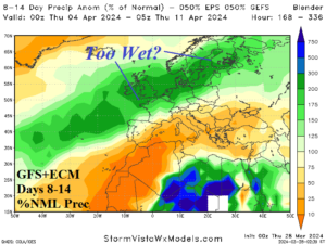
Fig. 6-7: The GFS+ECM 1-7-day and 8-14-day percent of normal rainfall across Europe.
