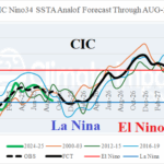
Weal La Nina Ahead; Possible El Nino Mid-2026
10/08/2025, 6:09 am EDT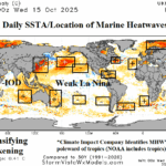
October 2025 Marine Heatwave Outlook
10/16/2025, 8:19 am EDT
Climate Impact Company AG Hot Spot
Issued: Monday October 13, 2025
Highlight: The surprising dry climate in Australia.
Climate discussion: In a surprise, the month of September and especially October (so far) have averaged drier than expected (Fig. 1-2) considering the normally wet bias Australian climate produces when Indian Ocean dipole (IOD) is negative and La Nina is developing. The dry and increasingly warmer than normal pattern, especially in the East (and more recently across the North) is due to negative phase of the southern annular mode (-SAM) or negative Antarctic oscillation (-AAO) in that anomalous high pressure covers Antarctica forcing strong mid-latitude upper troughs, one of which is south of Southeast Australia (Fig. 3). To compensate for the trough, a high-pressure ridge has anchored just off the Australia East Coast recently ridging across the continent (Fig. 4). The ridge broadens to deliver heatwave conditions the next 10 days before the trough south of Australia emits another strong cold front to break the heat in the 11-15-day period. The -AAO pattern is forecast to weaken, but not end, the last third of October (Fig. 5). Consequently, a wet-biased climate fueled by -IOD and La Nina waits.


Fig. 1-2: The SEP-25 and October 2025 (so far) precipitation anomalies.
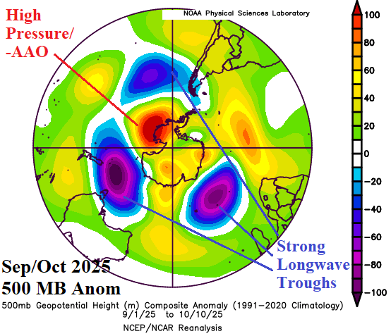
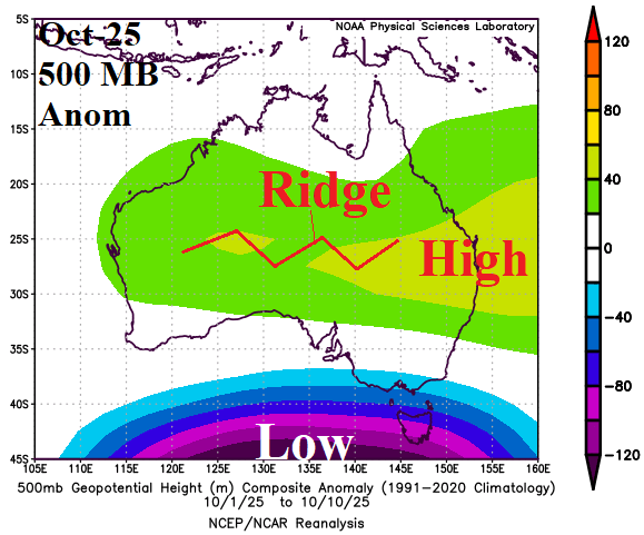
Fig. 3-4: The southern hemisphere 500 MB anomaly pattern since September 1st and October (so far) 500 MB anomalies across Australia.
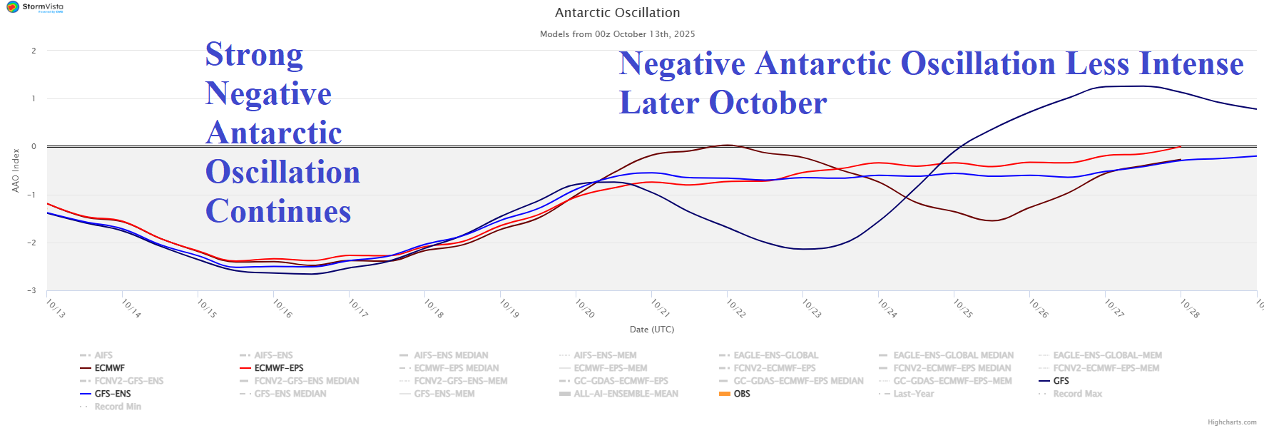
Fig. 5: The 15-day Antarctic oscillation forecast.