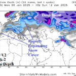
The Colder/Snowier Shift in Europe into Mid-winter
12/29/2024, 10:13 am EST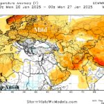
Europe Week 2-4 Outlook Revised Sharply Milder (and Drier)
01/02/2025, 7:12 pm ESTCharts of the day: Updated January/February 2025 temperature anomaly forecast.
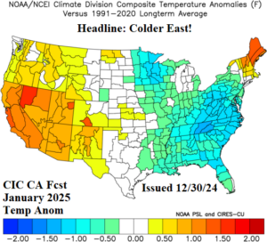
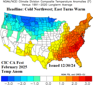
Discussion: The cold burst into the East during the first half of January biases the previous January 2025 temperature anomaly outlook slightly colder in the East and the adjustment is indicated above. A La Nina climate is developing and should bias the East U.S. warmer in February while cold risk shifts to the northwest quadrant of the U.S.
Week-2 Ahead Forecast valid January 5-11, 2025: Sprawling intense cold.
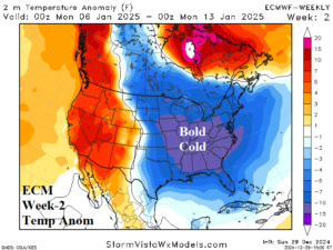
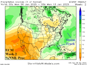
Discussion: An intense high latitude blocking pattern causes the polar vortex to shift southward to the Mid-Atlantic Coast. The intensity of the upper trough is stronger than early February 1978 when the infamous “Blizzard of ‘78” occurred in the Northeast U.S. This time, the upper low is positioned to keep the storm track offshore but attendant cold is widespread and the forecast trend is much colder.
Week-3 Ahead Forecast valid January 12-18, 2025: Lingering cold East/Southeast.
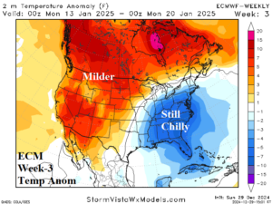
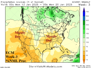
Discussion: The upper trough remains in-place although weaker and the attendant cold loses aerial coverage mostly confined to the Mid-Atlantic and Southeast States. The pattern is dry suggesting snow cover expansion is slowing mid-January.
Week-4 Ahead Forecast valid January 19-25, 2025: Moderating temperatures.
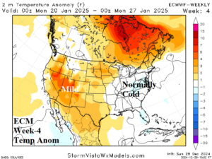
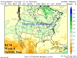
Discussion: Milder Pacific influence returns and causes a weak to moderate coast to coast storm track as temperatures moderate.

