Australia Medium-range Forecast: Vigorous storm track to develop. Colder air ahead!
07/10/2025, 7:05 am EDT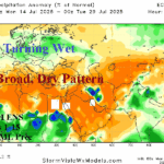
Wetter Pattern Change for Central Europe
07/14/2025, 4:38 am EDTClimate Impact Company U.S. Sunday Report
Issued: Sunday, July 13, 2025
Highlight: Many hazards to start the week; Medium-range trends warmer.

Fig. 1: Latest NOAA/NWS weather watch, warning, and advisories.
Discussion: Many hazards are affecting the U.S. this afternoon. Once again, the recent historic flooding event in Central Texas is once again struck by heavy rains and a Flash Flood Warning is in effect (Fig. 1). Flood Watch areas are in effect from Southwest Texas to eastern Oklahoma, eastern New Mexico, and the Interior Mid-Atlantic. Hot weather is widespread in the West including Excessive Heat Warnings for South Nevada and Northwest California. An Air Quality Alert is in effect for the entire Upper Midwest and Great Lakes region.
The NOAA/WPC excessive rain/flood risk areas are many today extending from New Mexico to Pennsylvania (Fig. 2) continuing in the Mid-Atlantic States tomorrow (Fig. 3). Additionally, tropical downpours could cause flooding in Florida tomorrow. On Tuesday, new heavy rains arrive in the Upper Midwest while continuing in Florida (Fig. 4). The NOAA/WPC 5-day rainfall outlook indicates substantial rainfall for Mexico, Florida, the Upper Midwest, and Mid-Atlantic States (Fig. 5).
In the tropics, NOAA/NHC has identified the north and northeast Gulf of Mexico as an area with 20% chance of a tropical cyclone after 48 hours (through midweek). At midday, operational models are downplaying the risk.
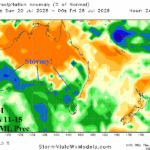
The U.S. medium-range forecast is hotter in Texas and remains hot Interior Northwest while the Central U.S. is marginally cool according to ECM ENS (Fig. 6). The recently launched AIFS ENS, scoring number 1 forecasting U.S. medium range temperature, is cooler in the North-central U.S. (Fig. 7). The ECM ENS trend is much warmer across most of the U.S. in the 11-15-day period (Fig. 8). AIFS ENS is hot in the East in the 11-15-day period (Fig. 9). The hotter trend is swept across the nation due to westerlies aloft south of a Canadian polar vortex. The U.S. 6-week population weight CDD forecast is likely not warm enough for weeks 4-6 (Fig. 10).
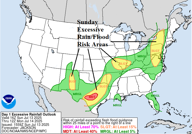

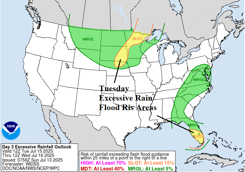
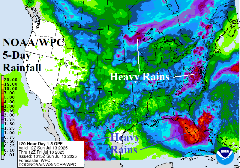
Fig. 2-5: NOAA/WPC excessive rain/flood risk areas for today through Tuesday and the 5-day U.S. rainfall forecast.
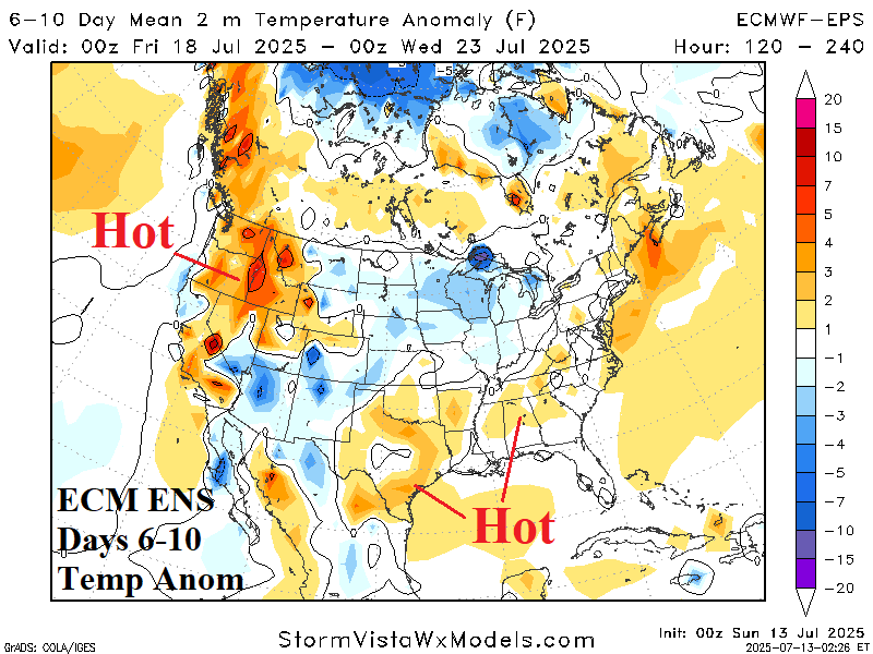
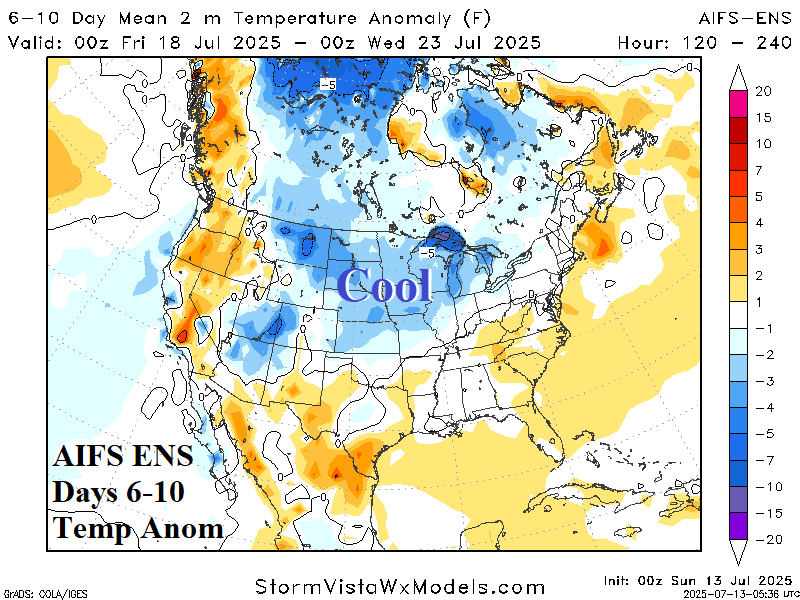
Fig. 6-7: ECM ENS and AIFS ENS 6-10-day temperature anomaly forecast.
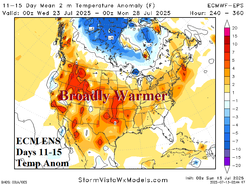
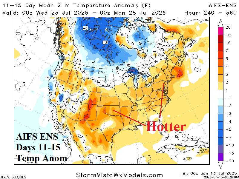
Fig. 8-9: ECM ENS and AIFS ENS 11-15-day temperature anomaly forecast.
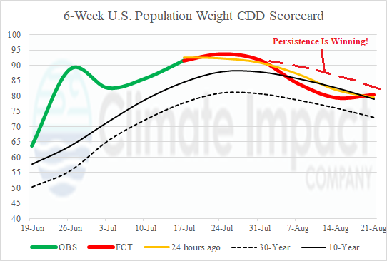
Fig. 10: U.S. 6-week population weight CDD forecast utilizing all models, their consensus, and comparing with 24 hours ago and 10-year/30-year climatology.