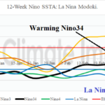
For Now, La Nina Modoki Strengthens
03/17/2025, 12:13 pm EDT
North/East Australia Excessive Rainfall!
03/24/2025, 8:11 am EDT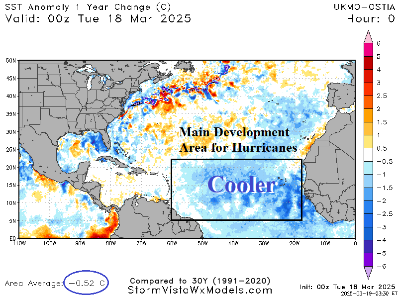
Charts of the day: North Atlantic SSTA.
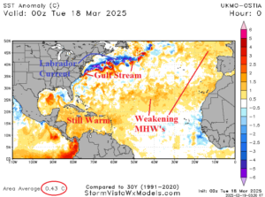
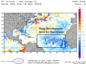
Discussion: The 2025 North Atlantic basin tropical cyclone season forecast will be issued soon. Currently, the North Atlantic basin remains warmer than normal but not as warm as one year ago. The main development region (MDR) has cooled to near normal. A marine heatwave in the subtropical North Atlantic remains but has weakened while very warm SSTA continue in the Caribbean Sea and parts of the Gulf of Mexico. Note the Gulf Stream and the Labrador Counter-current east and southeast of New England.
Medium-range 6-10 Day Forecast Valid March 24-28, 2025 (24-hour change)
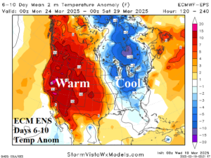
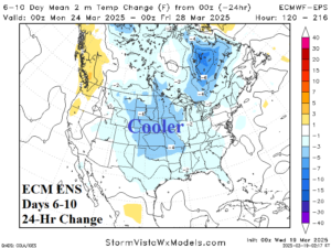
Discussion: The cool look across Ontario to the Great Lakes region strengthens. Cooler than normal weather extends through the Tennessee Valley. The Great Plains are less warm.
Medium-range 11-15 Day Forecast Valid March 29-April 2, 2025 (24-hour change)
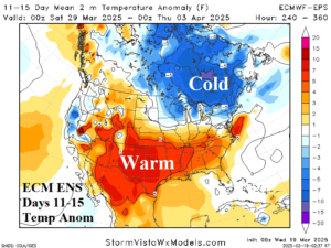
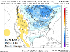
Discussion: The Canadian chill is expansive, a colder change since yesterday. The U.S. warm pattern is farther southward.
U.S. Medium-range Precipitation Forecast
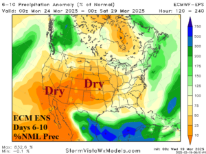
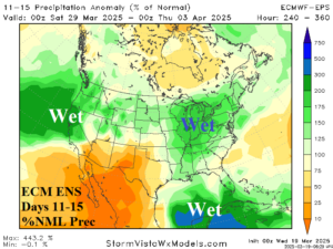
Discussion: The Gulf of Mexico region trends wetter. To the north, much of the U.S. is drier than normal in the 6-10-day period turning wetter in the 11-15-day period.
Days 16-20 Extended range Temperature Forecast valid April 3-7, 2025
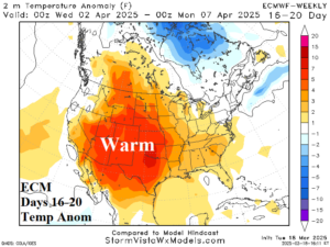
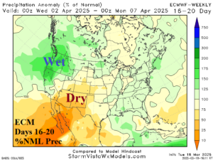
Discussion: The Northwest U.S. is wet and Southwest States dry in the 16-20-day period. Anomalous warmth extends across the Southwest U.S. and northeastward. Anomalous warmth stretches across the entire Southern U.S.