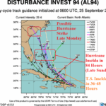
Possible Hurricane (Imelda) South Carolina Coast Monday Night; Humberto Likely to Become Major Hurricane
09/25/2025, 6:05 am EDT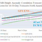
North and South America 16-30-day 500 MB Verification
09/30/2025, 2:01 pm EDTClimate Impact Company On-Climate Report
Issued: Sunday, September 28, 2025
The “warm blob” in the Northeast Pacific is weakening. La Nina is developing.
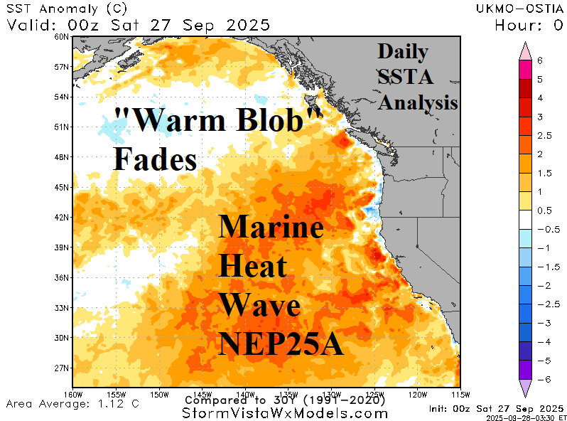

Fig. 1-2: The Northeast Pacific daily SSTA analysis and 30-day change.
Discussion: A NEW way to produce a “polar vortex” pattern across North America during the winter season driving cold and snow into the Lower 48 is the climate pattern associated with the “warm blob” in the Northeast Pacific. During the “polar vortex” winters of 2013-14 and 2014-15 in North America, the Northeast Pacific warmed to unprecedented levels including to depths of 300 meters. The influence on the mid-atmosphere was warming causing an amplified high-pressure ridge to extend northward across Alaska to Siberia commonly referred to as the “ridge bridge”. The “ridge bridge” inspired a downstream trough over central North America (“polar vortex”) and the extension of the “ridge bridge” to Siberia invited the arctic express into North America. Record cold and snow followed.
Last month, the “warm blob” returned to the Northeast Pacific (Fig. 1). However, during September the “warm blob” has lost intensity (Fig. 2) and an atmospheric river (AR) storm track into Southwest Canada this week is likely to cause further erosion. The weakening “warm blob” lowers the risk of a “ridge bridge” across Alaska with the compensating “polar vortex” pattern across North America. Important cold in North America for upcoming winter becomes more reliant on traditional cold weather catalysts such as sudden stratospheric warming (SSW) events or an active Madden Julian oscillation (MJO),
La Nina is forming as the daily Nino34 SSTA dips to -0.65C easily within the La Nina threshold (Fig. 3). Due to the developing negative Indian Ocean dipole (-IOD) and La Nina episode, the anomalous warm SSTA convenes north of Australia. This cool vs. warm pattern will have a dramatic impact on climate heading through Q4/2025 and Q1/2026. Primary influences will be a soaking wet climate for Indonesia/Australia and a widening drought across the Southern U.S. Note the warm mid-latitude SSTA due to many marine heat waves (MHW). Probabilistic climate forecasts grab the influence of that warm water and project warm winter seasons for most of the northern hemisphere.
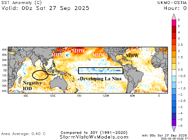
Fig. 3: The daily global tropical SSTA analysis.