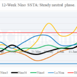
ENSO Remains Boring…Steady Neutral Phase
07/07/2025, 3:55 pm EDT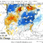
12Z GFS Much Cooler Midwest to Northeast in Medium Range
07/11/2025, 1:28 pm EDT

Climate Impact Company North Atlantic Basin 10-Day Monitor
Issued: Tuesday July 8, 2025, 9:00AM EDT
Highlight: TUTT has formed.
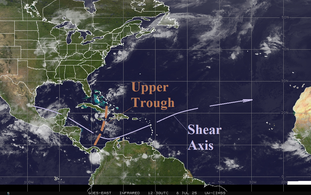
Fig. 1: The weather satellite view of the North Atlantic basin.
Discussion: A tropical upper tropospheric trough (TUTT) pattern has developed in the Caribbean Sea. The upper trough slowly drifts westward this week and is replaced by a second trough next week a little further to the north. The TUTT formed by release of shortwave energy from an energetic mid-latitude flow across the central North Atlantic basin southwestward into the tropics. This pattern is forecast to repeat next week with a third episode to follow. Consequently, upper shear in the vicinity of the Caribbean Sea and westward is sufficient to prevent any significant tropical cyclone risk. The TUTT is evident in the morning satellite view as an upper-level low-pressure trough spawn thunderstorms in the Caribbean Sea to the Southern Bahamas (Fig. 1). The shear axis rides beneath the upper trough and into the central North Atlantis tropics. In the main development region (MDR) for North Atlantic hurricanes, the upper ocean heat is near normal (for 2013-24) but considerably lower than the record warm past 2 years (Fig. 2).
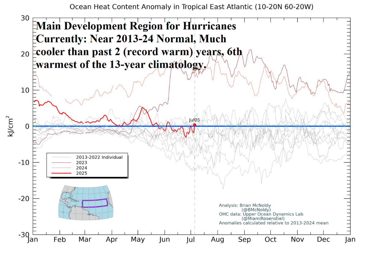
Fig. 2: Upper ocean analysis in the North Atlantic main development region for hurricanes.