Another Life Threatening Severe Weather/Flash Flood event East Texas to Southeast U.S.
04/19/2020, 11:35 am EDTAustralia Bureau of Meteorology ENSO and IOD Update
04/28/2020, 12:49 pm EDT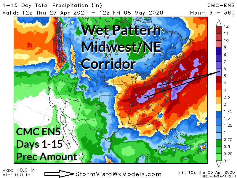
Discussion: Forecast trend of many operational forecast models is too lift the excessive rainfall/flash flood and severe weather pattern established across the Gulf region farther north to the Midwest U.S. extending to the Northeast Corridor to finish April and begin the month of May. The Canadian Ensemble illustrates this pattern most boldly featuring a wide swath of several inches of rain and high spots along the Ohio River and eastward to Pennsylvania near 6 in. The wet pattern is caused by entrainment of abundant moisture off the unusually warm Gulf of Mexico into the base of the upper trough across the northeast quarter of the nation. The Southeast is still wetter than normal but the excessive rain threat shifts northward.