Projecting Coldest U.S. Gas Population Weight HDD for January This Century
01/14/2025, 5:03 am EST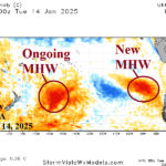
New Marine Heat Wave Influencing South America Climate
01/15/2025, 11:26 am ESTExecutive Summary: The Climate Impact Company constructed analog (CIC-CA) climate forecasts for FEB-25 through MAY-25 are updated. The outlook for FEB/MAR/APR 2025 indicates unusually hot and dry climate across northern continent, persistent rains on the East Coast, and marginally hot and dry across Southwest Australia (Fig. 1-2). Drought concern is across the northern and east-central continent plus the interior southeastern region. A fine line exists between wet and dry soil regions away from the coast in the East. The forecast is propelled by ongoing weak La Nina and the marine heat waves on either side of the continent.
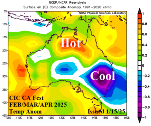
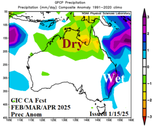
Fig. 1-2: The Climate Impact Company constructed analog temperature and precipitation anomaly forecast for FEB/MAR/APR 2025.
Climate discussion: As of mid-January, the deep layer soil moisture conditions across Australia are a mix of wet to very wet and dry to very dry (Fig. 3). Key crop areas are generally avoiding the dry risk areas. However, the dry zones across the north and east-central continent are strengthening and may expand.
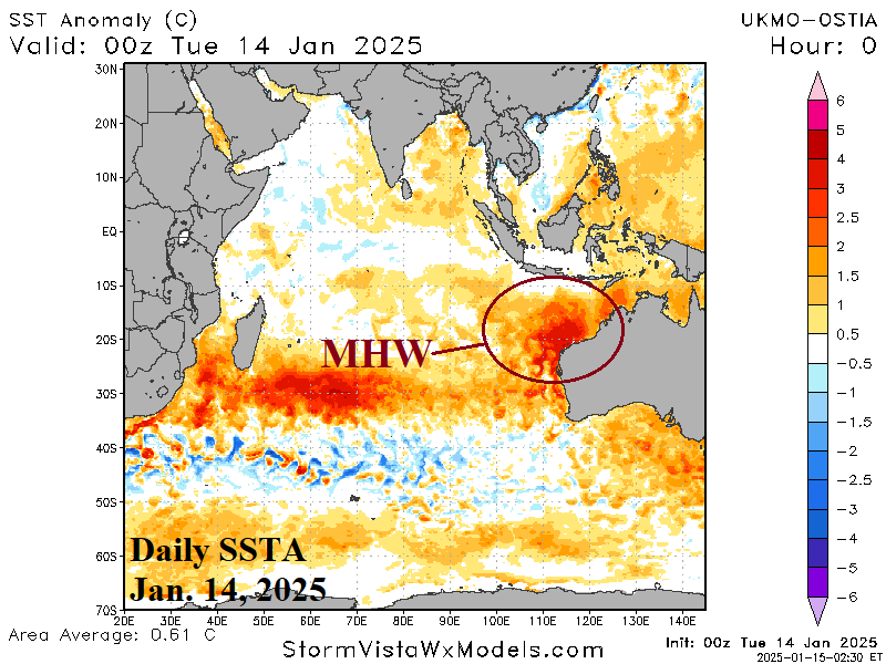
The summer pattern so far has featured a buoyant high-pressure ridge centered over Western Australia (Fig. 4) adjacent to a marine heatwave (MHW) off the west-northwest coast which has recently intensified (Fig. 5). To the east of Australia, a marine heatwave has weakened (Fig. 6), and the cooling is well-correlated to an upper trough near the Australia East Coast. The trough has produced occasional heavy rain on the East Coast while inland areas have been drier and hotter than normal due to the amplified subtropical high-pressure zone.
Regarding ENSO, oceanic La Nina formed in December. The cold ENSO intensity was impressive during mid-December at onset. However, in January, the convection phase of the Madden Julian oscillation (MJO) shifted east across the equatorial Pacific with lingering effects still present. As a result, a negative southern oscillation index (-SOI) developed as trade winds eased and the cooling up-welling pattern eased. East Pacific equatorial waters have warmed slightly. The MJO is forecast to shift to the tropical Pacific for the second half of January which will re-enforce +SOI and restore trade winds as La Nina gains strength again. La Nina is forecast to persist through Q1/2025 shifting to neutral in Q2/2025.
The Indian Ocean Dipole (IOD) has flirted with negative phase during Q4/2024 and in recent days. However, forecast models are not agreeable to an organized negative phase event.
Going forward, the primary influence on Australian climate through Q1/2025 is ongoing La Nina and the influence on the upper air by robust MWH’s northwest and east of Australia.
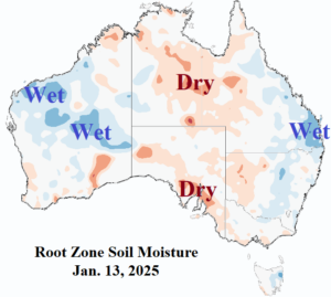
Fig. 3: The root zone soil moisture anomalies across Australia.
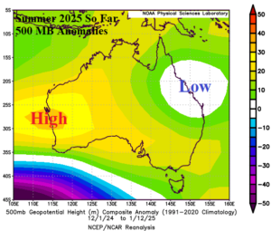

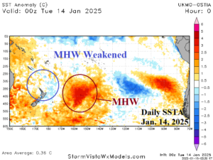
Fig. 4-6: The 500 MB anomaly pattern across Australia for summer 2024-25 so far and the SSTA analysis identifying marine heat waves either side of Australia.
February 2025: Low confidence forecast cools south and southeast continent due to presence of an upper trough. The cool anomalies at the coast where wet weather is confidently projected is reasonable. However, the cool anomaly across the developing southern drought area well away from the East Coast may be hotter. Northern Australia is unusually hot and dry for February.
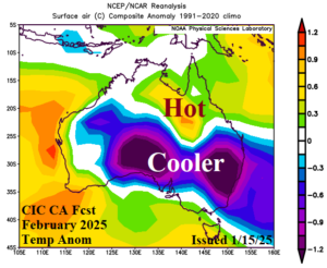
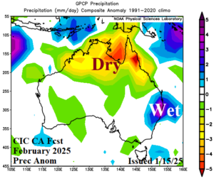
Fig. 7-10: The Climate Impact Company constructed analog temperature and precipitation anomaly climate forecasts for February 2025. Previous below.
March 2025: The wet pattern in the East continues suppressing heat risk. However, elsewhere is hotter than normal in March with expansive dryness continuing across Northern Australia.
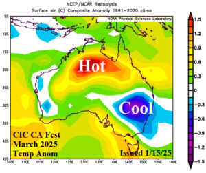
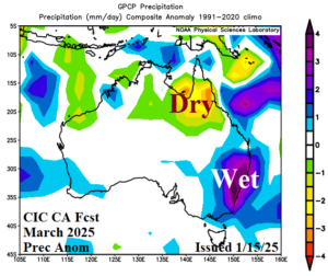
Fig. 11-14: The Climate Impact Company constructed analog temperature and precipitation anomaly climate forecasts for March 2025. Previous below.
April 2025: The wet pattern on the East Coast shifts northward to the Queensland Coast. Near normal rainfall is projected across the remainder of the continent. Anomalous heat is common especially across northern areas and all of Southwest Australia.
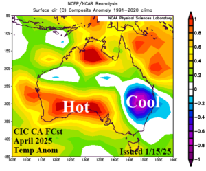
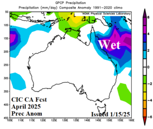
Fig. 15-18: The Climate Impact Company constructed analog temperature and precipitation anomaly climate forecasts for April 2025. Previous below.
May 2025: The preliminary outlook for May maintains a wet climate on the East Coast and adds heavy rain to the northwestern coast of the continent. Away from the wet climate zones, temperatures average warmer than normal.
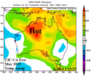
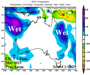
Fig. 19-20: The preliminary Climate Impact Company constructed analog temperature and precipitation anomaly climate forecasts for May 2025.

