CFS V2/ECM Week-4 Forecast Skill Scores Fall Through The Floor
12/10/2024, 4:13 am ESTRegional SSTA Patterns Bring Surprising Climate Regimes
12/16/2024, 4:43 am EST 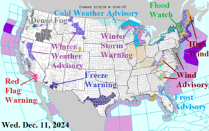
Fig. 1: NOAA/NWS U.S. weather watch, warning, and advisory areas.
Discussion: A plethora of weather watch, warning, and advisories across the U.S. this morning (Fig. 1). In the Northeast U.S. Corridor, a severe thunderstorm risk is issued today along the Mid-Atlantic Coast to southern New England (Fig. 2), an unusual projection for December! Attendant heavy rain causing a flood risk (Fig. 3) inspires New England Flood Watch areas. High Wind (45-60 mph) is expected later today and tonight across much of New England. HRRR projects a squall line organizing around 2PM in the coastal Mid-Atlantic shifting to southeast New England mid-evening (Fig. 4-5). A following cold wind across the Great Lakes region brings heavy snow to Michigan. In the West, a Red Flag Warning due to Santa Ana wind gusting to 60 mph today remains in effect for Southern California. The latest U.S. gas population weight HDD forecasts maintain warmth next week with a slightly colder forecast (near the 10-year normal) for Christmas week (Fig. 6). The ECM/CFS V2 consensus HDD forecast for weeks 4-6 ahead is less cold (Fig. 7).
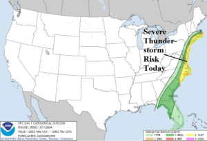
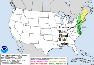
Fig. 2-3: Today’s severe weather and excessive rain/flood risk forecast.
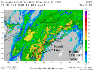
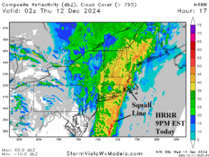
Fig. 4-5: HRRR radar forecast identifies today’s Northeast U.S. squall line.
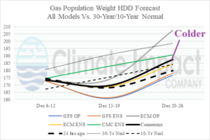
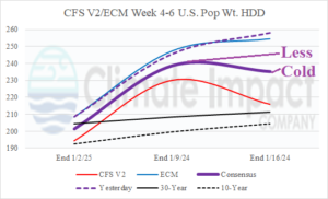
Fig. 6-7: The U.S. gas population weight HDD forecasts utilizing all models through Dec. 26 and CFS V2/ECM projections for week 4-6 ahead.
