Colder U.S. Pattern Change Ahead; Arctic Air Adheres to Snow Cover
02/05/2024, 5:55 am ESTBrazil and Middle East Drought to Worsen, Southeast Asia/Indonesia Reverse Wetter Ahead
02/07/2024, 5:04 am EST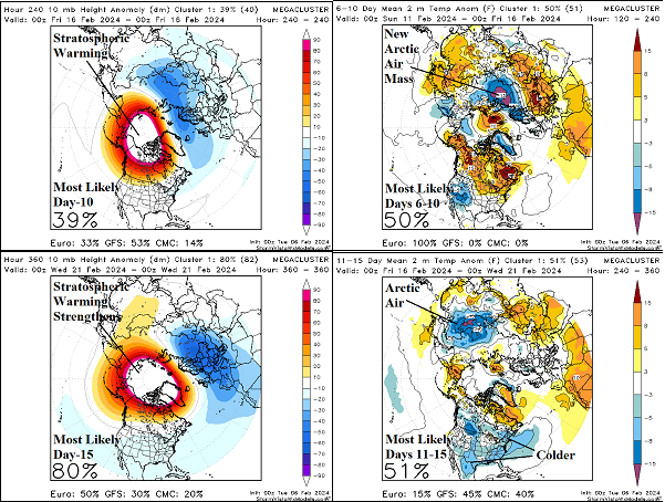
Charts of the day: Stratospheric warming versus arctic air generation.
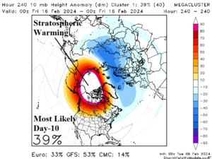
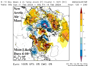
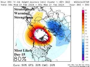
Discussion: The day-10 temperature anomaly forecast at 10 MB reveals a stratospheric warming episode over northwestern North America. The warming causes an arctic air mass to develop over Northwest Russia in the 6-10-day period. On day-15, the stratospheric warming is widening and, frankly, looks scary as widespread arctic air is normally produced by this signature. However, for now, the “most likely” scenario is arctic air moves east across Eurasia and is shifting southeastward toward China much like the outbreak in December.
Medium-range 6-10 Day Forecast Valid February 11-15, 2024 (24-hour change right)
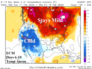
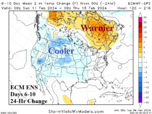
Discussion: The U.S. pattern is shifting colder, most evident in the West/North-central U.S. Canada warmth lingers and Quebec is much warmer since yesterday’s forecast.
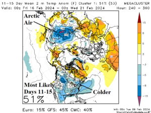
Medium-range 11-15 Day Forecast Valid February 16-20, 2024 (24 hour change right)
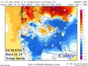
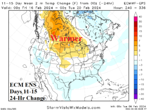
Discussion: The 11-15-day outlook identifies colder pattern change. There is a lack of arctic air intrusion therefore Central Canada is revised milder. Nevertheless, the South and East U.S. are chilly and trending colder.
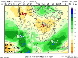
U.S. Medium-range Precipitation Forecast
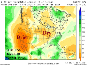
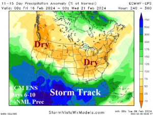
Discussion: The vigorous “atmospheric river” pattern fades in the 6-10-day period returning in the 11-15-day forecast stretched across Mexico to Florida.
Days 16-20 Extended range Temperature Forecast valid February 21-25, 2024
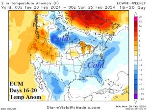
Discussion: The extended-range forecast maintains an East U.S. chill; only the Northwest is mild.