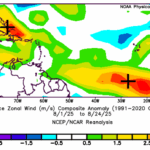
Strong Tradewinds Prevent Deep Tropics to Gulf Significant Storms So Far
08/26/2025, 1:30 pm EDT
Slowly, Equatorial Pacific Subsurface Cools
09/02/2025, 9:28 am EDT
Climate Impact Company Early U.S. Notes
Issued: Wednesday August 27, 2025
Highlight: Heavy rains shift across Southern U.S.; Cooler (national) forecasts.

Fig. 1: NOAA/NWS weather watch, warning, and advisories.
Discussion: The Northwest U.S. has opposing weather risks in the mid-week forecast. Gully-washer rains threaten flooding across the northwest Great Basin and much of Idaho while Red Flag Warning’s for high fire risk extend from the Columbia Basin to the western mountains in Washington (Fig. 1). Significant wet weather shifts across the southern U.S. over the next 5 days. Excessive rain causing a flood risk emerges in Kansas today and Arkansas tomorrow (where severe storms are likely). Excessive rain causes flooding across Western Texas late week. The 5-day rainfall totals through the weekend are in the 3-5-inch range centered on Arkansas/Louisiana, the Southeast Coast including Florida, and the New Mexico/Texas state line (Fig. 2). The lack of heat in the high population East U.S. signals high national electricity demand for summer is over as the CDD forecasts continue to trend cooler (Fig. 3).
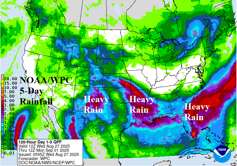
Fig. 2: NOAA/WPC 5-day quantitative precipitation forecast.

Fig. 3: The U.S. population weight CDD forecast utilizing all models through early September and the Climate Impact Company 4-6-week forecast added.