Wide Variation in ENSO Forecasts for Later 2025 Continue
06/02/2025, 9:26 am EDT
Europe Summer 2025 CDD Forecasts are Very Warm!
06/05/2025, 4:56 am EDT
Climate Impact Company Tropical Feature
Issued: Tuesday June 3, 2025
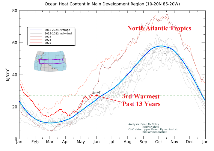
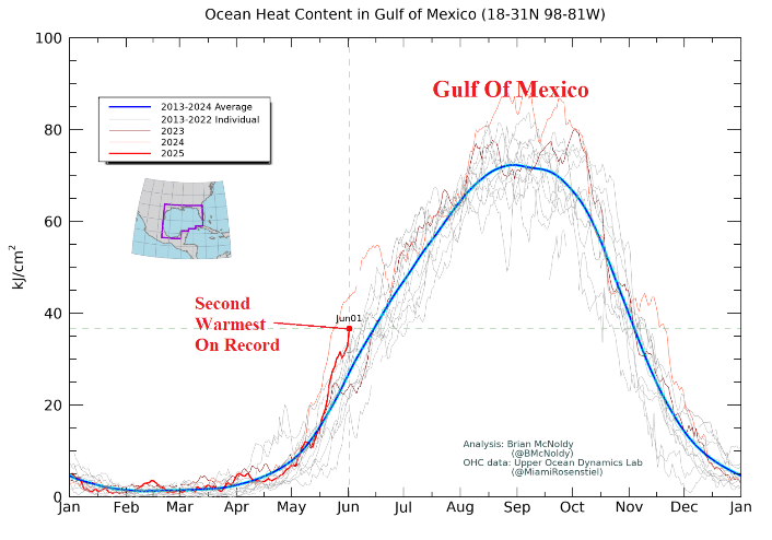
Highlight: North Atlantic upper ocean heat on June 1st.

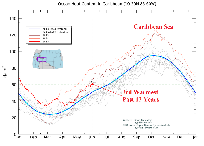
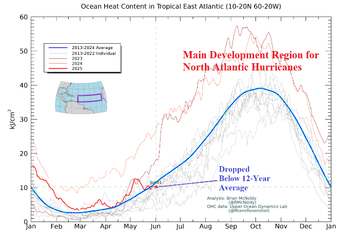

Fig. 1-4: Upper ocean heat observations for the tropical North Atlantic, Caribbean Sea, main development region for hurricanes, and Gulf of Mexico. Analysis is valid June 1, 2025, and provided by Upper Ocean Dynamics Lab.
Discussion: As the 2025 North Atlantic basin tropical cyclone season begins, a review of where we stand regarding upper ocean heat across various basins in the North Atlantic where tropical cyclones form and travel. The data is provided by Brian McNoldy at the Upper Ocean Dynamics Lab. In the tropical North Atlantic, upper ocean heat is above the 2013-24 normal and tied for 3rd warmest in the 13-year climatology (Fig. 1). If warming (compared to normal) occurs during the summer months, hurricanes will be in the upper limit of 6-10 forecast by NOAA for the 2025 season. In the Caribbean Sea where the strongest upper ocean heat is traditionally available to fuel the strongest hurricanes, the June 1st observation reveals the 3rd warmest signatures of the past 13 years just short of the warmest on record in 2023 and 2024 (Fig. 2). Once again, the Caribbean Sea appears poised to help inspire powerful hurricanes during the 2025 season. If additional anomalous warming occurs, the 2025 season major hurricane count is in the upper limit of the 3-5 forecast by NOAA. In the main development region (MDR) for North Atlantic hurricanes, the June 1st upper ocean heat observation has cooled to below the 2013-24 normal (Fig. 3). If this trend were to hold, there may be a bias toward this season’s strongest activity forming in the western North Atlantic basin and/or out of the deep tropics. Finally, the Gulf of Mexico upper ocean heat is scary, the 2nd warmest in the 2013-24 climatology (Fig. 4). Fuel for powerful hurricanes is available in the Gulf of Mexico.