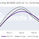
U.S. Winter Gas Population Weight HDD Biased Mostly Warm
10/01/2025, 6:58 am EDT
Climate Impact Company Week 2-4 Outlook
Australia
Issued: Thursday, October 2, 2025
Highlight: The pattern for late spring is not as wet as previously indicated and therefore hotter!
Chart of the day: Under-performing rainfall in September across Australia.
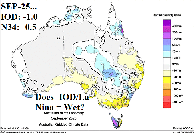
Discussion: Negative Indian Ocean dipole (-IOD) contributes to Central and East Australia rainfall during winter and spring while La Nina biases eastern continent wet. Both climate signals emphasize a wet bias to Australia climate and diminish dry risk. The -IOD regime is well established while borderline weak La Nina is present but without a clear atmospheric response. Consequently, the anticipated wet climate for early spring is patchy, based on September rainfall terciles. Note the dryness in key Australia crop areas in Victoria and eastward.
Week-2 Ahead Forecast valid October 12-19, 2025: Northern heat; Wet East Coast.
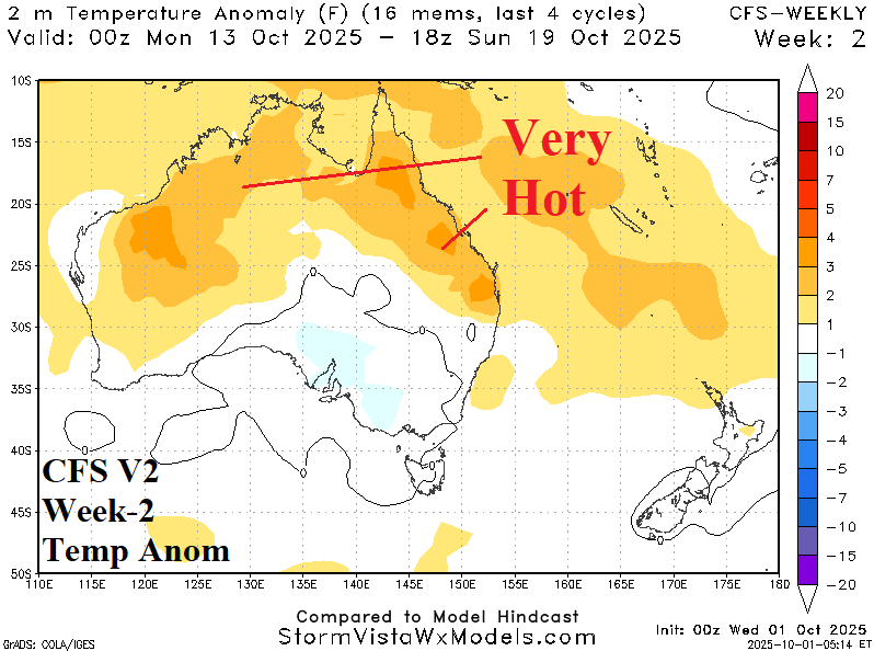
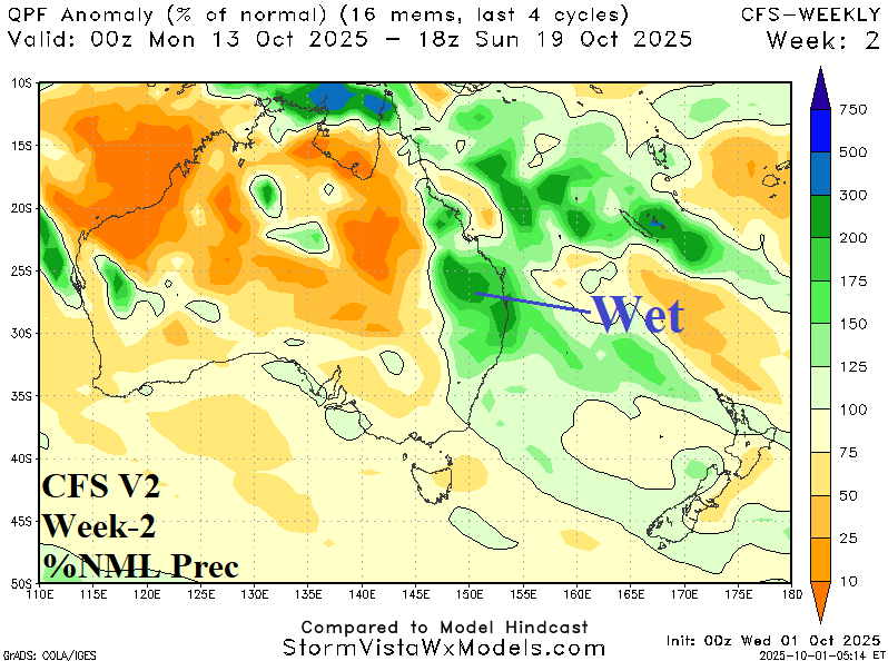
Discussion: Any effects from a recent stratospheric warming event over Antarctica and attendant influences on the Antarctic oscillation (AAO) are fading. CFS V2 is the best match to operational models (vs. ECM) leading into mid-October. Indicated is anomalous heat across northern continent with a wet bias on the Est Coast.
Week-3 Ahead Forecast valid October 19-26, 2025: Weak support for East Coast wet forecast.
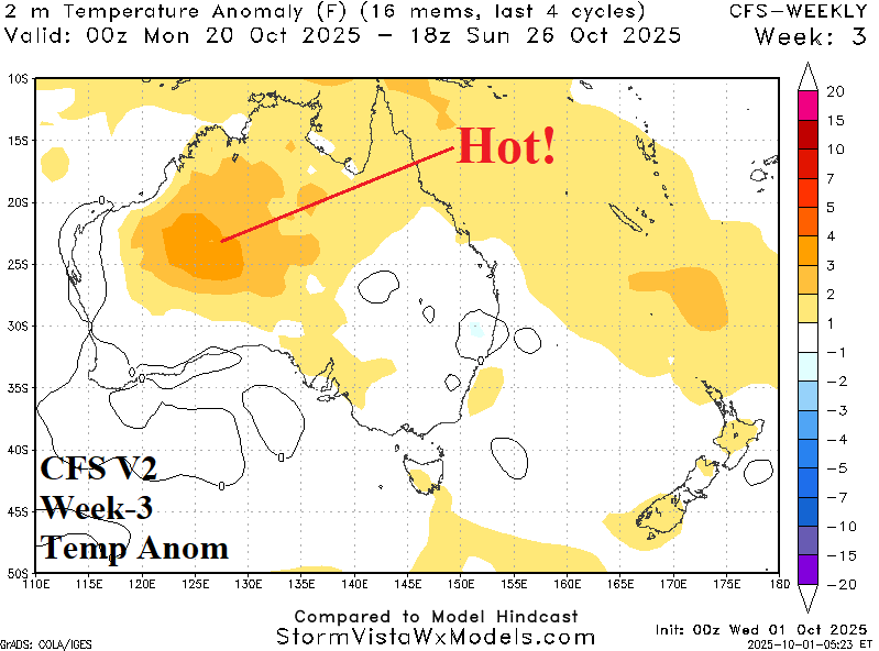
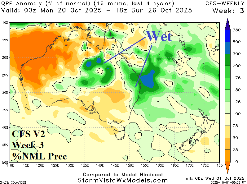
Discussion: Strongest upper air features are a high-pressure area across northwest continent causing attendant anomalous heat with weak support for temperate and wet weather on the East Coast.
Week-4 Ahead Forecast valid October 26-November 2, 2025: Very hot central continent.
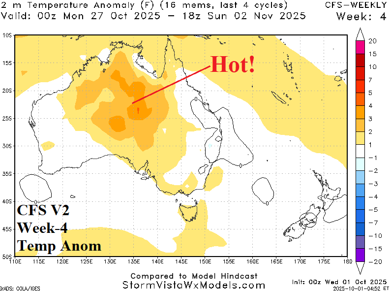
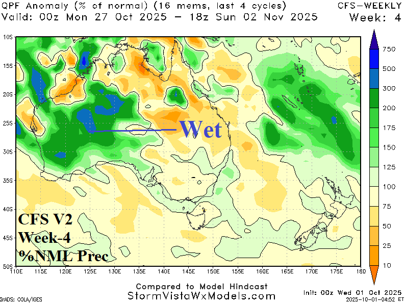
Discussion: Late OCT/early NOV “weeklies” continue to project an upper trough near the West Coast responsible for the wet outlook across the western half of the continent. Very hot weather is forecast for central continent.