U.S. Weather Pattern Heading Toward Extremes
10/24/2023, 8:39 am EDTEarly Solar Maxima 25 Forecast (by NOAA) and Adjusted Stronger. Surprises Still Possible.
10/30/2023, 10:07 am EDTChart of the day: Current satellite view.

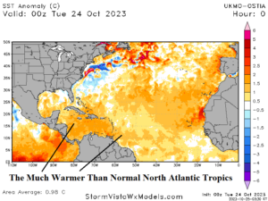
Discussion: Overnight “Otis” intensified rapidly to become a category-5 major hurricane just before striking Acapulco on the south coast of Mexico this morning. Otis moved across 87-88F water in an ideal atmospheric environment to cause the unprecedented intensification. Former Tropical Depression 21 has crossed Central America and entered the East Pacific and is likely to drift west-northwest and become another hurricane with a possible similar path to Otis. Hurricane Tammy is forecast to turn northwest and west and lose pure tropical characteristics while transitioning into a powerful extratropical cyclone. An ALERT is issued for the North-central Caribbean Sea for a possible tropical cyclone emerging next week. The latest GFS develops a significant tropical cyclone traveling toward Florida in 2 weeks. The Madden Julian oscillation (MJO) is centered on the East Pacific/North Atlantic tropics during the next 2 weeks enhancing risk of additional significant tropical systems despite entering November. As a reminder, the record warm North Atlantic tropics continues most notably in the Caribbean Sea heading toward November.

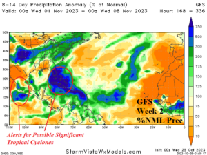
Week-2 Valid October 31-November 6, 2023: ALERT issued for potential development in the Caribbean Sea to Florida.

Discussion: As previously indicated, an ALERT is issued for the Northern Caribbean Sea next week for the potential emergence of a tropical cyclone. If so, this system drifts northwestward toward Florida on the backside of the Bermuda High. Another significant tropical cyclone is likely to threaten the south coast of Mexico.
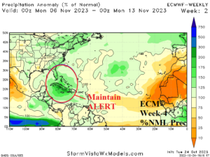
Week 3 Valid November 7-13, 2023: Maintaining Caribbean Sea to Florida ALERT.

Discussion: Late season ALERT lingers in the Caribbean Sea to Florida and the Bahamas for possible additional tropical cyclone activity.
Week 4 Valid November 14-20, 2023: Maintaining a late season ALERT.

Discussion: ECM indicates additional abundant tropical convection convenes in the Caribbean Sea near Cuba arcing northward to the Bahamas.
