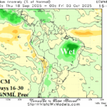
AG Market Hot Spot: South America Update
09/04/2025, 5:08 am EDT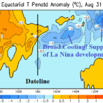
Subsurface East Equatorial Pacific Ha Notably Cooled Fueling La Nina Risk
09/09/2025, 5:02 am EDT
Climate Impact Company Early AG Market ALERT
Issued: Monday September 8, 2025
Highlight: Extended range Brazil wet weather risk easing back, Ohio Valley stays mostly dry, heavy rains Southeast Australia, and Europe trend is wetter.
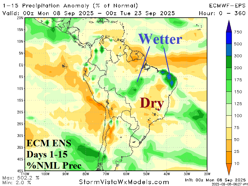
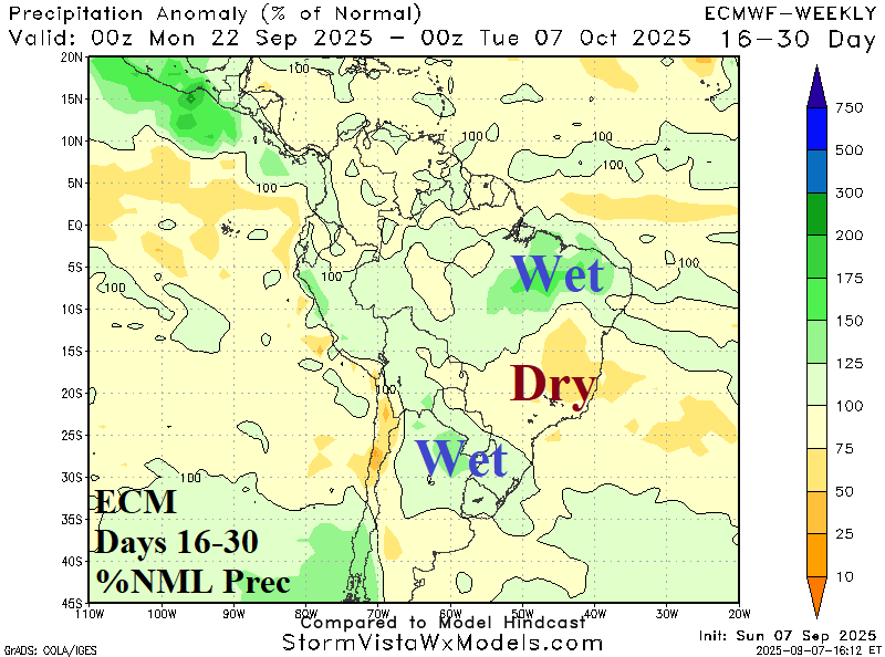
Fig. 1-2: ECM percent of normal rainfall forecasts through 30 days across South America.
Discussion: Extended-range forecasts offered beneficial rainfall to the Brazil drought area dating back to September 1st. How are these forecasts tracking? Generally, the wet risk remains although less impactful on the core of the drought area in East-central Brazil. ECM ENS has developing nearby rains during the medium range but leaves East Brazil dry in the latest 15-day forecast (Fig. 1). GFS is trending somewhat drier. In the 16-30-day period, ECM is considerably less aggressive forecast wet weather in Brazil biasing the wet anomaly farther to the north (Fig. 2).
In the U.S. AG Belt, the Ohio Valley remains mostly dry in the latest AI Graph Cast 15-day percent of normal rainfall forecast (Fig. 3). Graph Cast was selected based on the wetter trend not far to the west, across the Upper Midwest.
The cocoa growing areas in coastal West Africa remain in drought and based on GRACE soil moisture anomaly analysis, the drought has worsened (Fig. 4).
The AIFS 15-day rainfall forecast for Australia indicates potential for 8 inches of rain on the Southeast Coast with several inches extending well inland (Fig. 5). In Europe, the forecast trend is wetter through the next 15 days while Southwest Russia is the dry zone (Fig. 6).
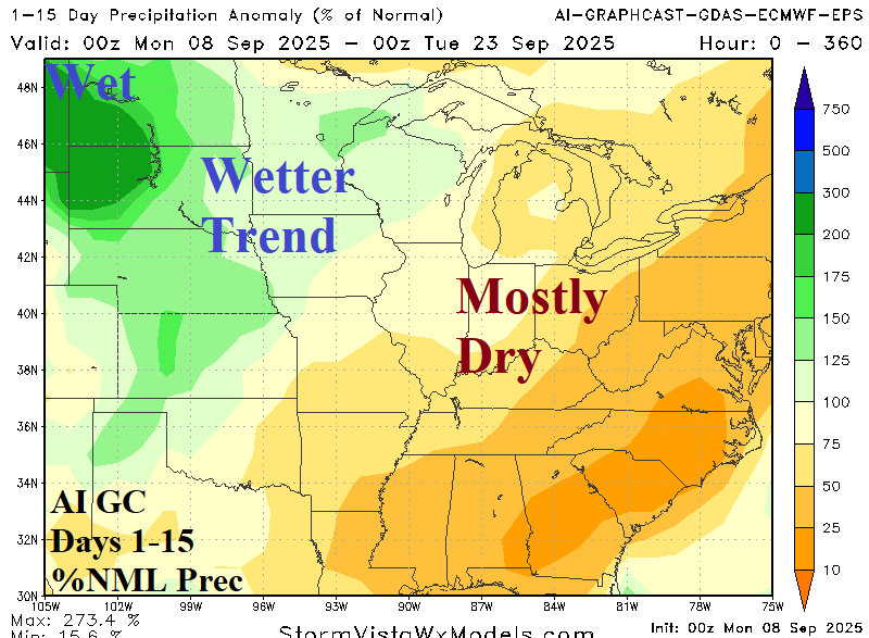

Fig. 3-4: Graph Cast 15-day percent of normal rainfall forecast for the U.S. AG belt and GRACE-based soil moisture anomalies analysis across Africa.
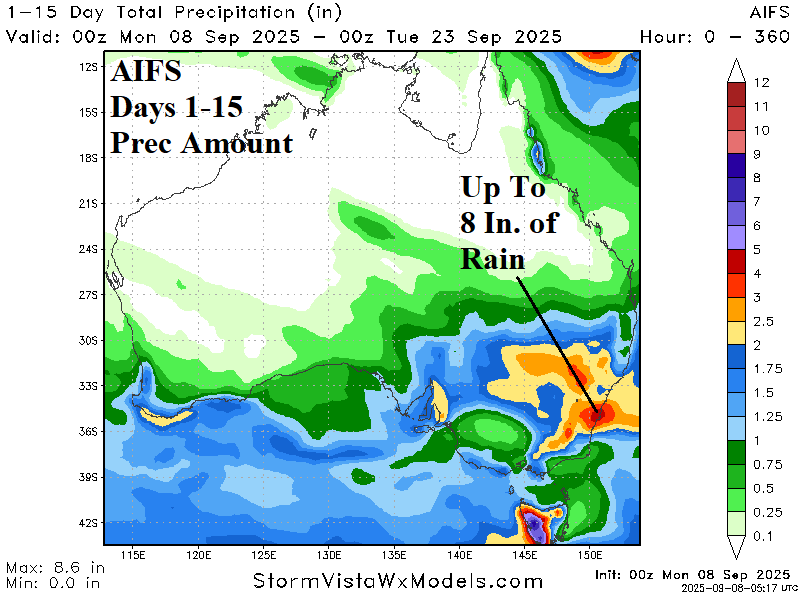

Fig. 5-6: The AIFS 15-day rainfall forecast for Australia and GFS 15-day rainfall anomaly forecast for Europe.