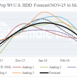
U.S. Gas Population Weight Winter 2025-26 HDD Forecast
09/18/2025, 8:29 am EDT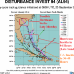
Possible Hurricane (Imelda) South Carolina Coast Monday Night; Humberto Likely to Become Major Hurricane
09/25/2025, 6:05 am EDT
Climate Impact Company Tropical Feature
Issued: Wednesday September 24, 2025
Highlight: Tropical Disturbances 93L and 94L expected to develop. 93L could become a major hurricane. 94L could reach Carolinas.
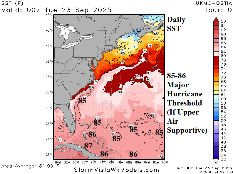
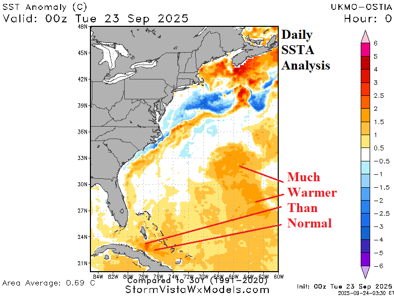
Fig. 1-2: The western North Atlantic daily SST and SSTA analysis.
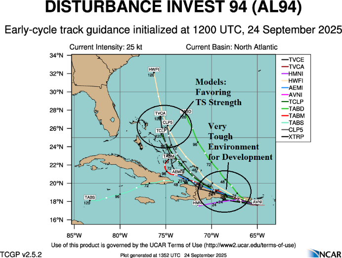
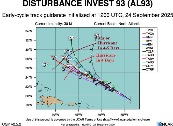
Fig. 3-4: The tropical cyclone models 5-day forecast tracks for Tropical Disturbance 94L and 93L with attendant intensity forecast comments.
Discussion: Ocean temperatures in the western North Atlantic basin feature 85F in the Bahamas eastward with 86F in the southern Bahamas extending eastward (Fig. 1). Waters south and southwest of Bermuda stretching to Cuba are above to much above normal (Fig. 2). In these areas, any passing tropical cyclone with a favorable development environment aloft, will become major hurricanes with ease. Currently, two tropical disturbances northeast of the Caribbean Sea and near Puerto Rico are monitored for development. NOAA/NHC indicates a high probability that each system becomes a named tropical cyclone. Tropical Disturbance 94L has the toughest road ahead due to proximity to land mass and upper shear just north of the system (Fig. 3). However, after 48 hours, as 94L moves away from the islands, a named storm is likely. Tropical Disturbance 93L will move west-northwest in an improving upper air environment, becoming a tropical storm shortly, and reaching hurricane strength by early weekend and possibly a major hurricane by late weekend as the storm reaches 85F water. Tropical cyclone models indicate 93L could reach major hurricane status in 4-5 days (Fig. 4). In 4-5 days, each system is relatively close which may cause one storm greater strength at the expense of the other system. This factor is important as a guide as to how strong 94L becomes and to what extent a threat to the Carolinas develops.