
Hot and Dry Pattern Ahead for Europe; Drought Expansion Southward!
06/11/2025, 4:44 am EDT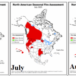
NOAA JUN, JUL, and AUG 2025 North America fire outlooks.
06/16/2025, 5:54 am EDT

Climate Impact Company Early U.S. Notes
Highlight: Heat is on the way, rain belt to shift north, drenching short-term rains centered on Virginia.
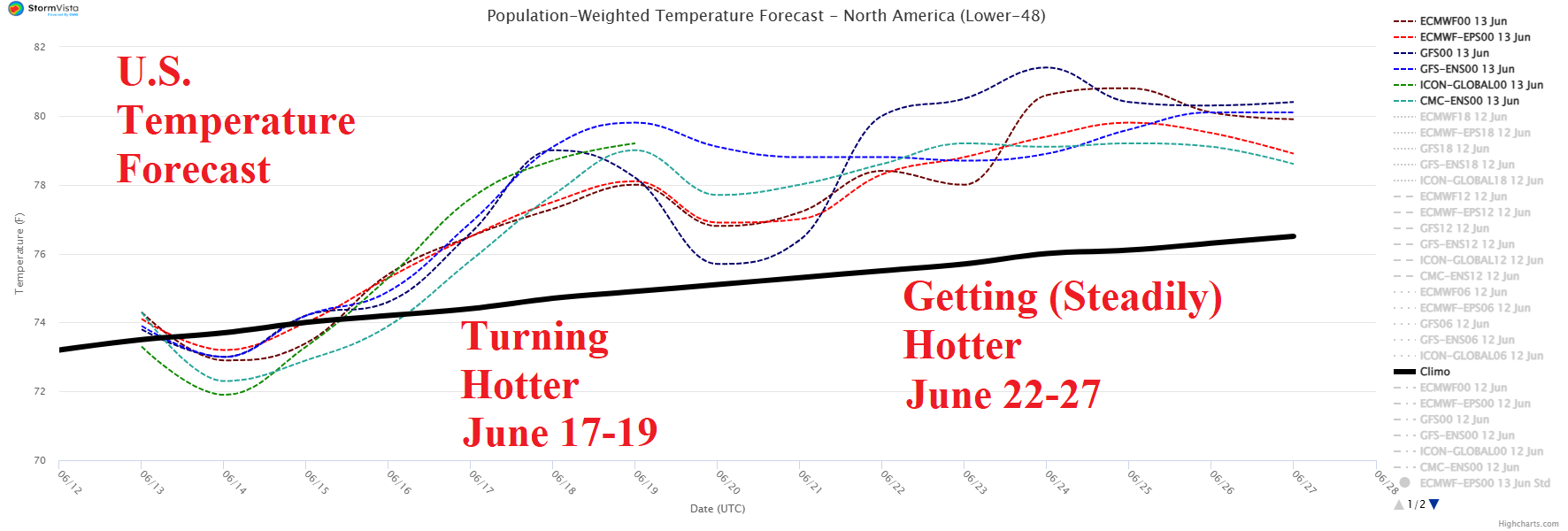
Fig. 1: U.S. 15-day temperature forecast compared to the 30-year normal.
Discussion: The U.S. national temperature is suppressed near normal for a few days primarily due to East U.S. rains. However, as the wet belt lifts northward during the medium range, hotter weather emerges, especially in high population areas of the East causing the national temperature surge somewhat warmer than normal (Fig. 1). During the next week, the eastern half of the U.S. is frequented by numerous thunderstorms and attendant heavy rain while the West is the dry (and hot) zone (Fig. 2). However, the western dryness extends eastward (with heat) in the 8-14-day period as the wet belt retreats to the U.S./Canada border (Fig. 3). During the 8-14-day period there is risk of a Bay of Campeche/southwest Gulf of Mexico tropical risk. NOAA/WPC identifies the excessive rain/flood risk areas for today featuring yesterday’s Texas rains shifting to the Mid-south U.S. while lingering on the Texas Coast (Fig. 4). Heavy rain with flood risk affects Virginia each day into early next week. Flooding rain appears in the southeast Great Plains tomorrow (Fig. 5) and lingers in the Midwest and Mid-south States through the weekend (Fig. 6-7). The severe thunderstorm threat is persistent across the northwest/west Great Plains and North-central States through the next week.
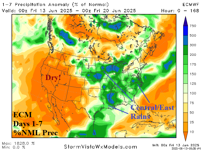
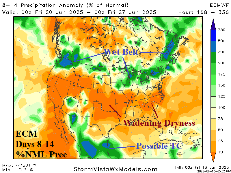
Fig. 2-3: ECM 1-7-day and 8-14-day percent of normal rainfall forecast across the U.S.
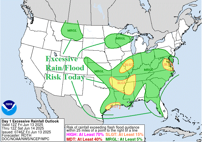
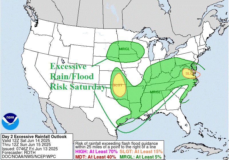
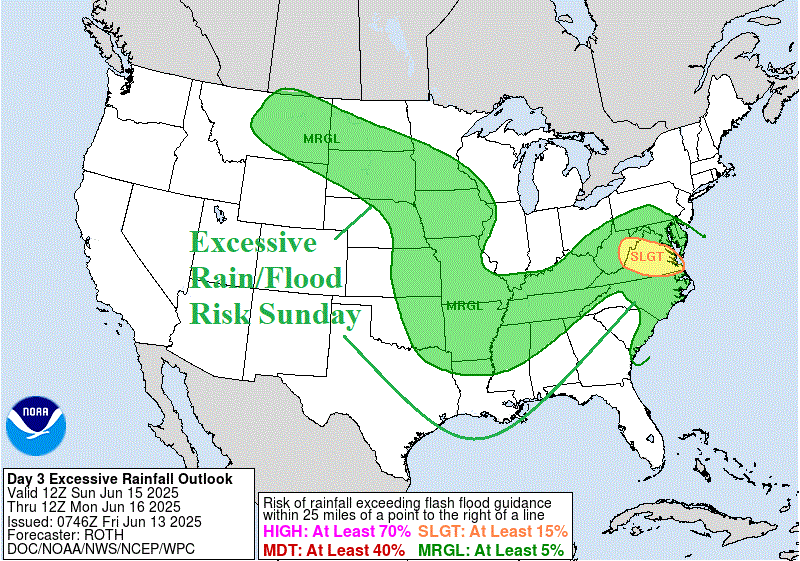
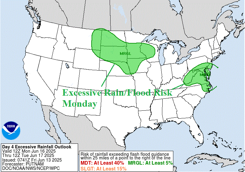
Fig. 4-7: NOAA/WPC excessive rainfall/flood risk areas for the next 4 days.