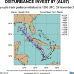
Tropical Cyclone Threatens Gulf of Mexico Later This Week
11/03/2024, 1:33 pm EST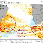
Emerging Marine Heatwave Off East Coast of South America; Correlated to Increased Summertime Argentina/Western Brazil Drought Risk
11/06/2024, 2:48 pm ESTHighlight: Rafael runs into strong upper shear before reaching Gulf Coast. Heavy rains continue Central U.S.
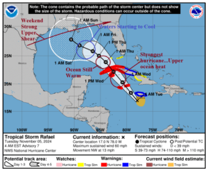
Fig. 1: The NOAA/NWS weather watch, warning, and advisory areas.
Discussion: Tropical Storm Rafael reaches peak intensity in the northwest Caribbean Sea where upper ocean heat is plentiful and the upper shear pattern is light (Fig. 1). Rafael maintains intensity across the warm waters of the Southeast Gulf tomorrow night. However, continued northwest tracking beyond the LOOP Current brings Rafael into cooler waters causing some weakening. On the weekend, Rafael encounters a vigorous shear pattern considerably lowering Rafael’s intensity.
Separate from Rafael, plenty of heavy rain remains in the forecast. Remnants of a strong frontal system in the East-central U.S. bring some much-needed wet weather to the Mississippi River today (Fig. 2). This rain system continues to produce some flooding. On Thursday, heavy rain areas regenerate across Texas and the Southwest Great Plains plus Florida and Georgia (Fig. 3). On the weekend, Rafael is weakening but attendant moisture is entrained into a slow-moving frontal system unloading more heavy rain on the southern half of the Great Plains eastward to the Tennessee Valley (Fig. 4). The rainfall pattern loses intensity shifting into the East on Sunday.
The U.S. gas population weight HDD forecast bounces much warmer for next week and is probably not warm enough for Nov. 15-21 (Fig. 5).
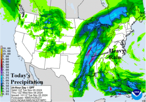
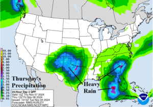
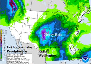
Fig. 2-4: The NOAA/WPC quantitative rainfall forecast for the U.S. today, Thursday, and FRI/SAT.
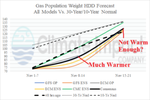
Fig. 5: The U.S. gas population weight HDD forecast through mid-November utilizing all models, their consensus, and comparing with 48 hours ago/climatology.

