New TC Alert Posted for Central/East Caribbean Sea for Late October
10/21/2024, 8:28 am EDT
Brazil Wet Pattern Lasts Through First Third of November
10/24/2024, 8:29 am EDT
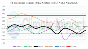
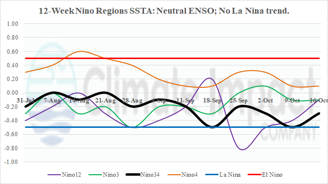
Fig. 1: The 12-week Nino SSTA observations.
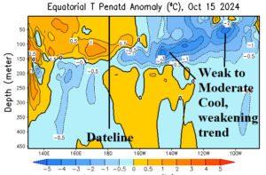
Discussion: After several weeks of missing data due to impacts on the NCDC located in Asheville, recovery is accelerating and availability of weekly ENSO data returns. The Nino SSTA regions are locked-in on neutral phase (Fig. 1). There is no shift in trend to indicate La Nina onset. In the subsurface, the anomalous cool water to fuel La Nina is diminishing (Fig. 2). Most of the cool water is between 100 and 150 meters with about half the strength of several weeks ago. Consequently, neutral ENSO persists and the likelihood of La Nina developing later in 2024 is diminished.

Fig. 2: The equatorial Pacific Ocean subsurface upper ocean heat anomalies.

