Unusual for La Nina Climate…Heavy Rains Texas
11/20/2025, 5:53 am ESTClimate Impact Company U.S. Sunday Report
Issued: Sunday, November 23, 2025
Highlight: Steadily, snow cover develops across the Northern U.S. this week; Set-up for much colder air which could surge south to Texas. Snow and ice mess possible! Questions whether (medium range) cold can reach the East.
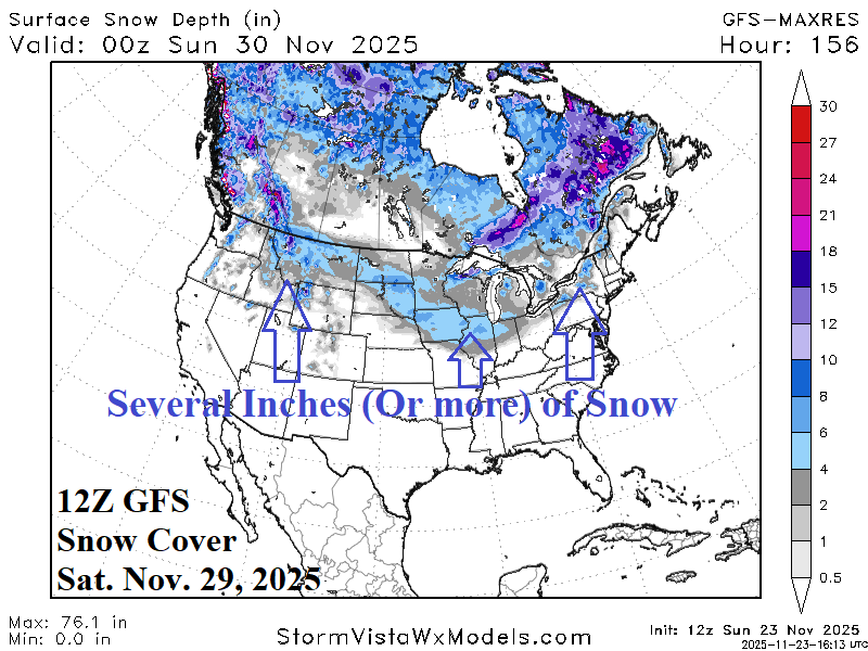
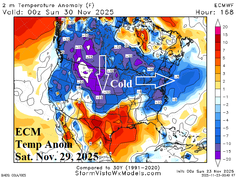
Fig. 1-2: The 12Z GFS snow depth forecast for Saturday and the attendant expanding cold as indicated by ECM.
Discussion: Upper trough brings colder weather with some snow across the northern Great Plains and Upper Midwest MON/TUE and by WED night the attendant low-pressure center strengthens dramatically near James Bay to propel colder weather (with high wind) across the Midwest and into the East U.S. on Thanksgiving Day. The southern periphery of this new chilly air mass stalls across the central Great Plains and eastward late this week. By late week and early weekend, a large veil of snow cover develops from Montana to Northern Missouri and northeastward to northern New England (Fig. 1). Once the snow is on the ground, the chilly regime across the northeast quadrant of the U.S. expands rapidly westward across the northern half of the Great Plains and Northwest States (Fig. 2). Arctic air develops across the Northern Rockies. Recipe for important cold is developing.
The midday 12Z GFS develops extremely cold air across the West-central U.S. in early December which surges southward into Texas (Fig. 3). Last night’s ECM was not as extreme but similar in character (Fig. 4). Note that east of the evolving cold, the Southeast is extremely warm. Clash of the air masses creates a very dynamic storm featuring a large area of snow and ice for early December (Fig. 5-6). The snow reaches northwestern Texas which gives limited time for cold air entering Texas for moderation.
The U.S. gas population weight HDD forecast is trending colder (Fig. 7). However, the colder change is due to the Central U.S. regime with questions on whether the (medium range) cold can impact the East.
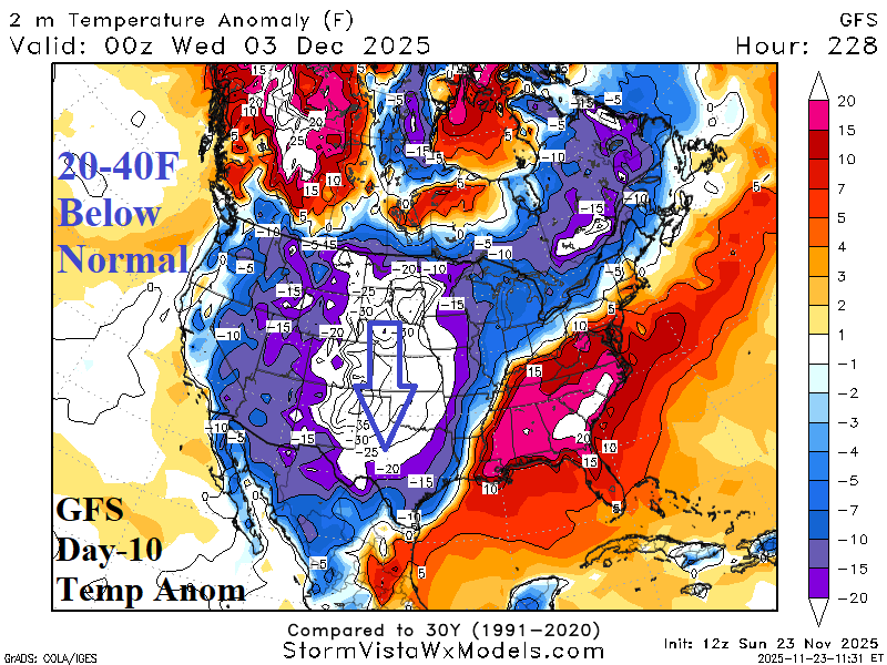
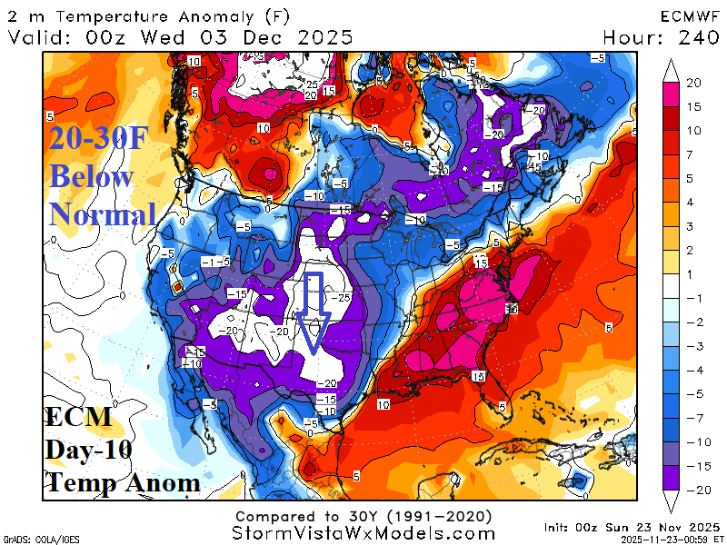
Fig. 3-4: Comparing the just-issued GFS and last night’s ECM 6PM CST Dec. 3rd temperature anomaly forecast.
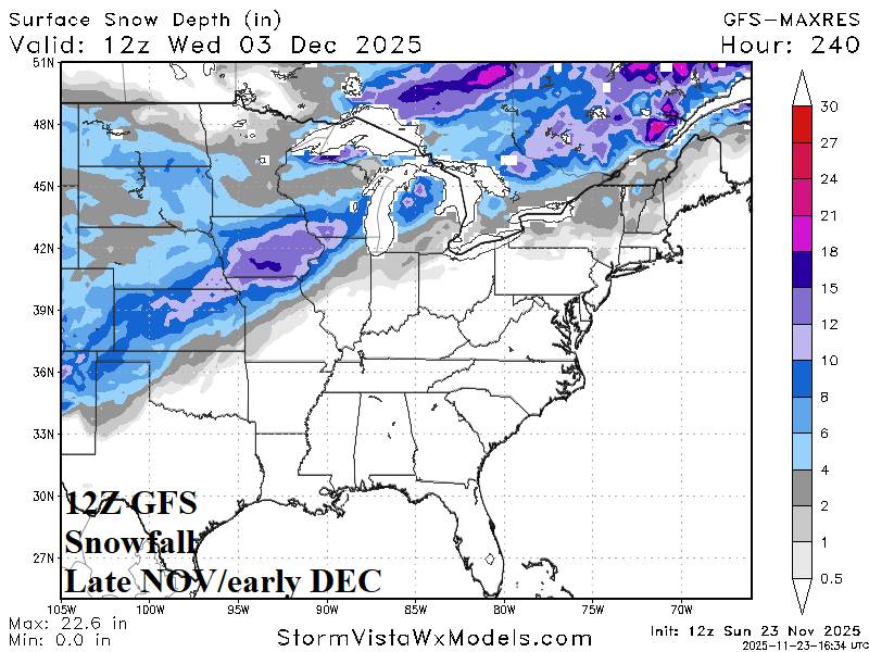
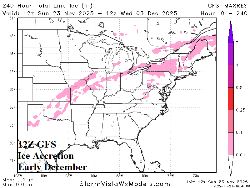
Fig. 5-6: The 12Z GFS snow depth on Dec. 3rd and ice accretion projection for early December.
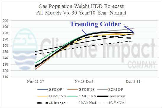
Fig. 7: The U.S. gas population weight HDD forecast utilizing all models through Dec. 11 comparing to 48 hours ago and the 10-year/30-year normal.