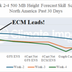
ECM “Weeklies” Rank No. 1 Past 30 Days for Week 2-4 Outlooks
09/16/2025, 2:29 pm EDT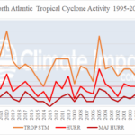
2025 Challenging 3 Other Years Since 1995 For Least Active TC Seasaon?
09/19/2025, 9:10 am EDT
Climate Impact Company North Atlantic Basin 10-Day Monitor
Issued: Wednesday September 17, 2025, 8:45AM EDT
Highlight: Tropical Depression 7 forms, likely to become a hurricane.
Discussion: Tropical Depression 7 forms overnight located about 1185 miles to the east-southeast of the Leeward Islands. TD 7 becomes Tropical Storm Gabrielle by tonight. NOAA/NHC mentions that the attendant convection is large and once consolidating, due to an increase in strength, may cause a possible relocation of the center. The NOAA/NHC 5-day forecast track indicates a general west-northwest track with gradual intensification to a hurricane (Fig. 1). In the short-term, strengthening is suppressed by streaks of upper shear (Fig. 2). However, once the upper shear weakens, and Gabrielle is southeast of Bermuda, passage over 30C water temperatures allows strengthening to a hurricane (Fig. 3). The fast upper westerly flow across the U.S. captures Gabrielle early-to-middle next week causing a fast right turn and out to sea possibly across Bermuda. Gabrielle is a powerful storm moving northward over the open waters of the North Atlantic in the 8-14-day period. The heat release of this tropical cyclone into higher latitudes could cause an amplified blocking high pressure over Greenland in 2 weeks (Fig. 4) as supported by the negative North Atlantic oscillation (-NAO) forecast (Fig. 5) suggesting a weather pattern change for both North America and Europe.
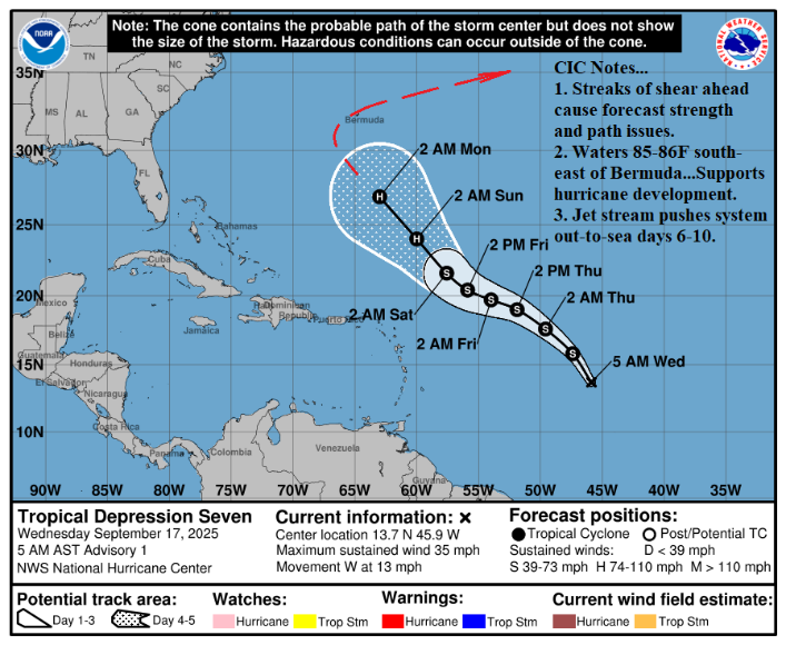
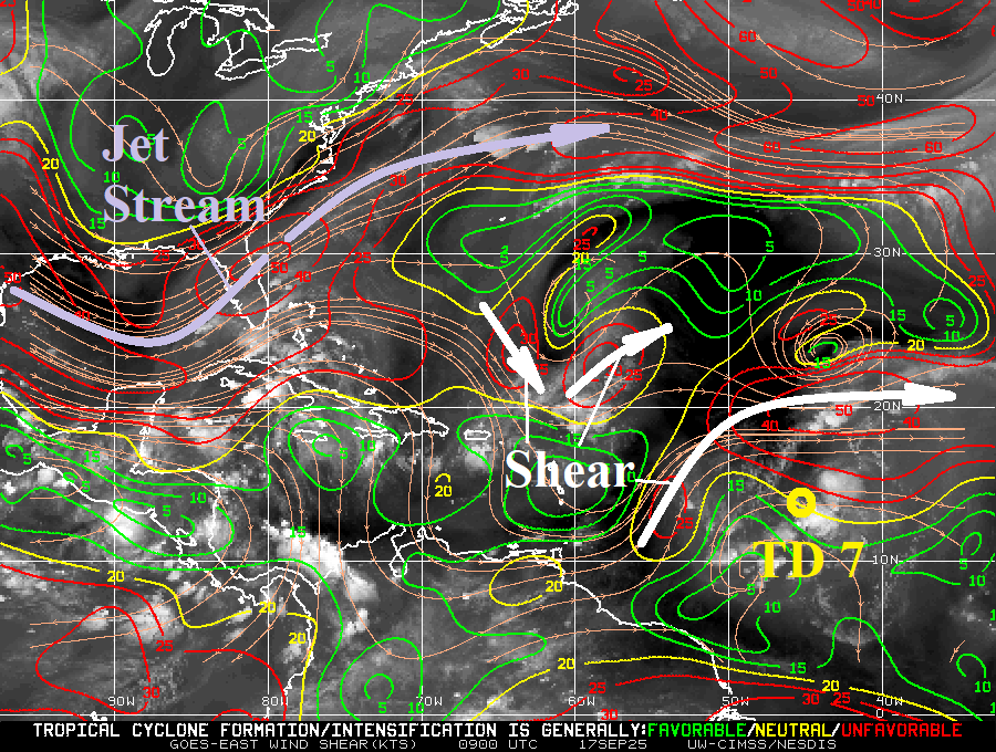
Fig. 1-2: The NOAA/NHC 5-day forecast track for TD 7 and axis of upper shear analysis across the North Atlantic.
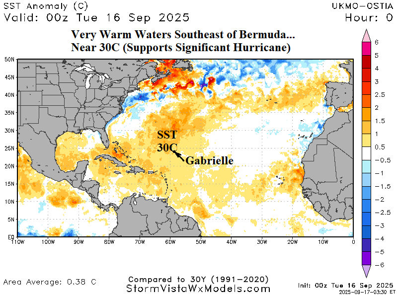
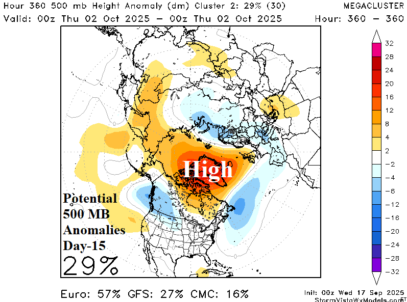
Fig. 3-4: The North Atlantic SSTA analysis reveals warmer than normal waters southeast of Bermuda. In 15 days, heat release of Gabrielle as the storm travels northward causes an amplified high pressure over Greenland.
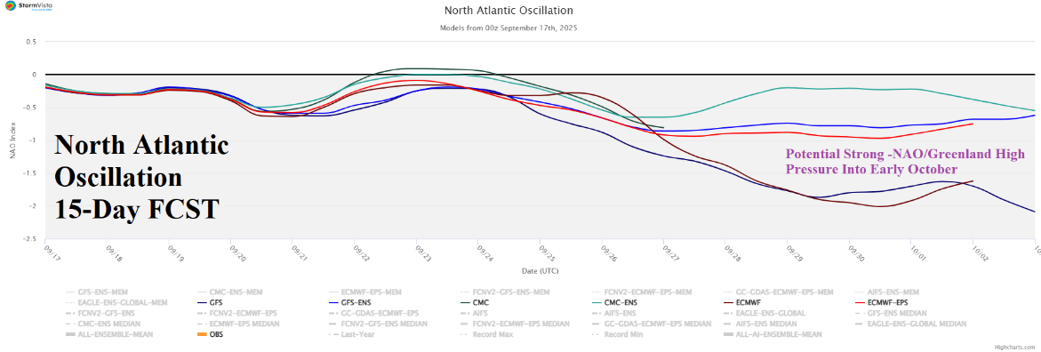
Fig. 5: Utilizing all models, the 15-day North Atlantic oscillation forecast shifts toward storm negative phase implying a Greenland blocking high pressure.