NOAA/CPC Long-lead Climate Forecast JUL/AUG/SEP 2025: Dry/Hot West; Wet East!
06/19/2025, 9:36 am EDT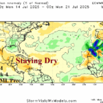
Deep Tropics Not Likely to Activate Until Around August 1st
06/24/2025, 5:58 am EDT
Climate Impact Company Climate Research
Issued: Sunday June 22, 2025
Highlight: NAWH pattern strongest since 2018, fuels East U.S./Europe heat.
Executive summary: Formation of the North Atlantic warm hole (NAWH), the strongest since 2018 fuels an upper air pattern promoting hot and potentially dry high pressure ridge areas across the East U.S. and much of Europe for mid-summer. Dangerously hot weather is developing and the risk of continuation during July has increased significantly.
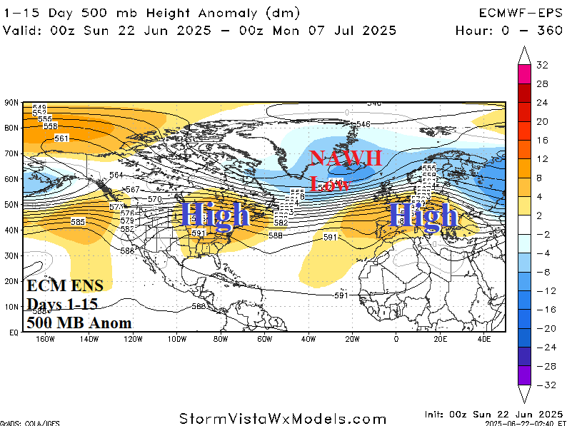
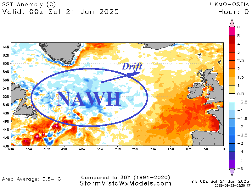
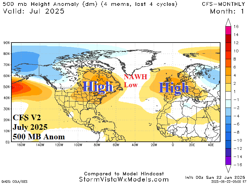
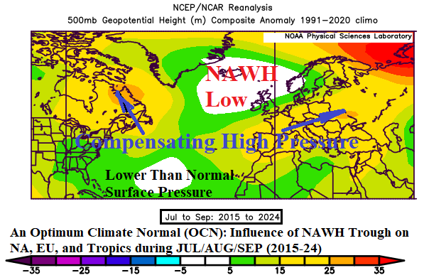
Fig. 1-4: The ECM ENS 15-day and CFS V2 July 2025 500 MB anomaly forecast across North America and Europe (upper) and the evolving North Atlantic warm hole (NAWH) and 2015-24 JUL-SEP 500 MB NAWH climatology.
Discussion: Extreme heat has generated or will develop during late June for much of the East U.S. and southern half of Europe. The ECM ENS 15-day 500 MB height forecast supports the hot pattern with ongoing amplified high pressure ridge areas for both regions (Fig. 1). The catalyst for this locked-in hot high pressure is compensation (by each upper ridge) to the intense North Atlantic warm hole (NAWH) trough pattern which is semi-permanent south and southeast of Greenland. The NAWH pattern is the strongest since 2018 (Fig. 2) and forms due to a rapid ice melting/runoff from Greenland creating a stratified chilly layer of ocean water which cools the atmosphere aloft and forces an upper trough to form while surrounded by high pressure (over warmer water) extending to land masses. The NCEP CFS V2 “monthlies” maintain the northeastern North America/Europe ridge pattern for mid-summer supporting anomalous heat and mostly dry weather throughout these regions (Fig. 3). The NAWH trough has been present much of the past 10 years with varying intensity during JUL/AUG/SEP increasing the risk of hot and dry climate (aside from tropical activity) for the East U.S. and Europe (Fig. 4).