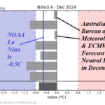
ENSO-Neutral, No Sign of La Nina Motivation
07/15/2024, 11:45 am EDT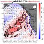
Northeast Pacific Marine Heatwave Helping to Propel Western U.S./Canada Heat
07/21/2024, 9:28 am EDT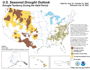
Fig. 1: The NOAA seasonal drought outlook valid through Oct. 31, 2024.
Discussion: New NOAA/CPC long-lead climate forecasts were released over the past hour. The Seasonal Drought Outlook valid through Oct. 31 expands drought across the Interior West while East U.S. drought erodes (Fig. 1).
The month ahead outlook valid for August 2024 identifies above normal temperature risk for the entire U.S. particularly in the Great Basin and central Appalachians (Fig. 2). The probabilistic rainfall outlook has increased confidence for a wet pattern in the Gulf States, Florida, and Carolinas (Fig. 3). The wet zone is a candidate for land-falling tropical cyclones in August.
The seasonal climate forecast for meteorological autumn 2024 maintains anomalous warm risk for most of the U.S. most prominently in the 4 Corners, Florida, and New England regions (Fig. 4). The precipitation outlook is dry across the Southwest with wet risk on the Northwest and East Coast (Fig. 5).
The meteorological winter 2024-25 outlook favors colder than normal risk in the Northwest U.S. and warmer than normal risk across the South and East U.S. (Fig. 6). The precipitation outlook favors a stormy winter across the North U.S. while the southern states are dry (Fig. 7). The NOAA winter outlook is strongly biased by La Nina climatology.
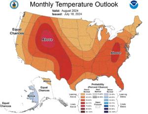
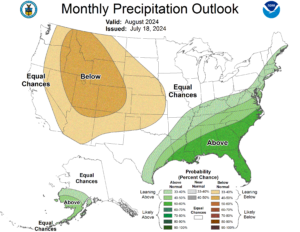
Fig. 2-3: The NOAA/CPC probabilistic temperature and precipitation outlook for August 2024.
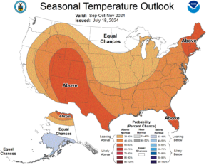
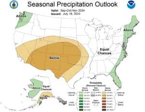
Fig. 4-5: The NOAA/CPC probabilistic temperature and precipitation outlook for SEP/OCT/NOV 2024.
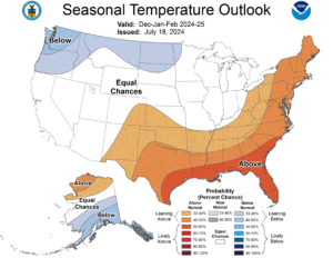
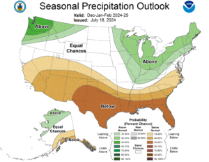
Fig. 6-7: The NOAA/CPC probabilistic temperature and precipitation outlook for DEC/JAN/FEB 2024-25.

