Watching The Gulf of Mexico for Additional TC Risk
09/29/2024, 2:45 pm EDTThe Helene Rainfall Amount Analysis
10/02/2024, 10:00 am EDT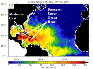
Fig. 1: The upper ocean heat across the North Atlantic basin for Sep. 30, 2024.
Discussion: As early October arrives, the North Atlantic basin observed sea surface temperature anomalies (SSTA) remain much warmer than normal. Clearly, the best place for tropical cyclone generation/intensification is the western and northern Caribbean Sea where upper ocean heat is immense (Fig. 1). Moderate to strong upper ocean heat is also present in parts of the Gulf of Mexico, East of the Bahamas, and central North Atlantic tropics.
The Gulf of Mexico cooled by 0.29C during the past week largely due to the passage of Helene. However, the basin remains much warmer than normal with buoyant fuel for tropical cyclone generation/intensification across the southwest basin (Fig. 2).
In the western North Atlantic, the Bahamas are much warmer than normal. North of the Gulf Stream has cooled. The 7-day change is slightly warmer as this zone remains supportive of tropical cyclone strengthening for systems passing through the waters of the Bahamas (Fig. 3).
The upper ocean heat in the Caribbean Sea is immense. The basin-wide SSTA is very warm at +0.83C (Fig. 4) although cooling by 0.29C during the past week. Storms forming or passing through the Caribbean Sea are likely to strengthen significantly.
The main development region (MDR) for North Atlantic hurricanes located between the Caribbean Sea and West Coast of Africa cooled by 0.21C last week but remains very warm at +0.81C and supportive of late season tropical cyclone development/intensification (Fig. 5).
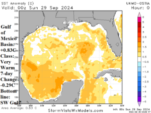
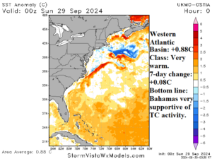
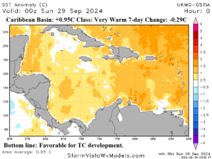
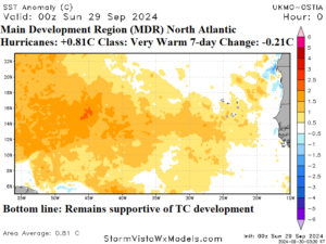
Fig. 2-5: The sea surface temperature anomalies and annotated remarks for the Gulf of Mexico, western North Atlantic, Caribbean, and outer North Atlantic basin(s).
