08/11/2025, 8:58 am EDT

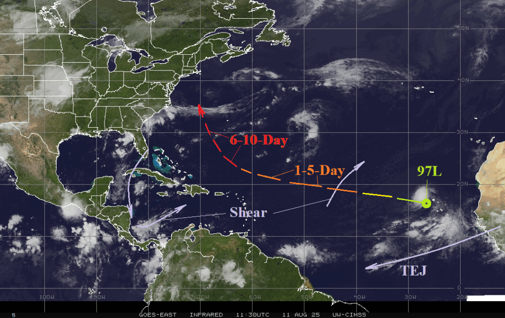
Operational models (GFS and ECM) are remarkably similar with the extended range (days 6-10) forecast of Tropical Disturbance 97L. NOAA/NHC indicates a high probability of a named storm within 48 hours, and tropical cyclone models indicate a steady westward track with intensification to a hurricane in 4-5 days.
