09/19/2025, 9:10 am EDT
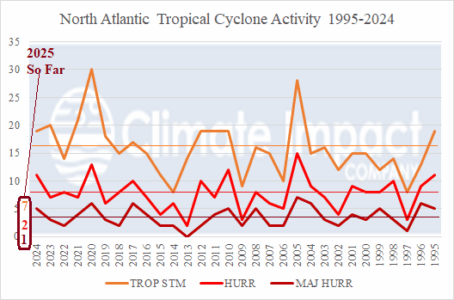
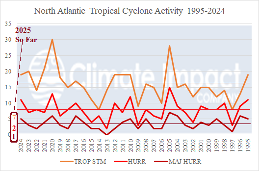
The long-term warm cycle of the Atlantic multi-decadal oscillation (+AMO) began in the middle 1990’s. During 1995-2024, seasonal activity increased dramatically compared to long-term averages. However, in 2025, seasonal activity (assuming Gabrielle reaches hurricane strength) is one of the lowest amounts for late September in the 30-year climatology. The least total amount of hurricanes observed since 1995 was 2 in 2013 and 3 in 1997 and 2009.
